

Reducing the risk of bird strikes using satellite images and Ascend’s Normalised Difference Water index software (NDWI)


BROWSE PROJECTS
Based on user needs and industry skills, the evolution of customized solutions and the establishment of innovative services is accomplished through project activities. Focusing on various thematic areas, relevant information on the project activities is provided below.
INSURE
Status date: 04 November 2022
INSURE aims to provide an extensive set of services to any company involved in the decommissioning of their oil and gas operation, as well as photovoltaic, wind and green energies offshore and onshore platforms. INSURE service implements a set of functional blocks for the monitoring of the environment, the platform status and support the management of the platforms off-shore during all the phases of activity through an advanced telecommunication system.
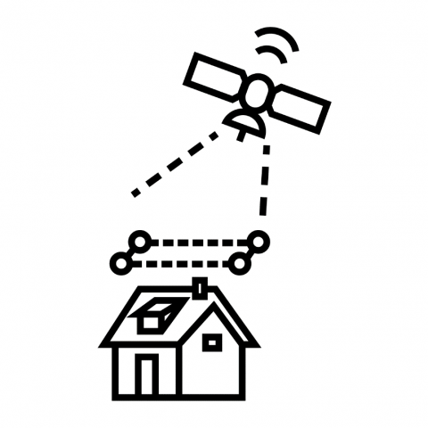
Roof Solar Panel Calculator
Status date: 04 November 2022
An easy-to-use service for detecting roofs suitable for solar panel installation. The service provides information about roof measurements, pitch, orientation, and potential solar energy production.
Profumo
Status date: 04 November 2022
Profumo proposes novel weather-based services for the Mediterranean navigation with the aim of granting fuel saving, pollution reduction and improving safety for passengers, crew, goods and ships’ instruments.
The idea is to establish a cooperative schema (between commercial vessels) where meteo-marine data is collected from standard and non-standard on-board instrumentation.
Acquired data is used in the Profumo service center to produce reliable high resolution meteo-marine forecasts and nearly real time information, allowing the provision of helpful route optimization and navigation services also in a complex and constrained basin as the Mediterranean one.
To satisfy the demand of commercial customers, Profumo has conceived innovative services expressly for the middle short routes.
Dynamic Routing at Mediterranean scale.
The service provides pre-voyage route planning and updated information for optimal re-routing for vessels. This is possible due to the Profumo’s integrated approach involving weather observations, forecasts and optimal route computation through the modeling of ship’s characteristics, for predicting the vessel’s specific response to weather phenomena, in terms of seakeeping and fuel consumption.
Moreover, the system provides frequently refreshed meteo information allowing in-route corrections, therefore optimizing speed and course.
Navigation assistance
By using the navigation assistance service, the crew is fully supported in the route decision and planning. Profumo, integrating real time meteo-marine conditions, increases the safety and the navigation comfort through the application of the most recent guidelines for avoiding dangerous situations in adverse weather and sea conditions.
High definition weather products
Thanks to the cooperative meteo data injected in high resolution, local-scale forecasts, Profumo provides detailed predictions with a native (not rescaled) resolution of few kilometers.

BeSpatial.AI
Status date: 02 November 2022
How do you target advertising to maximize customer reach and minimize costs? Where do target customers stay, live and work? What locations should be the focus of digital and physical advertisement campaigns?
BeSpatial.AI helps businesses in financial services and other industries to boost their ads performance with customer trained machine learning model (HolistiCRM).
Training is done based on internal datasets, EO (ESA) and GIS data (GeoX). In our first use-case machine learning model accuracy reached 91%.
Machine Learning supported targeting ROI 1127% thanks to lower CPC and higher conversion rates targeting the right (potential customer dense) locations.
RAMar
Status date: 31 October 2022
RAMar is assessing the introduction of space-based RF-data into the existing KSAT vessel detection service. The existing service based on SAR and AIS/LRIT data is expanded to utilise RF-data as an additional source of information on vessels at sea. The aim is to enhance the detection and characterisation of dark vessels.

POMERIUM
Status date: 27 October 2022
The POMERIUM project aims to realise a complex monitoring system for Cultural Heritage (CH) management in order to support managers in the daily and extraordinary activities and expert decisions. The system will be based on the added value given by the integration of different technologies: satellites, Remotely Piloted Aircraft Systems (RPAS), in-situ Internet of Things (IoT) monitoring, image recognition, advanced modelling, and 5G.
ZOE
Status date: 24 October 2022
The ZOE project focuses on the development of a self-powered water grid management system that enables continuous remote monitoring and leakage detection of water pipelines through decisions based on both terrestrial and satellite data. We aim to identify water leaks both in urban areas and the countryside.
UNDERSEE
Status date: 21 October 2022
In the same way we check the weather forecast and take preventive measures, so we will do for the water.
UNDERSEE
Status date: 26 July 2019
UNDERSEE is committed to develop a scalable solution to bring knowledge about rivers, lakes and oceans to water dependent stakeholders by providing simple access to water quality data.
SnowPower
Status date: 21 October 2022
The amount of water stored in snow is a crucial information for hydropower managers, yet hard to retrieve with current methods. SnowPower was able to generate large-scale snow information for mountainous regions at unprecedented accuracy and resolution from active radar satellites, combined with established data and a snow model to complement traditional methods.
AdRefAS
Status date: 21 October 2022
Build-up of a geo-referenced agricultural database by using satellite-based monitoring and cloud information technologies for collecting reliable and timely statistical data on agricultural parcel level in Latin America, complemented by a web-based platform providing continuously up-to-date georeferenced agricultural data for users and stakeholders.

NUA
Status date: 20 October 2022
The increasing frequency and severity of extreme weather events has drawn the attention of the insurance industry on climate change risks. For insurance to act as a climate change adaptation tool to increase the resilience of our society, new data and services are necessary. NUA is a highly innovative SaaS for the climate risk management and forecast at local scale.
Cert-EO
Status date: 21 October 2022
The aim of Cert-EO („Certified with Earth Observation”) is to apply Earth Observation solutions to support certification procedures of organic farming. The feasibility study project focuses on a service that can complement the personal on-the-spot checks with serving gap-filling data about a selected area, parcel or crop by automated analysis and evaluation of remote sensing (satellite) images.

Project Lunar
Status date: 21 October 2022
Phase 1 of Project LUNAR has determined the feasibility of a multi purpose shared electric fleet solution for NHS Hospitals. We wanted to reduce transport related challenges for employees and patients by providing a sustainable, optimised solution that improves access and reduces cost.