Objectives of the service
The collaborative solution from Krucial, SAS and Deep planet aimed to address critical water quality and quantity stress in global catchments. Users face challenges such as agricultural runoff, urban development, and climate change impacts leading to variable water availability and quality. Our solution leverages advanced IoT sensors, satellite imagery, and data analytics to provide real-time monitoring of water stress indicators. The project sought to enhance water management practices, supporting sustainable use and regulatory compliance. By integrating in-situ and remote sensing data, we offer a scalable and adaptive tool for proactive water resource management, benefiting communities, governments, and industries.
With the feasibility now proven, the solution is poised to help organisations worldwide take smarter, faster action on water stress.
Users and their needs
The project targeted government agencies, researchers, NGOs, agricultural businesses, and aquaculture operators in the UK and potentially other regions. The user communities face challenges such as water pollution from agricultural runoff, variable water availability, and compliance with regulatory requirements.
Our solution addresses these needs through:
-
Real-time monitoring of water quality and quantity.
-
Predictive models for flood and drought management.
-
Integration of in-situ and satellite data for comprehensive analysis.
-
Tools for regulatory compliance and sustainable water management.
With feasibility now confirmed, the solution is ready to support a broad spectrum of users—helping them turn complex water data into confident, informed action.
Service/ system concept
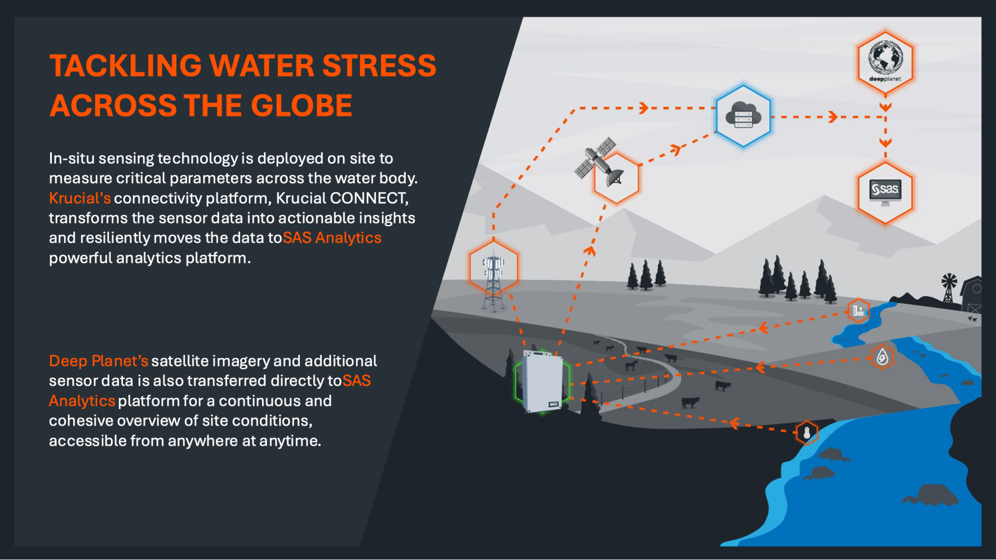
Our solution provides users with real-time water quality and quantity data, such as pollution levels from agricultural runoff and flood prediction models. The system integrates data from IoT sensors and satellite imagery, processed through advanced analytics to offer actionable insights. Users can access these insights via a centralised platform that displays key indicators and trends.
The system architecture includes:
1. Data Collection: IoT sensors gather in-situ data (e.g., dissolved oxygen, temperature, nitrate levels). 2. Satellite Imagery: Remote sensing data provides a broad overview of water conditions. 3. Data Processing: Both data types are processed and analysed using machine learning algorithms. 4. User Interface: A dashboard presents the information, enabling users to monitor water stress and make informed decisions.
This holistic approach ensures comprehensive and accurate monitoring, helping users address water management challenges effectively.
With feasibility now validated, the platform stands as a powerful, ready-to-deploy tool for transforming how organisations monitor, manage, and respond to water challenges.
Space Added Value
Our project utilises Earth Observation (EO) data from satellites, such as optical, thermal, and Synthetic Aperture Radar (SAR) imagery, to monitor water quality and quantity across vast areas. Combining EO data with in-situ IoT sensors offers a comprehensive view of water basins, providing high-resolution, continuous monitoring.
The added value of using space assets includes:
-
Coverage: Satellite data offers near-global coverage, including remote and inaccessible areas.
-
Consistency: Regularly updated EO data provides consistent, long-term monitoring.
Integration: Combining EO and in-situ data ensures a detailed, accurate analysis.
This approach surpasses current methods by delivering comprehensive, scalable, and reliable water monitoring solutions.
Current Status
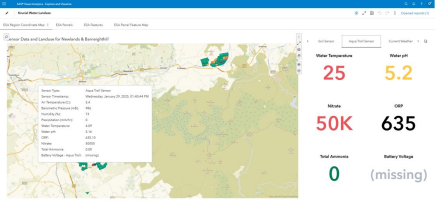
The project has successfully completed its Feasibility Study and final demonstration phase. The full end-to-end system—including in-situ sensors, satellite data integration, and analytics dashboard—was deployed and tested at Barneighthill Farm in Ayrshire, Scotland, located within one of the UN CEO Water Mandate’s priority basins.
Key achievements include:
-
Successful deployment and remote monitoring of water quality and quantity parameters
-
Seamless integration of Krucial’s in-situ data and Deep Planet’s EO-derived insights into the SAS Analytics platform
-
Validation of user requirements and technical feasibility through hands-on demonstration and impact assessment
-
Engagement of multiple user segments—agriculture, aquaculture, NGOs, and water authorities—to shape system design and ensure relevance
The project confirmed both the technical and commercial feasibility of the solution. Several early-stage commercial opportunities have now entered the Go-To-Market funnel, including potential pilot projects with water utilities, aquaculture operators, international NGOs, and environmental auditors.
With the demonstration complete, the consortium is now focused on securing pilot partners and progressing toward commercial roll-out across high-priority global basins.
Prime Contractor(s)

Subcontractor(s)