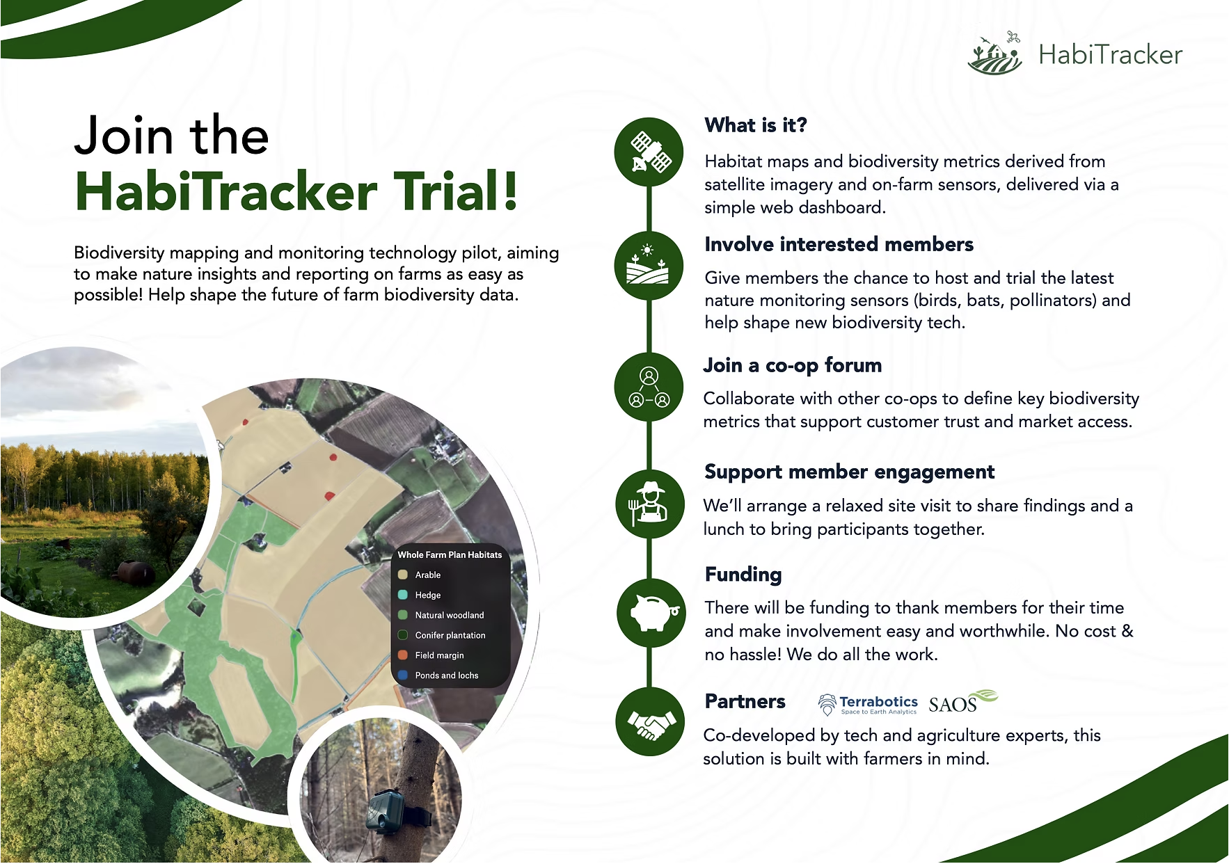
Objectives of the service
Farmers and land managers increasingly need to monitor and report on their biodiversity to meet environmental subsidy requirements and supply chain expectations. Yet, no standardised, scalable, or affordable solution currently exists. HabiTracker addresses this gap by integrating satellite-based habitat mapping with IoT sensors to deliver meaningful biodiversity insights in a standardised, cost effective, and verifiable way.
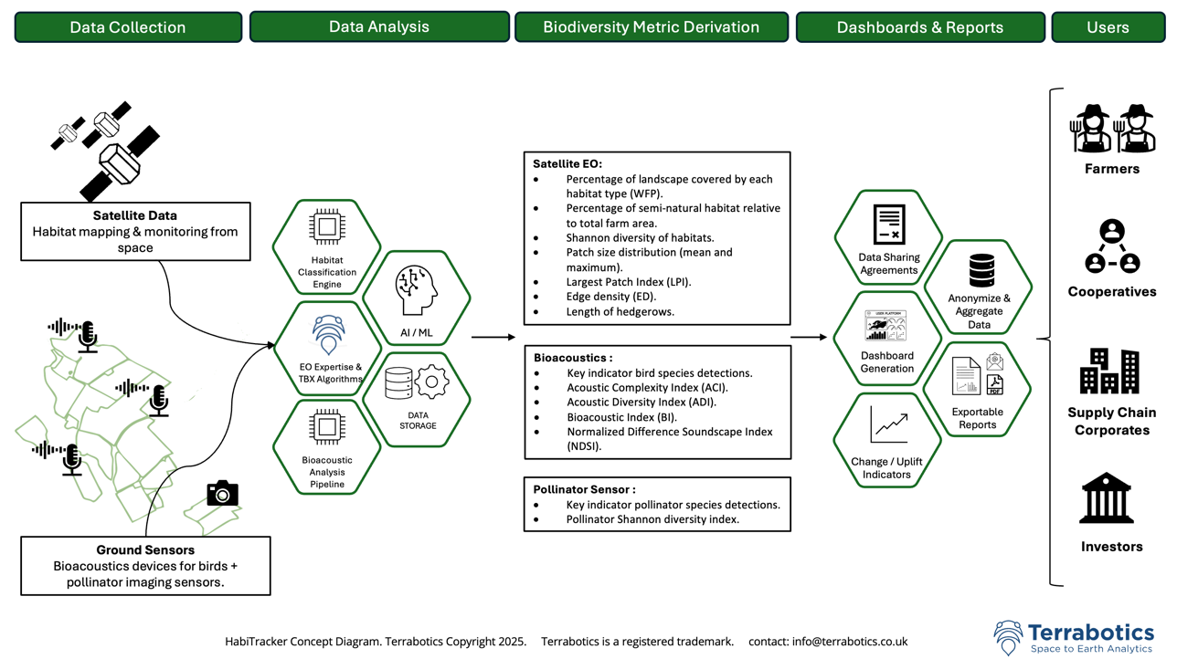
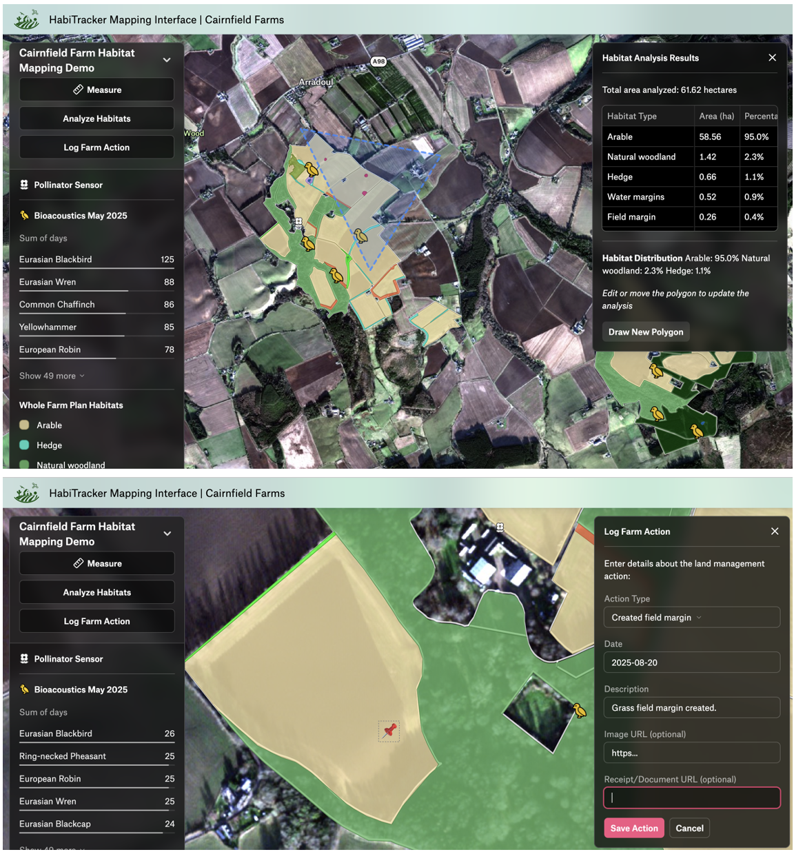
The service provides habitat classification maps in line with reporting standards, tracks changes in habitat condition over time, and uses species-level biocoustic and pollinator data to quantify biodiversity uplift at locations where nature-positive interventions are being made on the farm. A farmer-facing dashboard presents these insights alongside a set of recommended land management actions tailored to habitat type and condition.
HabiTracker is being co-designed with the Scottish Agricultural Organisation Society (SAOS), which supports a membership of 65 agri cooperatives with approximately 24,000 farmer members, to ensure alignment with real-world farm practices and enable practical rollout in Scotland.
Users and their needs
HabiTracker serves a broad ecosystem of stakeholders, with primary users being UK farmers who face growing regulatory and market pressure to provide biodiversity data. Farmer co-operatives are key delivery partners, helping scale adoption through trusted networks and group onboarding. Agricultural consultants, supply chain buyers, and processors act as influential users and potential early funders, driven by compliance and ESG requirements, while nature markets and financial institutions represent emerging opportunities as standards mature.
Structured interviews with farming cooperatives conducted by SAOS revealed growing awareness and readiness for biodiversity monitoring, despite current uncertainty around standards, limited farmer incentives, and competing priorities. Co-ops highlighted the need for low-effort, affordable tools that integrate with existing farm practices, provide clear guidance, and preserve data ownership.
Service/ system concept
Key functionalities include:
-
Periodic high-resolution habitat mapping using commercial satellite imagery, aligned with UK biodiversity standards (e.g. Scotland’s Whole Farm Plan).
-
Continuous species-level monitoring of birds and pollinators using self-sufficient on-farm IoT sensors.
-
Customised, scheme-aligned biodiversity reports for stakeholders.
-
Real-time dashboard access with visual summaries and tailored nature-positive farm management recommendations.
HabiTracker turns biodiversity monitoring into a compliance advantage, equipping farmers and supply chains to meet the requirements of schemes such as Scotland’s Whole Farm Plan, SFI, LEAF Marque, and SAI Platform FSA Gold. By streamlining mapping and generating standardised reports, it reduces audit risk, saves time, and provides a single dataset usable across multiple frameworks, supporting market access, protecting payment eligibility, and embedding biodiversity into quality assurance and long-term business resilience.
Space Added Value
HabiTracker leverages EO data to enable consistent, cost-effective, repeatable biodiversity tracking across entire landscapes, avoiding the need for manual surveys and specialist fieldwork. Unlike many competitors that focus on a single monitoring method, such as acoustic sensors or lab-based eDNA, HabiTracker integrates satellite data with on-ground IoT sensors to provide both habitat- and species-level insights. This combined model delivers a scalable, compliance-ready solution that aligns with evolving biodiversity reporting requirements, positioning HabiTracker as a uniquely comprehensive and practical tool for farmers, co-ops, and supply chain actors.
Current Status
The KickStart phase validated HabiTracker’s core technical feasibility through a habitat mapping and sensor deployment trial at a calibration farm site in Scotland. Alongside this, user engagement through SAOS’s network revealed growing interest in biodiversity monitoring but a “wait and see” approach due to the nascent nature of the market and evolving regulations. As compliance pressures and sustainability-linked incentives grow, demand is set to rise, and HabiTracker is well positioned to meet it.
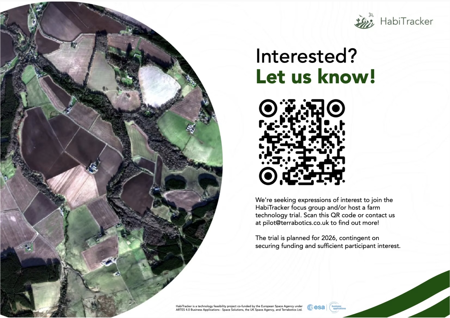
A pilot phase is the next step to refine the business model, co-design features with farmers, and demonstrate real-world value across diverse farming contexts. Invitations-to-Pilot were shared during the KickStart, resulting in some clear expressions of interest to trial the solution and participate in focus groups. By working directly with farmers and cooperatives during the development phase, HabiTracker aims to build a trusted, scalable tool that enables land managers to confidently meet evolving policy and market demands, support biodiversity restoration across the UK and EU, and unlock financial incentives that de-risk investment in nature.