Objectives of the service
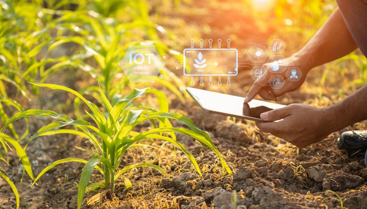
The service that the SIA4AGRI project will demonstrate answers the question “when and where to irrigate” to reduce the use of water while optimizing crop growth and adapt more effectively to changing climate conditions.
Powered by satellites & Artificial Intelligence for a unique combination of satellite earth observations, advanced soil moisture probes, agronomic data and weather data in our referenced water model, the service gives an ultra-accurate view of crop water demand at field level.
The Irrigsat tool, available through the project, places knowledge at the heart of farmers’ decisions. Its fully automated insights enable farmers to survey plants, and monitor satisfactorily irrigation, to reduce crop damage and yield loss, to save water while improving crop growth, to adapt more effectively to changing climate conditions.
Users and their needs
Irrigated agriculture under ever-increasing demand and climate change, must deal with increasingly limited and regulated water resources. The same questions arise to farmers who want to optimise their irrigation practices and save water turns, to cooperatives supporting the farmers production, to the Agro-industrial companies engaged in production and which want to continue producing where their factories are located: How to adapt? How to manage irrigation? How to manage the water stocks? How to support daily operations and tactical management to plan pieces of land and cultures for irrigation, to reduce the use of water while optimizing crop growth?
-
To answer such challenging questions, they need:
-
To understand and survey the water stress specifically during agriculture season
-
To get recommendations for irrigation
-
To analyse or demonstrate the efforts for reduced water consumption
-
To manage at larger scale (several plots)
Service/ system concept
Irrigsat is a high-tech solution which couples innovative algorithms to a referenced water model to compute and communicate automated water indicator to monitor satisfactorily irrigation:
-
Monitor daily the water status of an agriculture plot with actualized consumption values
Space-based surveillance for understanding and monitoring of the water use of crop
-
Recommend when it is time to irrigate and how long to irrigate
Notifications to prevent crop damage, to save water, to optimize crops’ growth
-
Trace water supplies
For optimization or performance analysis of water turns, to replay some irrigation strategy
-
Prioritize & orchestrate several plots for irrigation
Considering operational constraints related to the type of irrigation machinery (pivot, drop by drop, etc.)

Precision and accuracy are driven by the combination of 4 sources of data:
-
Crop coefficients derived from satellite imagery and made available by the European Copernicus land service.
-
Hyperlocal soil conditions (moisture and temperature) measured by cost-effective satellite probes supplied by DFM Technologies and implanted in crop plots.
-
Weather forecasts (precipitation and temperature)
-
Agronomic and irrigation data from farmers, specific of plots and cultures in open fields,

Space Added Value
The tools rely on the latest satellite-based technologies to provide information wherever on Earth and derive innovative and actionable information:
-
Satellite communication and navigation
Current water model lacks precision due to the absence of precise and hyperlocal soil data. The timely data collection is achieved everywhere on Earth using universal KINEIS satellite IoT baseline communication protocol provided through Argos Services, powered by CLS. Tensiometric probes are used to adjust continuously the model to ground truth.
-
Earth observation satellites
The service relies on Sentinel-2 optical imagery to monitor the distribution and changes of the so-called Leaf Area Index. This is the second key feature of our innovation, a dimensionless quantity that characterizes the growth and vigour of vegetation, fitted for use in the agriculture domain. It is made available, everywhere on earth, by the free Copernicus land service.
-
Weather satellites
Knowledge of weather data (namely precipitation and temperature) is essential to adapt and plan agricultural practices. This knowledge is provided by standard meteorological services. The use of high-resolution space weather services can be also envisaged. Weather satellites are used by weather model to release weather information. The selection of the weather service is done depending on the country and contract in place.
Current Status
The project is currently developing the solution to meet above requirements. The demonstration phase will start in 2026. It will have showcases in Europe and South Africa, for various cultures, wheat, soya, corns, vegetables. If you, a farmer, a cooperative or a local authority are interested in the demonstration, please contact your trusted partners, CLS & Abelio.
CLS, a subsidiary of CNES and CNP, is an international company that has been pioneering Earth observation and monitoring solutions since 1986. Our vision is to design and deploy innovative solutions to understand and protect our planet and manage its resources sustainably.
Abelio is an AgTech company based in Toulouse, France, which provides high value-added consulting services on agriculture linked to a CSR policy, for more economical, ecological production, to simplify farm monitoring and better manage the use of inputs, while increasing yields.
Prime Contractor(s)
Subcontractor(s)