Objectives of the service
SREC addresses the increasing need for objective and scalable verification of soil management practices. Many current monitoring systems rely on manual inspections or self-reported data, which can be costly, inconsistent and difficult to validate at scale.
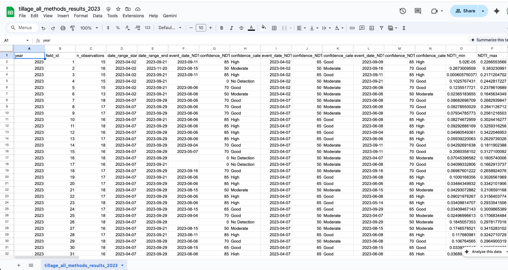
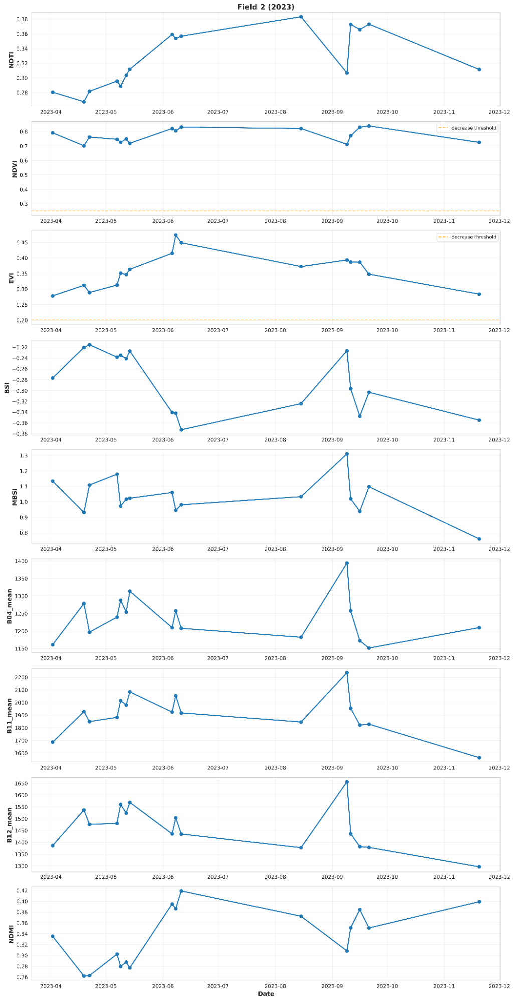
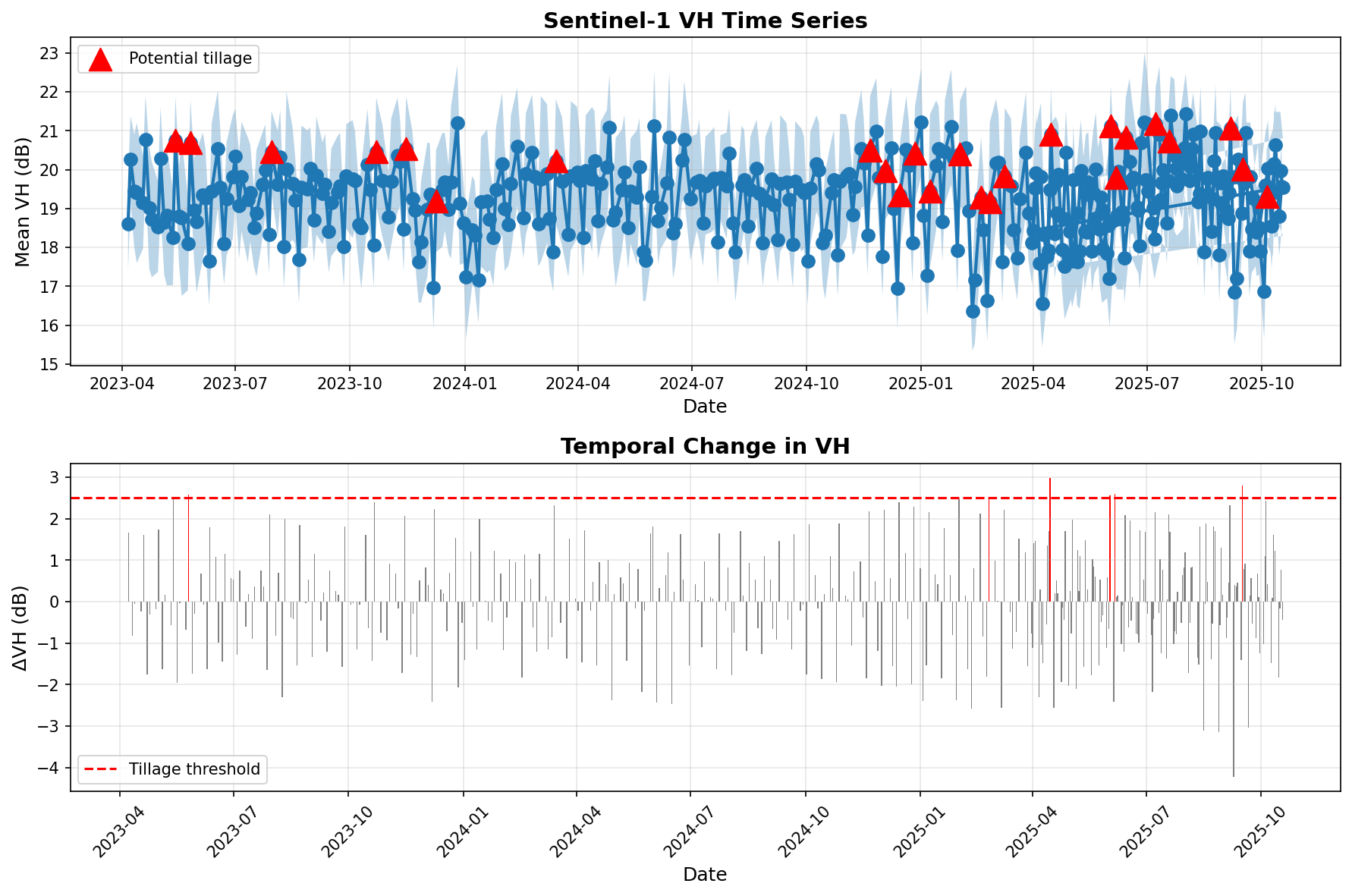
The project validated a satellite-based tillage detection service that integrates directly into customer platforms via API delivery. The system combines Sentinel-1 radar and Sentinel-2 optical data with AI-driven time-series analysis to identify soil disturbance patterns and classify tillage events at field level.
The activity focused on confirming:
-
Technical feasibility of reliable tillage detection
-
Cross-sector applicability (insurance, regenerative agriculture, carbon MRV and public agencies)
-
Commercial interest from early stakeholders
-
A structured pathway toward pilot deployment
SREC demonstrates how space assets can support operational, revenue-generating downstream services in sustainable agriculture.
Users and their needs
SREC serves organisations requiring independent and repeatable evidence of soil management practices.
Primary user groups include:
-
Agricultural insurance platforms
-
Regenerative agriculture programmes
-
Carbon MRV and sustainability reporting platforms
-
Agricultural Paying Agencies
Key user needs confirmed during the activity:
-
Independent verification not based on self-reporting
-
Scalable monitoring across large portfolios
-
Reliable time-series detection across seasons
-
Integration-ready outputs via API
-
Adaptability to regional cropping systems and soil conditions
Initial validation activities involved stakeholders in Europe and North America, confirming applicability across multiple regulatory and climatic contexts.
Service/ system concept
SREC provides an AI-enabled tillage detection layer derived from multi-temporal Earth Observation data.
The system:
-
Analyses Sentinel-1 radar and Sentinel-2 optical time-series data
-
Detects soil disturbance events and timing at field level
-
Provides binary tillage classification with associated confidence metrics
-
Delivers results via secure API in GIS-compatible formats
Deep Resolution processing enhances spatial detail, improving detection capability for smaller and fragmented fields.
The modular architecture enables integration within insurance scoring models, sustainability dashboards, carbon monitoring systems and compliance workflows.
Space Added Value
SREC relies on Copernicus Sentinel satellite data to independently monitor agricultural land management practices at scale.
The use of space assets enables:
-
Large-area monitoring without physical inspections
-
Uniform methodology across regions
-
High revisit frequency for seasonal tracking
-
Consistent long-term monitoring capability
Satellite-based monitoring ensures repeatability, objectivity and scalability that cannot be achieved through manual audits alone. By combining space data with AI-based analytics, SREC transforms raw imagery into operational environmental indicators suitable for commercial and institutional applications.
Current Status
Completed Achievements
-
Developed and validated time-series tillage detection methodology
-
Processed multi-year datasets across Lithuanian agricultural fields
-
Demonstrated cross-validated binary classification performance suitable for pilot evaluation
-
Established cloud-native processing pipeline for multi-temporal EO analysis
-
Conducted structured stakeholder workshops confirming market relevance
Ongoing Activities
-
Regional adaptation for additional European and North American datasets
-
API refinement and integration specifications
-
Continued validation of binary tillage classification workflows
-
Preparation of structured pilot phase with early adopters