
Objectives of the service
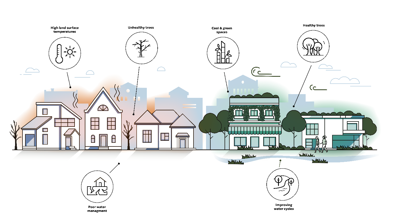
The aim of the Urban Green & Liveability Tracker is to provide a dashboard of the health, extent and impact of Green infrastructure within cities. Cities need to understand how their efforts to plant and maintain trees, reduce flood risk and eliminate dangerous urban heat are going. The tool will also include high resolution data to measure green infrastructure and liveability at a neighbourhood scale for consumers.
Users and their needs
Project partners are from two sectors – with the Cities of Madrid (Spain) and New Bedford (USA) representing municipalities and Schroeder & Associates (Luxembourg).
The key pain point for municipalities is that the environmental data they have access to is often out-of-date or at an insufficient resolution to be of practical use in monitoring their progress in urban greening and climate adaptation goals. Therefore, the project seeks to determine the feasibility of producing a range of urban green quality and impact indicators, updated on a seasonal or annual basis, and made available on a central portal for a subscription fee.
The use of this data is to understand and optimise urban greening strategies (tree planting, green roof subsidies, reduction in sealed surface strategies), as well to communicate progress to decision makers, elected officials and the general public.
For the real estate development sector, the tool will provide a way to measure their impact and benchmark this against others in the industry.
Service/ system concept
The Urban Green & Liveability Tracker will track measures of urban greening and liveability to help cities and developers monitor their impact and progress.
The urban green indicators will be derived using a data processing pipeline hosted on the AWS cloud service platform. Updated data will be produced automatically on a periodic basis and be uploaded for display on a geoportal or to be directly consumed in client’s internal geodatabases.
Space Added Value
Copernicus Sentinel 2 and 3 satellite data will be used as the raw data to produce the various technical inputs required for the Urban Green & Liveability Tracker. Therefore, space data and more particularly regular, affordable and reliable Copernicus data is integral to the project. The primary limitation of the raw datasets is spatial resolution and a variety of machine and deep learning techniques will be used to improve this resolution.
Current Status
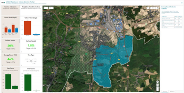
The project is progressing well and is on schedule. WEO and B-Kode are reaching the end of the technical development process, including the automation of product derivation and the front-end (which can be seen above). The factory acceptance testing milestone is expected to be reached in December 2024.
Prime Contractor(s)

Subcontractor(s)
