
Objectives of the service
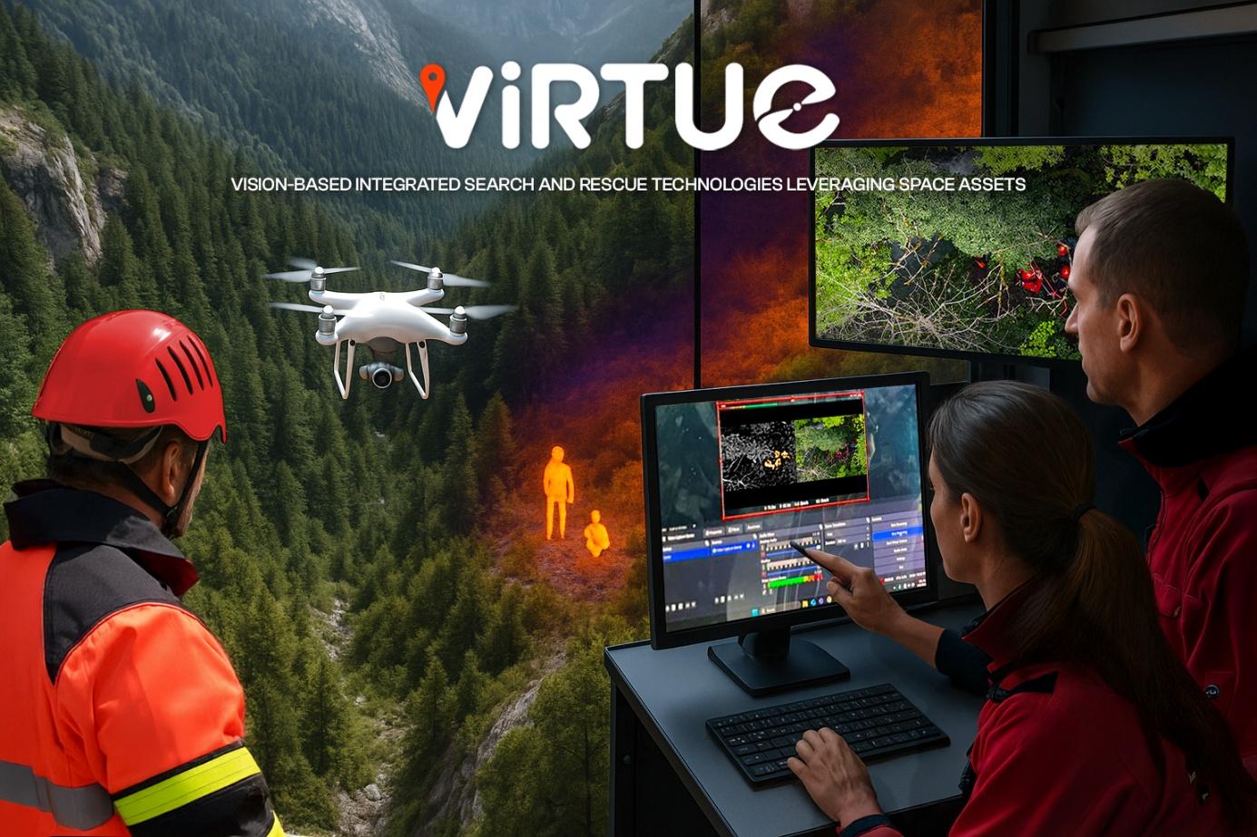
VIRTUE is a European Space Agency-funded project that brings cutting-edge technology to mountain Search and Rescue (SAR) teams, helping first responders save lives, and enabling faster and more efficient deployment of SAR missions. When every second counts, responders often face limited visibility, vast and hard-to-access terrain, and the inability to rely on terrestrial communication networks due to the remoteness of the area. VIRTUE offers a powerful solution: drones with visible and thermal cameras scan the landscape, while onboard artificial intelligence highlights potential victims in real time.
The system combines satellite navigation and communication to ensure that even in the most remote areas, data reaches mission dispatch and trained volunteers who assist with analysis. This synergy between human expertise and smart automation gives rescue teams a sharper, clearer view of the situation from anywhere.
Developed together with mountain rescue agencies in Romania and Italy, VIRTUE is being defined, implemented as Proof-of-Concept and tested, as well assessed for use in other high-risk situations, such as nuclear or radiological emergencies. The project’s goal is to shape a robust, field-ready service that turns modern technology into real-world rescue impact.
Users and their needs
VIRTUE is designed primarily to support mountain Search and Rescue (SAR) teams, and secondly nuclear emergency responders, all operating in extreme, remote environments. These users face daily challenges such as poor visibility, difficult terrain, harsh conditions, and in most cases a complete lack of terrestrial communication infrastructure. Their missions demand fast, precise, and well-coordinated actions, but current technologies often fall short.
Key user needs include:
- Accurate detection of missing or injured persons using drones equipped with visible and thermal cameras;
- Real-time and asynchronous video annotation to enhance collaborative victim confirmation;
- Reliable long-range transmission of video and location data in remote areas also without terrestrial network coverage;
- User-friendly interfaces accessible to both on-site teams and remote support personnel;
- Modular, adaptable system design that fits with national protocols and operational workflows;
- Comprehensive data protection and security compliant with European regulations to ensure user privacy and data sovereignty.
VIRTUE service is going to be validated in multiple European countries, with a focus on Italy and Romania, ensuring it meets real operational requirements and improves response effectiveness where it matters most.
Service/ system concept
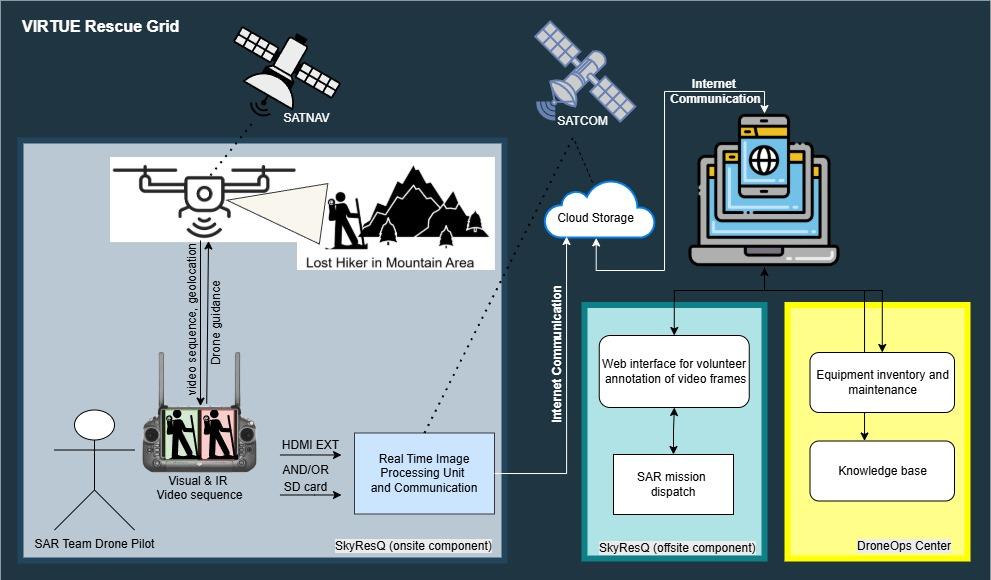
VIRTUE RescueGrid revolutionizes mountain Search and Rescue (SAR) by combining drones, smart detection, and teamwork tools. A drone equipped with both visible and thermal cameras flies over the area, capturing live video footage. This video is sent to a dedicated on-site processing unit that instantly spots possible victims using artificial intelligence and pinpoints their exact location using satellite navigation.
The system has two main parts (as it can be seen in the figure below):
- On-site component: performs real-time detection directly where rescue teams operate;
- Off-site component: transmits video and data via the internet or satellite networks to cloud storage and remote users.
Through a specific platform, trained volunteers anywhere can review the footage, tag potential victims, and help confirm AI findings. All this information is then delivered to the mission control center to speed up life-saving decisions.
VIRTUE also is designed to include tools for managing equipment, scheduling maintenance, and sharing knowledge ensuring teams stay connected and informed during critical missions.
Space Added Value
VIRTUE harnesses the power of space to support life-saving missions in the world’s most challenging terrain. By combining satellite communication and satellite navigation, the system stays fully operational even where no terrestrial network exists, such as deep valleys, forests, or high-altitude areas.
Satellite Communication allows drones to send real-time video feeds directly to mission coordinators and remote volunteers, no matter how isolated the location is. This ensures rapid assessment and collaborative decision-making without depending on ground networks.
Satellite Navigation provides accurate geolocation for drones, field teams, and detected individuals, crucial for coordinating movement and ensuring precision in victim location and extraction.
Unlike traditional SAR tools that fail when connectivity drops, VIRTUE creates a seamless flow of critical information. This synergy of space assets not only enhances detection accuracy and response times, but unlocks a new level of collaboration across distributed rescue teams.
With space on its side, VIRTUE redefines what’s possible in emergency response offering reach, reliability, and resilience beyond the limits of current solutions.
Current Status
The VIRTUE Feasibility Study has been completed. Between January and July 2025, the consortium carried out structured end-user engagement, system definition, and Proof-of-Concept (PoC) validation activities with mountain rescue stakeholders in Romania and Italy.
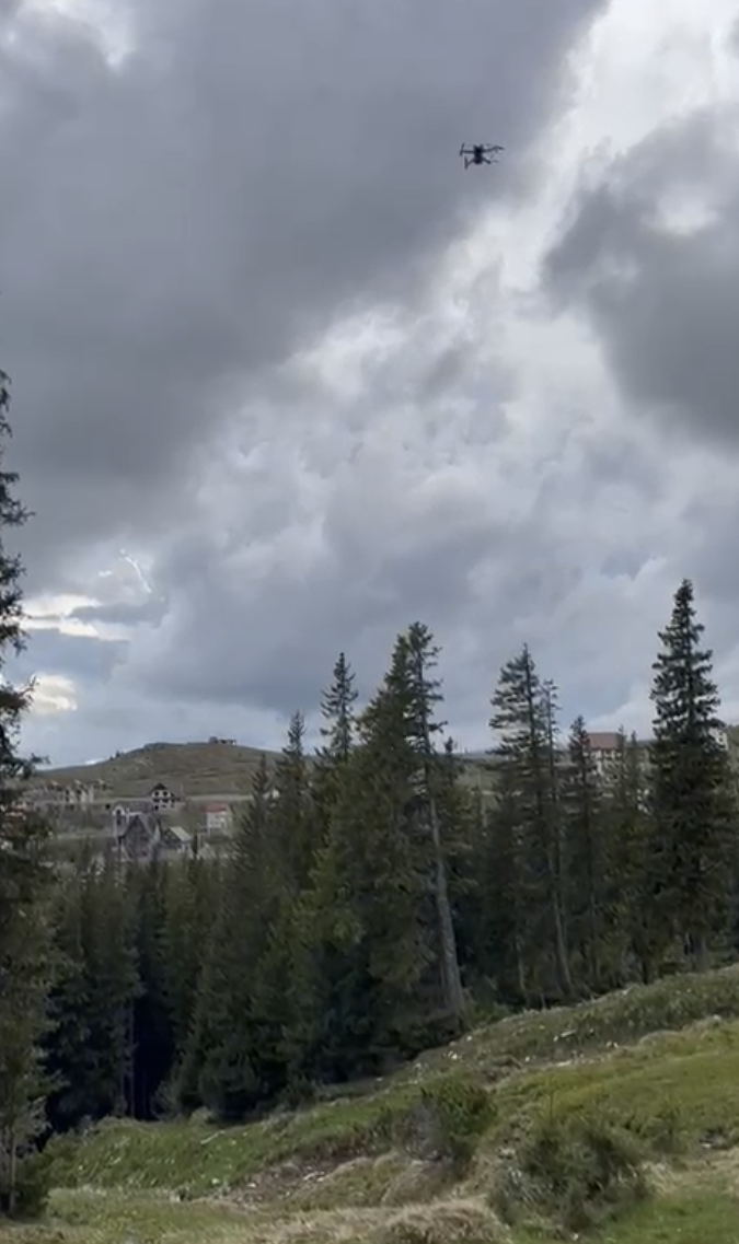
Three major field workshops were organised in Rânca (Romania), Claut and Fabriano (Italy), and included simulated day and night SAR missions in mountainous terrain.
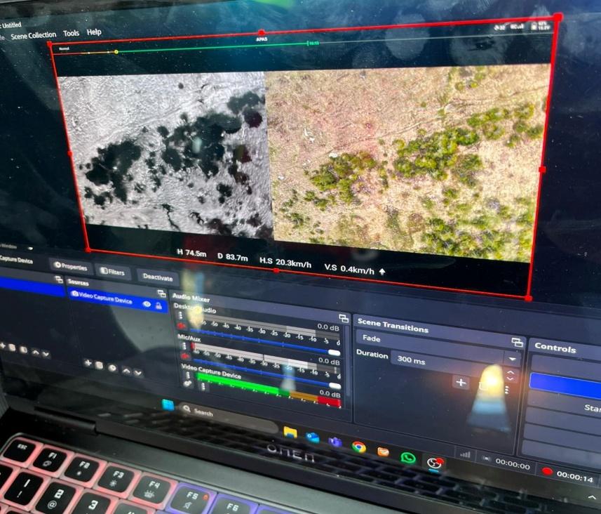
The PoC validated the end-to-end VIRTUE workflow, covering UAV-based visible and thermal image acquisition, on-site AI inference on GPU platforms, video recompression, satellite-enabled data transmission, cloud ingestion, and user-driven annotation through the RescueGrid interface. AI models were trained and evaluated using more than 3,000 annotated images.
Technical feasibility, operational constraints, and preliminary commercial assumptions were assessed and documented, providing the basis for the Implementation Plan during Technical Phase 2, August – December 2025.

