

Objectives of the service
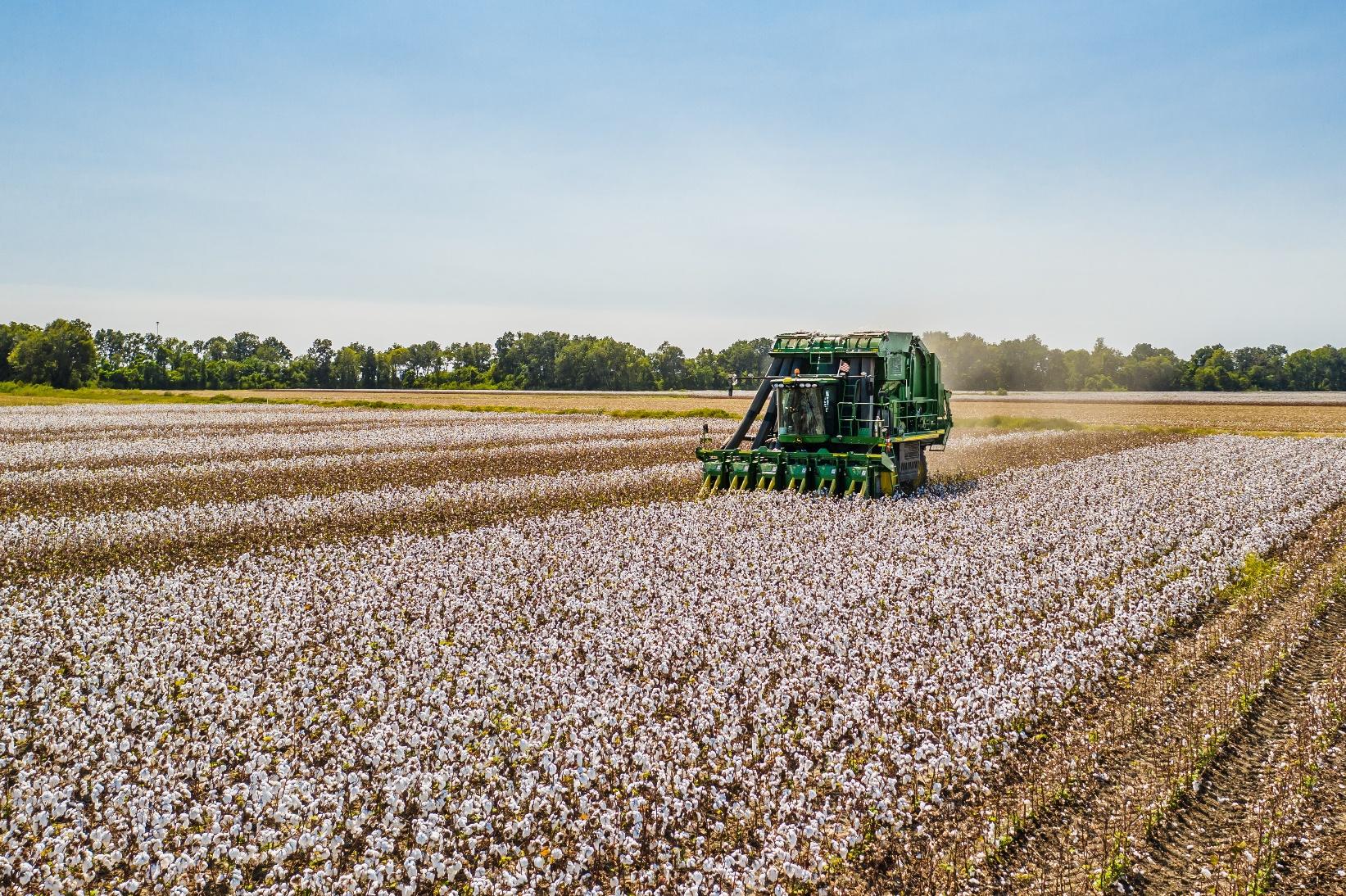
Cotton is the main natural fiber used by the global textile industry. World production reached 26M tons last year. The 5 major producers are China, India, USA, Brazil and Pakistan. As most cotton is still grown in a classical, unsustainable way, it has a variety of negative effects on the environment. This circumstance led to the creation of several sustainable cotton standards.
The GreenerCotton project aims at supporting sustainable cotton production through the application of satellite based digital agriculture technology. A comprehensive set of micro services for data capture and validation, cotton mapping, crop growth monitoring, disease risk assessment, yield estimation and sustainability reporting is delivered via API to external IT systems.
GreenerCotton provides the following services:
-
Cotton Transparency (CT): identifies and maps cotton growing regions and validates the area under cultivation. Growing regions are checked for non-violation of responsible land management standards. The cotton production is regionally monitored against environmental hazards.
-
Cotton Farming (CF): provides continuous crop performance monitoring at field level based on remote sensing data, integrated agrometeorological weather, and validates areas and yields.
The services are qualified for the new European Sustainability Reporting Standard (ESRS), the Global Reporting Initiative (GRI) and the Sustainable Development Goals (SDGs).
Users and their needs
Main user groups:
-
Extension services
-
Ginneries or raw cotton
-
Traceability solutions
-
Sustainable cotton standards
They benefit from:
-
improved quality of the standard
-
greater implementation efficiency
-
higher transparency preventing green washing
The Textile Industry can profit from easier fulfilment of their reporting standards based on better data, while Ginneries can better support farmers and improve their production processes. One major stakeholder are smallholders, they become indirect users of the services receiving advice and support from extension services.
Regions with small and medium sized farms like India, Africa and Southeastern Europe are mainly targeted.
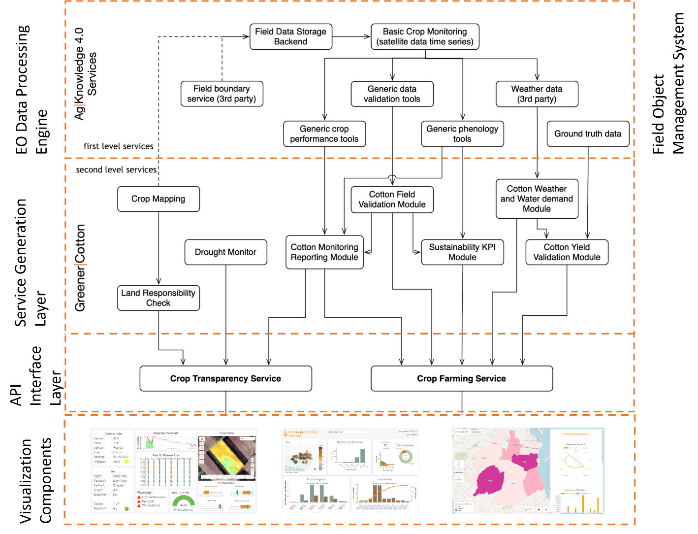
Service/ system concept
Describe in less than 200 words the capability or information supplied to the user, i.e. type of information that is delivered, specific features or functionalities, the capability the user will have when the service is deployed.
Also explain how the system works in simple terms (no jargon) for a wide audience. Explain the system architecture (on a high level). A simple diagram may be included but make sure it looks good. Don’t use serif fonts or font sizes which are too small to be readable.
Within the services Cotton Transparency and Cotton Farming we provide three supporting tools - Sustainability Check, Production Monitor and Cotton Farming.
-
Sustainability Check – this regional risk assessment tool allows to assess the deforestation risk and protected area violation risk in the cotton production region of your ginneries. On top of the spatial visualization of your cotton production area you can click through maps and reports around these risks and export them as pdf to provide them to ginneries, auditors and other users. You get auditable information, that means a detailed risk assessment at regional level, based on remote sensing data and derived products that can be used as part of your CSDDD or ESRS sustainability reporting.

-
Production Monitor – this dashboard provides an accurate regional overview of crop status and crop performance, harvest activities and anomalies of large cotton field portfolios down to the field level

-
Cotton Farming – our API-based cotton field monitoring service can be integrated in any external IT system like Farm Management Systems or Traceability Software. It supports field advisory by offering performance monitoring, alerts and warnings on pest and disease risk and weather events and Sustainability KPIs at field level.

Space Added Value
GreenerCotton is based on the Ag|Knowledge 4.0 platform, which is making intensive use of various space assets, primarily open remote sensing satellite data originating from Copernicus Sentinel like Sentinel-1, Sentinel-2, Sentinel-3, Landsat 8/9 and MODIS.
Weather data originating from Eumetsat satellites like Meteosat and GOES are exploited among other data sources by global circulation forecast systems as operated by weather providers. For GreenerCotton commercial weather data providers are used as weather data source.
GNSS will be primarily used for ground data collection. It will be collected by stakeholders via GNSS equipped smartphone devices and mobile apps.
Current solutions for in field auditing suffer from the lack of area coverage and the high costs involved (for field surveys or drones, aerial photography, sensor networks or very frequent field visits, in-field sampling techniques). The use of EO data in contrast provides objective and continuously updated information at low costs while at the same time covering up to 100% of the requested area.
Current Status
The project started in October 2023 and builds on the ESA Kick-Start GreenerCotton feasibility study 2021. In July 2025 the Final Review was held and the Demonstration Project finished successfully.
Four pilots were conducted to test the service quality, user acceptance and scalability:
-
AbTF Sustainability Check Pilot
Support the implementation of AbTF’s Cotton made in Africa (CmiA) sustainability standard in Tanzania with our “Sustainability Check”.

-
Bext360 Sustainable Cotton Monitoring Greece Pilot
Assess sustainability KPIs for BASF’s Certified Sustainable FiberMax (CSF) cotton in Greece by integrating field-level data into Bext360’s traceability platform alongside other agricultural inputs.


-
Reinhart Crop Assessment Pilot
Improve and support their cotton crop and yield assessment in India by providing the „Production Monitor“ and yield data analysis.


-
Intrasys Auditing Pilot
Implement, test and audit the new Quality Management procedures in the operational environment of Geocledian and evaluate the usability of Geocledian pilot services.


