
OPPORTUNITY
Mining is the process of extracting minerals, metals and other valuable materials from the surface of the Earth, including the seas. The mining sector is pivotal to the world’s economy and recent infrastructure-driven growth in Asia has stimulated a significant increase in demand for commodities like iron ore, copper and coal (PWC, 2018).
Satellite technology can add value to the four major types of mining operations: surface, underground, dredge, and artisanal & small-scale (ASM). It can help to protect miners working in characteristically hazardous environments and to prevent risky illegal mining activities. Mining can have a severely adverse impact on the environment, leading to loss of biodiversity, erosion, and the contamination of surface water, ground water, and soil. Satellite technology can therefore help mining companies, who face increasing pressures to report on indicators like water use and greenhouse gas emissions, to prove that they are undertaking activities to minimise environmental damage.
TOPICS OF RELEVENCE
- Exploration: Exploration is the process of finding ores to mine. The initial discovery can be made through research of mineral maps and geological reports, but can include multispectral and hyperspectral imagery from satellite, drone or aircraft-based systems. Exploration is an inherently risky business, and so it is crucial to have an in-depth and well-defined understanding of a geological region when targeting and developing prospective sites. Since so much of the surface has been explored, the search for new mineral resources must now rely on more sophisticated prospecting and exploration techniques
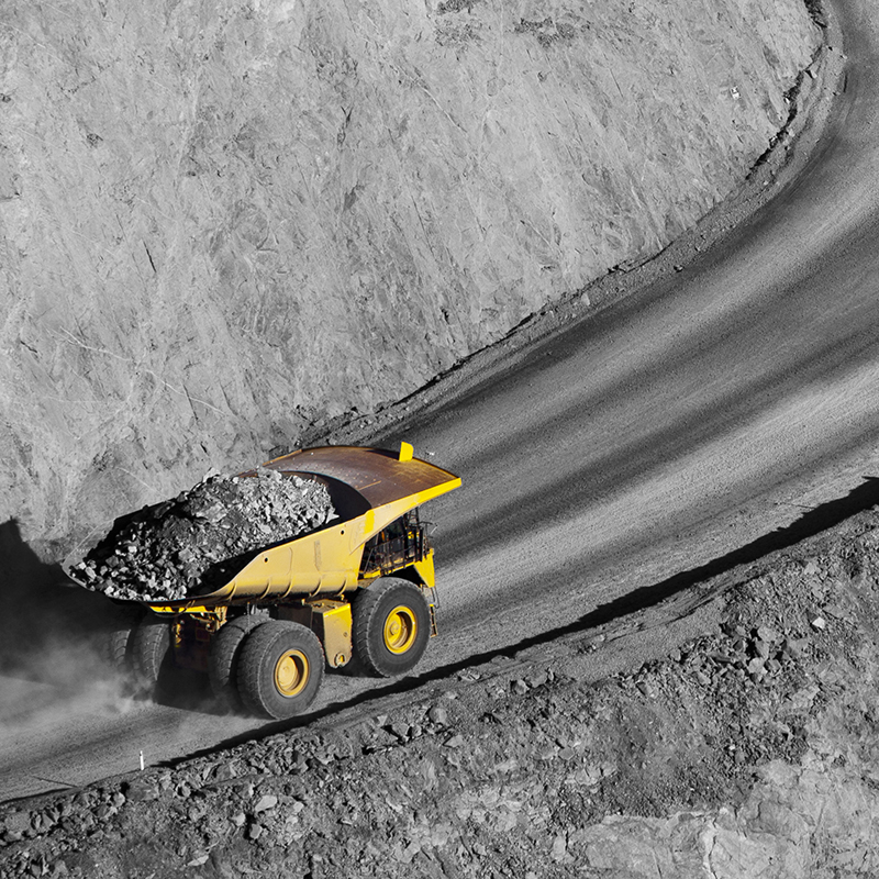
- Construction & Operation: Construction of mining sites involves building roads, processing facilities, environmental management systems, employee housing, and other facilities. Minerals are then recovered, processed, and transported. Emerging technologies are expected to significantly impact these stages of the mining process.
- Closure & Rehabilitation: Once a mining site has been exhausted of reserves, or is no longer profitable, the site is shut down. Rehabilitation then begins and aims to return the land and watercourses to an acceptable standard of productive use. Mines may require ongoing treatment of mine discharge water, periodic maintenance of tailings containment structures, and monitoring any ongoing remediation technologies.
- Commodity Trading: To assess which commodities to invest and divest in, miners need to understand fluctuating consumer demands, global demographic shifts, economic movements, and the effects of environmental change. Shareholders and institutional investors consistently monitor the mining sector to assess if companies are in danger.
- Illegal Mining: Illegal mining can belong to large-scale organised crime, led by illegal mining syndicates, or it can be a subsistence activity. There are, for example, an estimated 6000 Zama Zamas (artisanal miners who conduct illegal mining in discontinued mines) underground in South Africa at any one time. There are considerable risks to illegal mining. The unregulated and illicit nature of the work has brought about violence, corruption, and turf warfare.
- Safety of mining workers: Mining is risky and hazardous. Accidents occur and workers can suffer from fatigue and injury. Technological advancements can help to improve the safety of workers.
WEBINAR
05/03/2019 (11:00 CET)
13/03/2019 (15:00 CET)
![]()
VALUE OF SPACE TO MINING
New technologies promise to optimise asset utilisation, remotely monitor and control activities, and automate repetitive tasks using robotics. Terrestrial and space-based technologies can add value across the entire mining lifecycle.
Earth Observation
Multispectral and hyperspectral imagery can help in remote or hazardous areas where ground-based exploration is challenging. Feature extraction, elevation models and satellite imagery can identify the location of infrastructure and the proximity of mining sites to environmental zones. Remote sensing techniques can be used to map hazards and assess the susceptibility of a region to risks like bushfires, floods, fires, and landsides.
During the construction and operation stage, satellite data can cover infrastructure and facility components, transportation routes, and environmental features. Earth observation can also monitor the natural environment, water resources, and pre-existing culturally sensitive regions. Furthermore, satellite imagery and predictive analytics can help to combat illegal mining by spotting suspicious activity.
Earth observation data can identify and quantify rehabilitation areas. It can be used to monitor the removal of equipment, demolition of facilities and the safe closure of all mine workings.
Global Navigation Satellite Systems (GNSS)
Autonomous equipment can improve drilling precision and efficiency, but also exposes fewer people to dangers in the work environment. LIDAR (light detection and ranging) sensors on autonomous trucks could be used to measure range and recognize humans within range. GNSS could be used to avoid collisions.
In open pit mining, accurate GNSS is useful for tasks such as machine guidance, grading, dozing, drilling, collision avoidance, surveying, and fleet management. GNSS-based blasthole drilling systems provide drill monitoring, control and guidance. The positioning of shovels, loaders, dozers and graders could be overlapped with the planned design of the mines, ore blocks, pits and roads to show the operator where to mine. Truck fleets can be assigned to different loading machines in real time via a central control station to improve overall efficiency.
Logistics companies can benefit from applications that integrate autonomous transportation methods, such as autonomous trains and cargo ships, with advanced systems for product tracking and continuous communication. Supply chain optimisation would improve system efficiency and safety. GNSS provides a way of locating assets across the globe.
Satellite Communications (SatCom)
During mine exploration, SatCom can enable remote personnel to transmit images and drilling data from the field for centralised analysis without the need to send a vehicle back to base or search for an alternative communications link. SatCom can provide reliable connectivity before permanent communications are installed, or can ensure that the site remains connected even in severe weather. Sensors measuring vehicle health, for instance tyre pressures, and the driver’s wellbeing, like heart rate and skin temperature, can be geotagged and sent to a central control system to improve safety and efficiency.
WHAT WE LOOK FOR
Kick-start Activities elaborate the business opportunity and the technical viability of new applications and services exploiting one or more space assets (e.g. Satellite Communications, Satellite Navigation, Earth Observation, Human Space Flight Technology). This call for Kick-start Activities is dedicated to the theme "Mining", which means that the call is open to companies which intend to develop space-enabled mining applications.
HOW TO APPLY
1. Register by completing online questionnaire on ESA-STAR Registration (minimum ‘light registration’)
2. Download the official tender documentation (Invitation to Tender) and create ‘Bidder Restricted Area’ via EMITS Reference AO8872 from April 9th 2019.
3. Write your proposal and obtain Letter of Support from National Delegation, if needed (see Authorisation of Funding section below).
4. Submit your proposal via ESA-STAR Tendering by the 20th May 2019.
AUTHORISATION OF FUNDING
Currently Norway, Germany and the UK have pre-approved funding for this Kick-start activity. Applications from any other Member State will require a letter of approval from their national delegation.