

Being a smart cyclist is far easier when you know somewhere well enough to pick a route that suits you. But once you leave an area you are familiar with, choosing the ideal route can be difficult. Beeline aims to tackle that, making bike journeys safer and more enjoyable with its new Velo 2 device, which uses a combination of space data and crowd-sourced information to provide a selection of route options for each trip.
The best journey in any vehicle is not always the fastest. It may not be the most direct either. Instead, what you consider the ‘best’ route on any given day will depend on a range of parameters, such as your vehicle, your confidence, your familiarity with the area and how urgently you need to get somewhere. This is especially true for cyclists, who not only have access to routes which are inaccessible to motorised vehicles, but who may also prefer to avoid larger roads, even if they are more direct.
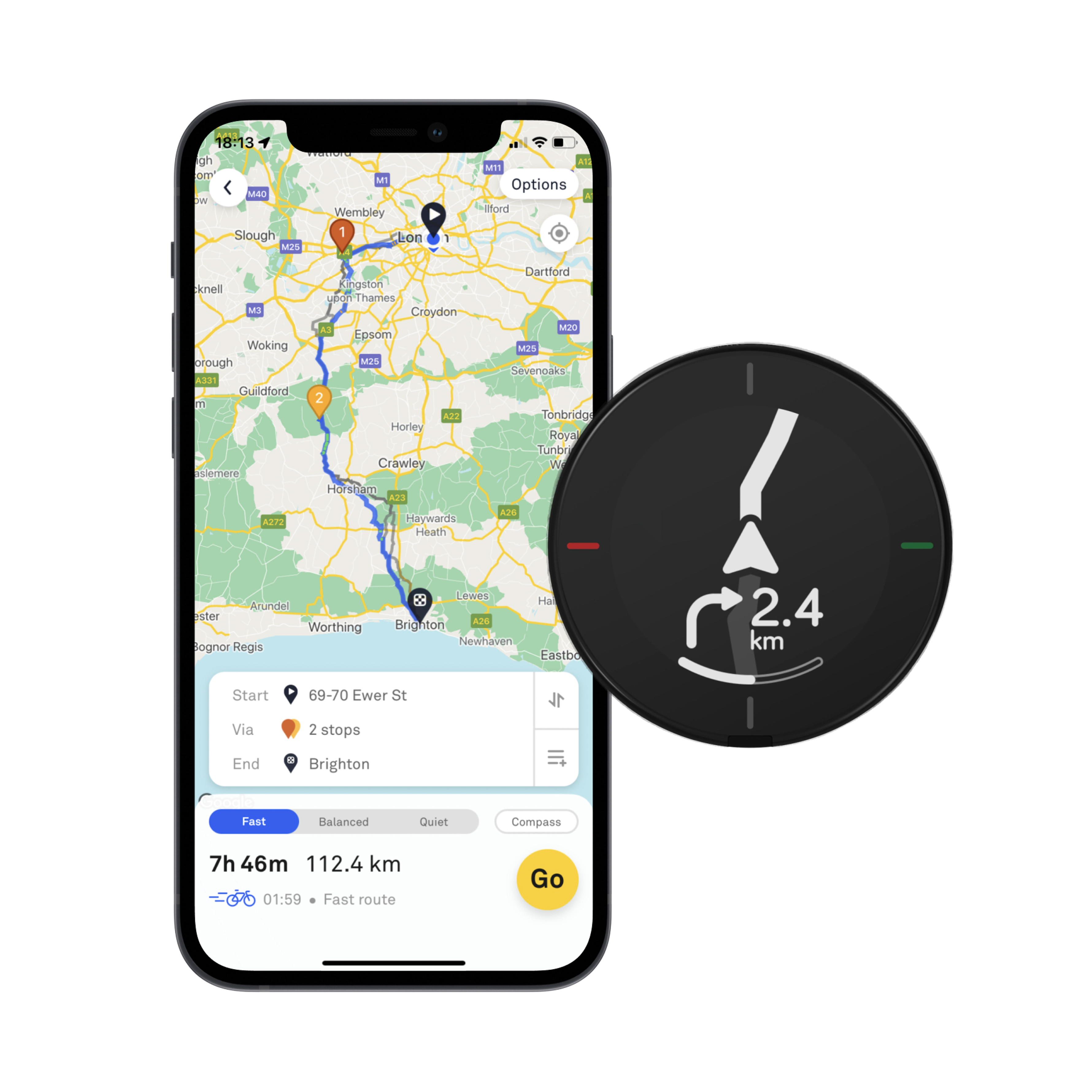
London-based Beeline set out to solve this dilemma by combining satellite Earth observation (EO) and Global Navigation Satellite System (GNSS) location data with feedback from cyclists in a mobile phone app (iOS and Android) as part of an ESA Demonstration Project. The app is linked via Bluetooth to a small device attached to the bike’s handlebars, which provides directions. Beeline has now launched a new enhanced version of its Velo device and app as it expands into new territories.
Smart cycling with GNSS and EO data
The Velo 2 uses the GNSS data from the user’s phone to ensure that it supplies the correct guidance on when to turn, according to the route chosen by the cyclist from the ones provided on the app at the outset of their journey. Directions are provided via an LCD display on the top of the Velo 2.
Among the EO data sources used for the app are digital elevation models from NASA’s Shuttle Radar Topography Mission (SRTM) which, along with other EO data, are initially used to predict road characteristics. This function is enhanced over time as more and more Velo users travel along each road, as the device also features buttons where users can rate segments of the route they deem to be positive or negative for cycling, based on their individual judgement. This Velo data is then analysed together with artificial intelligence (AI) algorithms to further characterise the quality of the road and improve the overall mapping. This means that every Beeliner around the world plays a part in building better routes.
The Beeline Cycle Routing ESA Demonstration Project started in November 2018 and finished in July 2021. As part of this phase, the team measured journey satisfaction using its app against those proposed by Google and found that Beeline sent users on 67% fewer ‘bad’ roads, with an average journey duration increase of only 6%. Beeline routes were clearly skewed towards cycleways and minor roads.
“The support provided by ESA during the Demonstration Project was vital in order to enable us to develop and test the service, and incorporate the space-derived data, without which our routing system simply wouldn’t work,” said Tom Putnam, Co-Founder of Beeline. “We could have tried to make this work just by using feedback from cyclists. However, we’d need an enormous amount of road rating data to cover every street in all the geographies we aim to cover which would be unattainable. By applying AI to the GNSS based road rating alongside existing Earth observation data we can achieve the coverage we need.”