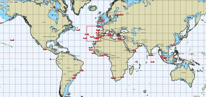
 Selected offshore vessels within EU waters and beyond are now in sight of EU customs officials as an ESA demonstration project, in support to the European Maritime Safety Agencyâs Blue Belt pilot project, gets fully underway.
The ESA IAP Demonstration Project (ARTES element 20) led by the prime contractor CLS (Collecte Localisation Satellites), with exactEarth Europe and KSAT as sub-contractors, has been delivering SAT-AIS data to EMSA since 20 October 13:00 UTC.
The satellite data will be carefully assessed to ensure it meets end-user and stakeholder requirements. It will also determine whether SAT-AIS services offer added value to the terrestrial AIS data for this type of ship tracking based service.
EMSA initiated the Blue Belt pilot project to promote short sea shipping and assist EU customs authorities by providing them with additional information about ships, their journey and their cargoes within the EU. A total of 250 voluntary vessels or âblue shipsâ are being tracked. Customs authorities of EU Member States receive a timely notification report before the arrival of a blue ship to an EU port.
The ESA demonstration project provides a service based on satellite-based AIS data complementing the terrestrial data collected by EMSA. This service detects offshore vessels equipped with AIS tracking devices which are impossible to detect by shore-based systems alone. Knowing the actual vessel journey beyond the coastal region is important to Custom authorities. This can only be achieved by using satellite AIS data.


