
Satellite technology could change the landscape of landmine clearance – saving countless lives

Approximately 2,000 people are killed or injured by landmines every month according to the UN. But clearance operations are notoriously complex and risky – it’s estimated that one deminer is killed and two injured for every 5000 successfully removed mines. Cobham Antenna Systems has been working with ESA Business Applications on a set of tools using space-based assets and Virtual Reality to improve demining operations, with potentially far-reaching humanitarian consequences.
‘MIDAS’ or Mine and IED (Improvised Explosive Device) Detection Augmented by Satellite is an Integrated Application Project developed by the UK arm of Cobham Antenna Systems. MIDAS includes a number of innovative product lines using Global Navigation Satellite System (GNSS) and Earth Observation imagery. These products aim to digitise demining in a way that improves efficiency as well providing unparalleled access to the actual process in real time.
Demining – a delicate operation
Mine clearance has always been a painstakingly slow and expensive process heavily reliant on large numbers of skilled operators with handheld detection systems. With MIDAS training is enhanced by using a risk-free fully immersive Virtual Reality (VR) environment, in which the student uses a VR headset and a real detector which is tracked in 3D and modelled in real time in the virtual environment.
But the jewel in MIDAS’s crown is a software tool that captures the ‘physical nature’ of the minefield on a map using common systems such as Bing maps, augmented using Earth Observation imagery. This tool captures the shape and boundaries of the minefield, and by using the detector tracking hardware, shows the live location of each mine detector in the operation to an accuracy of 3cm. The tracking hardware can also be used on robotic, vehicular or drone-based sensing systems.
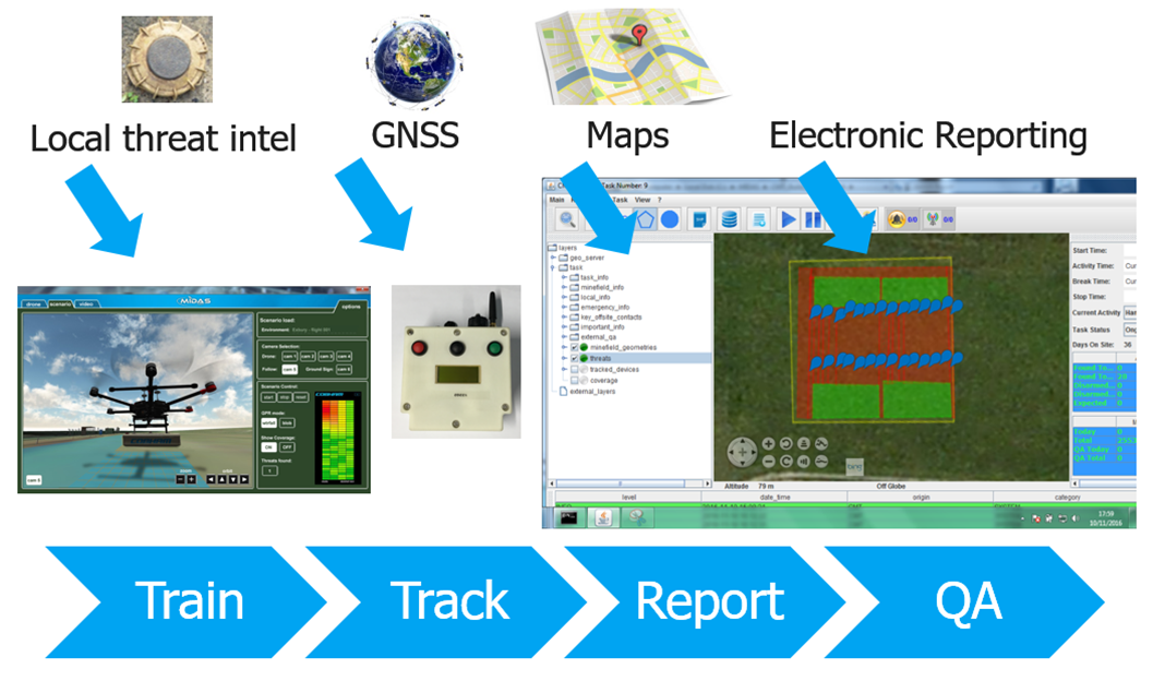
Also under development is the ‘Amulet system’ using a small Unmanned Air System (UAS) to deploy a Ground Penetrating Radar sensor. Amulet makes a map of the minefield as it operates, reporting in real time. The system is deployed remotely – critically removing the human from harm’s way. It can also search minefields that are otherwise inaccessible by road, for example due to flooding or landslide.
“MIDAS represents a real leap in the evolution of mine clearance. The tools are more efficient, lower cost, more auditable – not to mention the impact of the safer, humanitarian angle,” says Roberta Mugellisi Dow, Senior System and Data Systems Engineer, European Space Agency.
Paul Curtis, IED Product Manager at Cobham Antenna Systems adds: “This innovative new technology will yield a higher rate of land release for a fixed clearance budget. Through electronic mapping and reporting, through more timely and cost effective training, and by automation of search where there is value to do so; we can achieve a quicker return of land to vital local needs including farming and industry, to help mine affected countries return to a stable and prosperous state.”