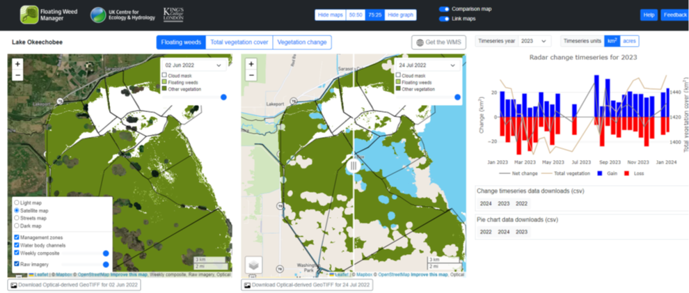
A new Floating Weed Manager system has completed testing and is now ready for commercial upscaling. The system uses data from Earth Observation satellites to monitor and support the management of invasive aquatic plants in freshwater bodies across the globe. The Floating Weed Manager was developed under ESA’s Business Applications and Space Solutions (BASS) Programme by the UK Centre for Ecology and Hydrology and the Environmental Research Group at Kings College, London.
Floating invasive aquatic weeds can rapidly clog up lakes, reservoirs and navigation canals, leading to major economic impacts for businesses, fisheries and leisure activities. Growth and spread of these weeds are a global problem, requiring frequent monitoring to inform boat access, target weed control programmes, and provide early warning of weed problems in new locations. However, providing a continual and complete picture is challenging. Existing survey methods, undertaken by boat and helicopter, can take up to a month to cover an entire body of water. Many countries lack the funds for regular monitoring, and in situ surveys expose staff to health and safety risks from weather and wildlife.
“We are pleased to have supported the Floating Weed Manager system, which is a great example of how satellite technology can deliver both environmental and economic benefits” said Francesco Feliciani, Head of the Company Led Projects Section at ESA. “We believe the service has the potential to transform the management of waterways across the world.”

The Floating Weed Manager combines radar and optical images from ESA Sentinel satellites to provide more comprehensive and more frequent vegetation maps than existing ground surveys. Once an image is acquired by the satellites it is delivered to the Floating Weed Manager within 48 hours, with a cloud-free whole-waterbody map available every 1 - 2 weeks. With timely and accurate data delivery it is easier to evaluate the scale of the problem and earlier intervention is possible. This means that a more targeted approach can be taken, consequently reducing the volume of herbicides needed to control the spread.
“For the first time ever, we can get a macro look at our project on a weekly basis with a plant focus” said Jessica Fair from The United States Army Corps of Engineers (USACE), one of the partners in the project. Jon Lane, also from USACE, added “Current methods of quantifying floating weed cover include costly helicopter surveys. If sufficient information is gathered with this method, there could be significant savings while improving accuracy and precision of whole lake floating weed cover estimates.”

The system was co-designed with partners in the field to ensure it met user demand, with coverage tailored to the characteristics of local water bodies. The United States Army Corps of Engineers (USACE), responsible for maintaining inland water transport and infrastructure routes in the USA, and the Florida Fish and Wildlife Conservation Commission were involved from the outset in the design and testing of the system.
Successful pilot tests took place at Lake Okeechobee and in South Florida, USA, and at Lake Victoria, Kenya, in partnership with The Kenyan Marine and Fisheries Research Institute (KMFRI). Feedback from the successful tests was extremely positive, and the system is now ready for commercial upscaling. With floating invasive weeds found across the globe, there is large market potential for widespread uptake.


