 Details on the Demonstration of Space Services Benefits in Aviation Systems (S²BAS) IAP project have been published to iap.esa.int. S²BAS is a project that will investigate improving access and operations in small and regional airports that cannot afford the expensive cost of conventional navigation means.
 Small and mid-sized airports face many challenges. Airport traffic is unevenly distributed over the day; general aviation traffic directed to minor airports cannot usually rely on the availability of flight information services, and in many cases general aviation aircraft flying inside non controlled airspaces cannot rely on air traffic controllers ensuring separation against other aircraft.
 Another issue faced by small airports is the production Aerodrome Obstacle Charts. This must be done periodically to ensure the required level of safety ANSPs (Air Navigation Service Providers). Currently this is done by the use of expensive aero photogrammetric techniques and on-site surveys by traditional topographic techniques.
S²BAS works toward a solution for these issues through the use of available satellite technology.
Satellite-based services used in S²BAS are:
-
GNSS (Global Navigation Satellite System) based navigation assistance in the terminal area to assist flight approaches.
-
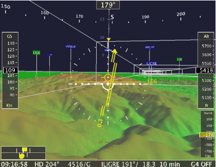
Production and distribution of Aerodrome Obstacle charts by means of satellite based Earth Observation data, to provide the pilot with a 3D mapping of the landscape elements in the airportâs proximity.
-
Satellite communications for remote airport management and control.
Key issues that will be addressed with this project include:
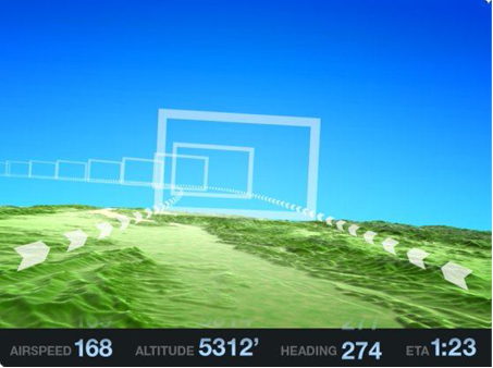
Navigation assistance: The S²BAS system aims at providing VFR pilots with satellite navigation solutions enabling the use of area navigation, based on dedicated GNSS routes and procedures, even for small and low-cost aircrafts.
Lack of up-to-date flight information: The S²BAS system aims at providing a specific Information Service, called General Information Service Broadcast, capable of broadcasting, via air-ground data-link, up-to-date meteorological (e.g. METAR), aeronautical (e.g. NOTAM), airport and touristic information.
Lack of traffic information on-board: S²BAS aims at increasing traffic situation awareness by providing pilots with surrounding traffic information via a CDTI (Cockpit Display of Traffic Information) on-board.
Detection of obstacles in the airport area: The S²BAS system will exploit an innovative technique relying on satellite based earth observation to enable automatic, more frequent and less expensive monitoring of the airport surroundings.
Airport air traffic services at (unmanned) minor airports: Economy and safety considerations suggest centralizing the provision of âairport air traffic servicesâ for a cluster of minor airports. In this perspective the S²BAS system aims at providing a solution to co-locate several air traffic and aerodrome handling services to a single (remote) centre. S²BAS encompasses the use of satellite based internet-like communication links in case of airports not covered by any terrestrial communication infrastructure.
Prime contractor for this project is Techno Sky (IT). Click here for complete details of the S²BAS project or see the links in the column to the right.


