
The Observatory of Water Availability – System of Integrated Services (OWASIS), developed by Dutch firm HydroLogic with the support of ESA’s Business Applications and Space Solutions (BASS) programme, is set to roll out across the Netherlands this year. The cutting-edge water management system uses satellite data and advanced technology to revolutionise how water resources are monitored and managed. From February 2025, OWASIS will be incorporated into the services delivered by the Waterschapshuis, the governing and implementing organisation for the 21 water boards in the information and communication technology field.
Efficient water management is critical for addressing challenges such as water scarcity, floods and the increasing impacts of climate change. OWASIS provides a transformative solution, allowing water authorities to assess available storage in the soil and to estimate available water resources in their area or detect any deficit in subsoil.
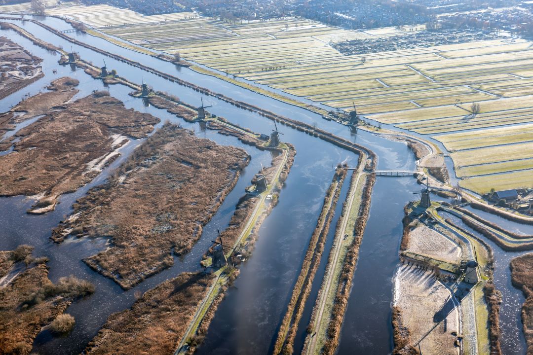
With nearly 30% of the Netherlands lying below sea level, effective water management has long been a necessity to keep the country flood-free – a matter of life and death since the Middle Ages. To address this, and to advance water management further, HydroLogic developed a soil water storage capacity service as part of OWASIS. By delivering real-time, unbiased data, it provides insights into water usage, soil moisture and vegetation, facilitating accurate monitoring and forecasting for water distribution systems.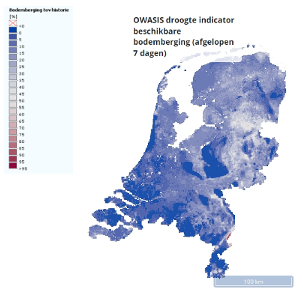
OWASIS integrates Earth observation data from ESA’s Sentinel satellites with ground-based information and artificial intelligence using the HydroNET platform. OWASIS gives access to more accurate information on the current and expected status of water systems via interactive maps and graphs, on a spatial scale that suits users’ needs. This reduces the reliance on manual inspections and supports sustainable resource management. The benefits are efficient and improved water allocation, reduced flood and drought risk and standardisation of water storage capacity – critically showing where water is still available.
The system has already demonstrated success in pilot projects in the Netherlands, including during a period of extreme draught. It has demonstrated its potential to reduce water losses, improve decision-making, and enhance infrastructure resilience. With its upcoming rollout, the Netherlands will serve as a model for other regions aiming to modernise their water management strategies.
"OWASIS demonstrates how satellite technology can address pressing challenges on Earth” said Beatrice Barresi, Senior Sustainable Applications Officer at ESA. “This project exemplifies ESA’s commitment to enabling innovative solutions for water resource management, and we are delighted to see it being rolled out across the Netherlands. Data shows that OWASIS can save an equivalent amount of water to 200 Olympic swimming pools for a single region in the Netherlands; imagine the huge gain when the solution is applied across the whole country.”
"With the support of ESA, HydroLogic and their partners have successfully deployed the OWASIS product for a number of water boards in recent years. This success has led to the product now being rolled out on a national scale under the name National Soil Moisture Information Service (LIBV). With these services, we will continue to provide water authorities with data-driven changes in soil moisture, essential for operational, tactical and strategic water management, over the coming years."
The country-wide adoption of OWASIS in the Netherlands marks a major milestone in the use of satellite technology to tackle real-world water challenges. With its ability to enhance efficiency, reduce waste and provide actionable insights, the system is setting a new standard for smart water management and is poised to make a significant impact on the sustainability of water resources.