
Limited water resource availability and efficient water management are major global challenges facing policymakers worldwide. In collaboration with the University of KwaZulu-Natal, the Dutch company WaterWatch has demonstrated a pre-operational service aimed at tackling these challenges. The GrapeLook project was co-funded by the Department of Agriculture of Western Cape in South Africa and by the ESA Integrated Applications Promotion programme.
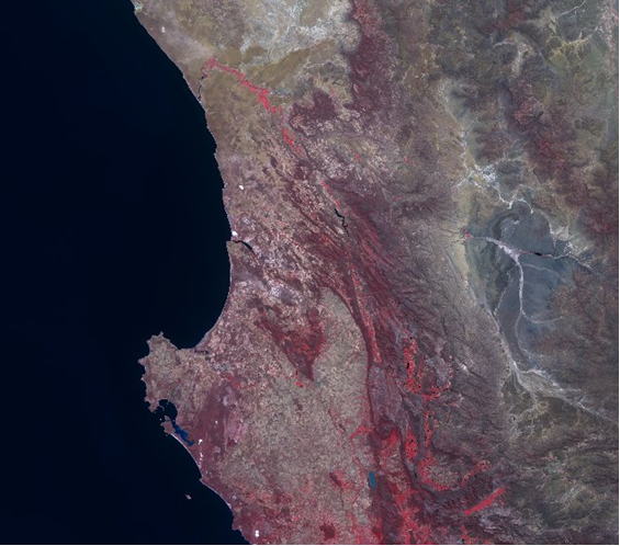 In South Africa, water is a critical resource and there is strong competition between the urban, industrial and agriculture sectors. The National Water Act (1998) states that water should be used efficiently and has to be reserved for basic human needs and for protecting aquatic eco-systems first, with agriculture having a lesser priority. However, agriculture remains of high economic importance as it contributes to export, employment and livelihood. The challenge is to increase agricultural production while reducing water consumption.
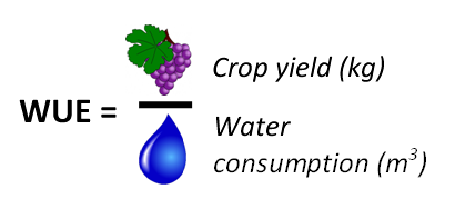 One of the major sectors in the Western Cape Province of South Africa is the table and wine grape industry. Water productivity or water use efficiency (WUE), defined as crop production divided by the total water consumption, is a vital parameter to assess agricultural performance. To optimise the water use efficiency, one needs information on the crop production and the crop water consumption. The physical process behind crop water consumption is the process of actual evapotranspiration (ETact).
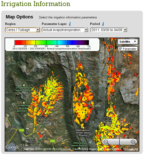
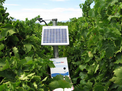 It is well known that satellite Earth observation can deliver regular maps on physical properties of vegetation. In the GrapeLook project, space based remote sensing algorithms are used to monitor actual evapotranspiration, biomass production and water use efficiency as well, and this is a breakthrough. The engine of the system relies on a complex modelling scheme which ingests Earth observation data and in situ measurements (left picture). In-situ soil moisture measurements are transferred in real-time to the processing centre thanks to a satellite communication link.
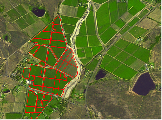 Once the product is generated by the processing centre, the maps are displayed to the users (farmers and authorities in charge of water management) through a Google Maps based website www.GrapeLook.co.za. A group of demonstration farmers also received forecasts on soil moisture and irrigation water requirements for their farms. The farms of the demonstration farmers have been accurately geo-referenced thanks to GPS surveys (right picture).
Participating grape farmers received training on how to use the information provided by the pre-operational service. During the 2010-2011 grape growing season, they have regularly connected to the website to check the status of their own farms. Their feedback can be summarized as follows.
- GrapeLook is useful to monitor crop water stress, crop growth, and to identify irrigation system malfunctions;
- GrapeLook supports more efficient farm management practices;
- On the medium term, GrapeLook will help reducing labour and input costs, increasing products quality/yield and improving water use efficiency.
The demonstration project also convinced the Department of Agriculture: Western Cape that GrapeLook is a very cost effective tool for improving water use efficiency.
 The project was successfully completed in October 2011. It proved that the system concept was mature although a number of improvements are needed for GrapeLook to become a fully operational service in the coming years.
But most important the project showed that the target end-users were supportive of such a service, although very innovative. It will take a few years to strengthen trust and awareness with these user communities. The South-African authorities are aware of this, and are willing to support the prolongation of a freely available GrapeLook service for another season.


