
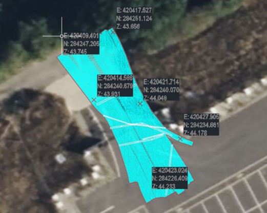
Infrastructure is the backbone of a nation’s economy, ensuring essential services, such as power, water and transportation remain operational. Roads, bridges, rail and utility networks need to be maintained, and planned new developments require information about what is happening both above and below ground. Subsurface imaging provides vital insights for the utility and infrastructure sectors by identifying existing utilities, buried obstacles or other hazards, minimising delays and reducing risks. TrueWaveGPR has been developed by UK company, PBU (UK) Ltd., under ESA’s Business Applications and Space Solutions (BASS) Programme supported by the UK Space Agency and provides interactive 3d models with unprecedented detail of the subsurface, even in areas with uneven ground.
Currently, utility companies use a combination of time-consuming and costly topographical and ground penetrating radar surveys to establish where existing utilities and hazards are located. This can lead to significant disruption from excavation, excessive noise, emissions from machinery and traffic congestion. TrueWaveGPR replaces topographical surveys and cuts survey time by up to 50%, while increasing the accuracy of results. The system can also be used in challenging terrain, meaning areas previously deemed too costly or time consuming to survey can be included in plans.
In order to develop the system, PBU (UK) Ltd worked closely with infrastructure clients, such as Balfour Beatty VINCI, AMCOGIFFEN and Excalon. This enabled them to meet client needs around futureproofing assets and efficient planning of new infrastructure installations, identifying the best routes by detecting obstacles and buried debris which would impede progress. The precision of the images can also prevent cable strikes, improving safety and reducing costs and delays to projects.
“In the sector where PBU operates, excavation and horizontal drilling are daily occurrences, often in rural areas of challenging terrain, so it is essential that utility strikes are kept to a minimum for the safety of our employees and the efficient delivery of our service” said Chris Norris, Project Manager for PBU. “This is the reason we developed the TruewaveGPR technology and we are enthusiastic to see and support future development as we transition to track inspection for Network Rail to identify ponding water or unknown culverts which and warning signs which could lead to embankments collapse and landslips.”
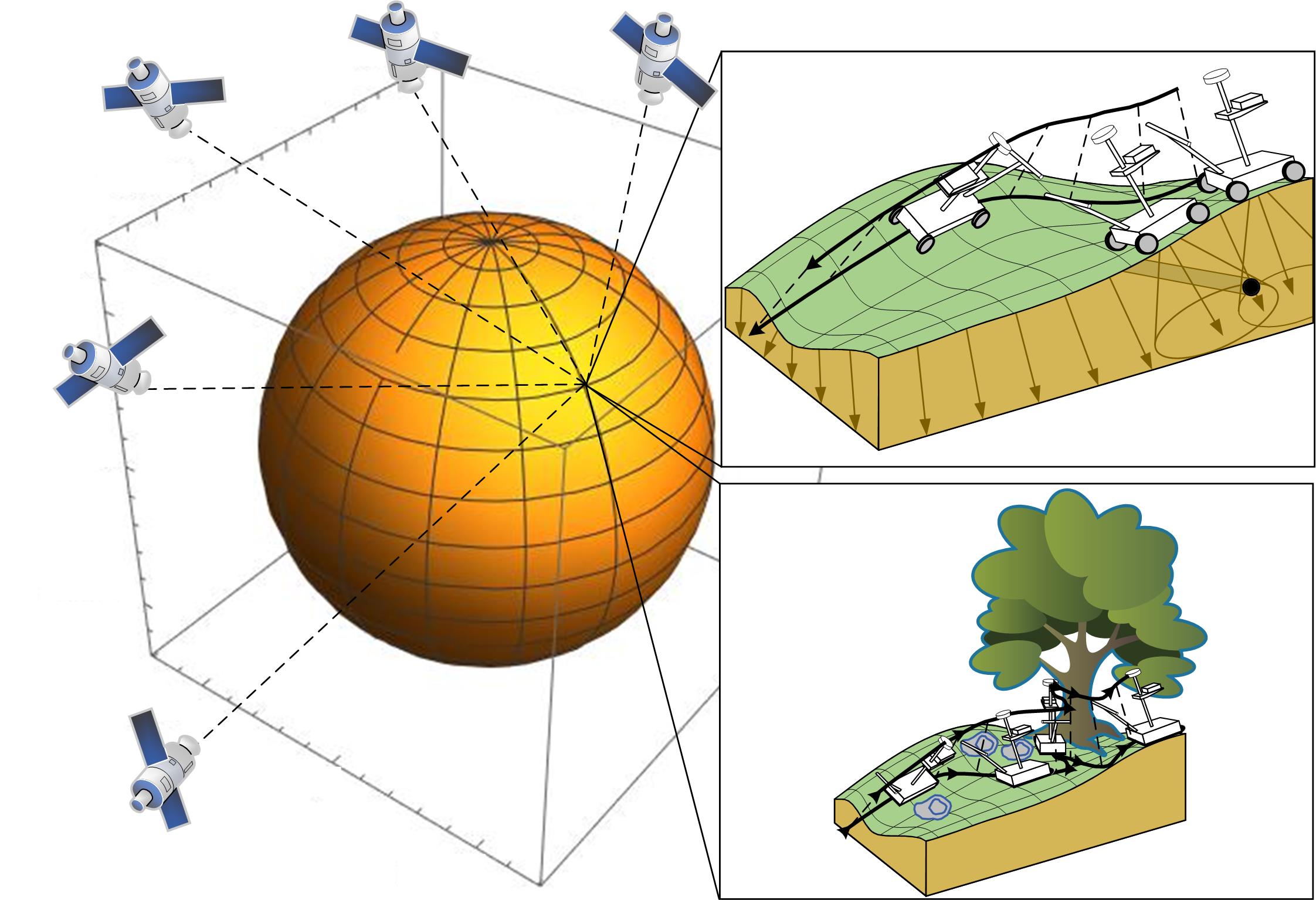
Traditional ground-penetrating radar (GPR) systems historically struggle to surveying areas of undulating terrain, and the TrueWaveGPR project advanced GPR technology to encompass undulating and difficult-to-access terrain, including areas with trees, buildings and slopes. They created a modular system based on a Global Navigation Satellite System (GNSS), which leverages satellite technology to determine the exact position of the radar, coupled with the change in antenna angle associated with the ground. Previously, topographic surveys relied on external references, including the Earth’s magnetic field, which can be variable over time and reduce accuracy. TrueWaveGPR combines GNSS with an inertial measurement unit (IMU), and an advanced data collection system, and the system has increased the image accuracy of buried utilities networks by over 80% in a rural setting, providing images to10cm accuracy in urban locations, compared to the current UK standard (PAS128) of 50cm.
‘We are delighted to see that TruewaveGPR has achieved such remarkable results in challenging conditions, leading to commercial opportunities and contracts” said Enrico Spinelli, Applications Engineer for ESA. “This is the kind of project we are proud to support as it helps customers work more sustainably, safely and efficiently.’
TrueWaveGPR has already demonstrated its value to the sector and been utilised in high-profile projects, including surveys for Balfour Beatty at HS2’s Coventry Main Compound and Network Rail at Belsize Park and Newton Street Glasgow, where the investigation of hidden railway shafts is a priority. Commercial contracts are in place for 2025, and plans include further technological development for track inspection applications to address the challenges of rail infrastructure maintenance. The project’s ongoing collaboration with industry leaders demonstrates the success of the system’s innovative approach and commercial viability.