Objectives of the service
AgriPoints aims to deliver an innovative Earth Observation (EO) based tool for farmers, agricultural associations and agri-services providers, to add value to their activities by increasing their differentiation and competitiveness.
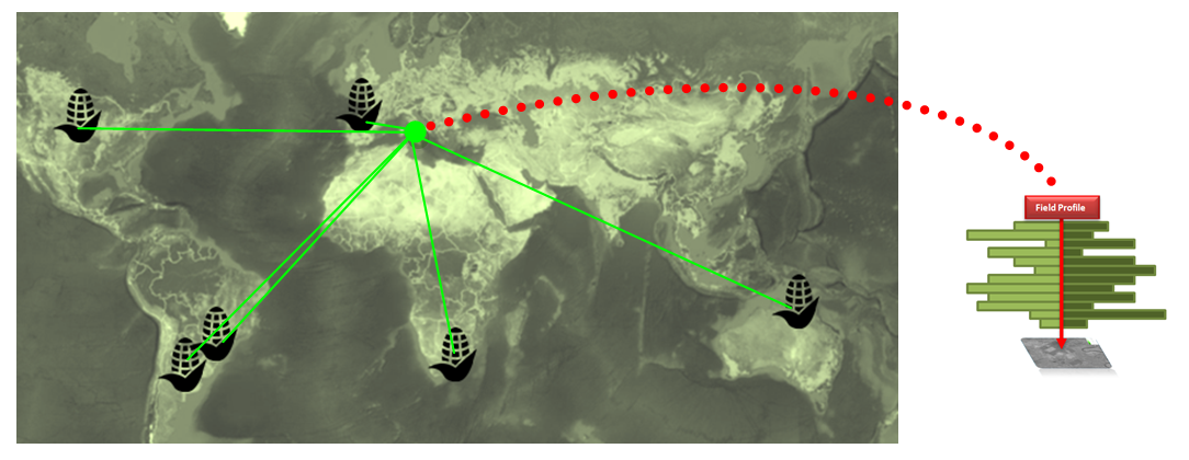
AgriPoints assists farmers to deal with some of their most challenging problems which impact their activities, such as crop growth unexpected development. Taking advantage of satellite imagery AgriPoints is capable to reveal the variables hidden from the farmers perspective, but still under their control. The service is capable to monitor not just a single field, but fields distributed regionally (or even worldwide) under similar agro-ecological conditions and agricultural practices.
AgriPoints portfolio is based on the provision of EO-based added value information which fall under the following categories: (i) Land Use / Land Cover maps; Vegetation, Soil and Water indices maps, Crop Health and Water Stress status maps; Zonification maps, Drought maps; Crop Yield analysis under drought and optimal conditions, (ii) Meteorological datasets and forecasting, (iii) Historical crop trends and field patterns, (iv) Crop pest monitoring.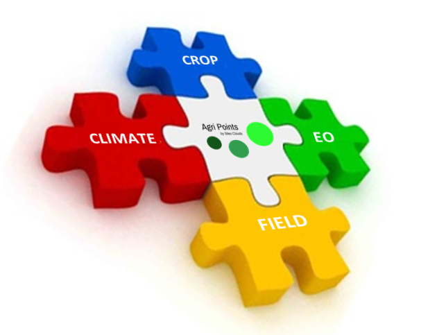 The full service puts into perspective farmers’ crop fields, their characteristics and growth status in order for the farmer to take timely decisions where and when it is needed.
Users and their needs
AgriPoints manages to reach end-users via distributors, such as agriculture associations, insurance companies, agri-services providers, and consultants, selected on the basis of location, crop type and area cultivated. Some of the main potential end users which were identified and contacted during this activity are farmers, investors and agricultural project developers, companies related to the sector of Irrigation Systems, Agronomists Consultants, and Agricultural trading companies.
So far potential customers from countries located in Europe, South America, and Africa have been contacted to gather user needs, requirements and their insights.
The main needs collected are comprised of: (i) Detection of crop growth anomalies, (ii) assessment of the performance of own fields’ compared with the ones of the region, (iii) early detection of potential pest outbreaks, and (iv) differentiation need of service providers’ portfolio with innovative products.
AgriPoints translated the captured user needs into service requirements in order to develop and deliver a multi-dimensional service. With scientifically proved models, enabling crop yield forecasting and identifying risks of pests outbreaks, AgriPoints empowers agri-analytics professionals enriching their performance with an innovative tool.
Service/ system concept
The core system is fed with Earth Observation images correlated with data provided by end users and in-situ sensors. The acquisition and processing of the satellite images takes place in both local and Cloud-based servers in order to guarantee redundancy and service availability 24/7. To assure the accessibility and interoperability with third parties systems, AgriPoints products are offered in the most common formats, via user-friendly dissemination tools.
The products can be accessed after signing up on a subscription plan. A Freemium plan gives the possibility to monitor a limited number of hectares, with limited but meaningful functionalities conditioned by the provision of information regarding field characteristics (such as crop type, agricultural practices) and user details. Basic and Premium subscriptions include the reports of similar fields, anomalies detection, crop yields forecasting, and crop pest risk maps.
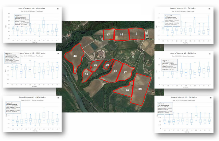
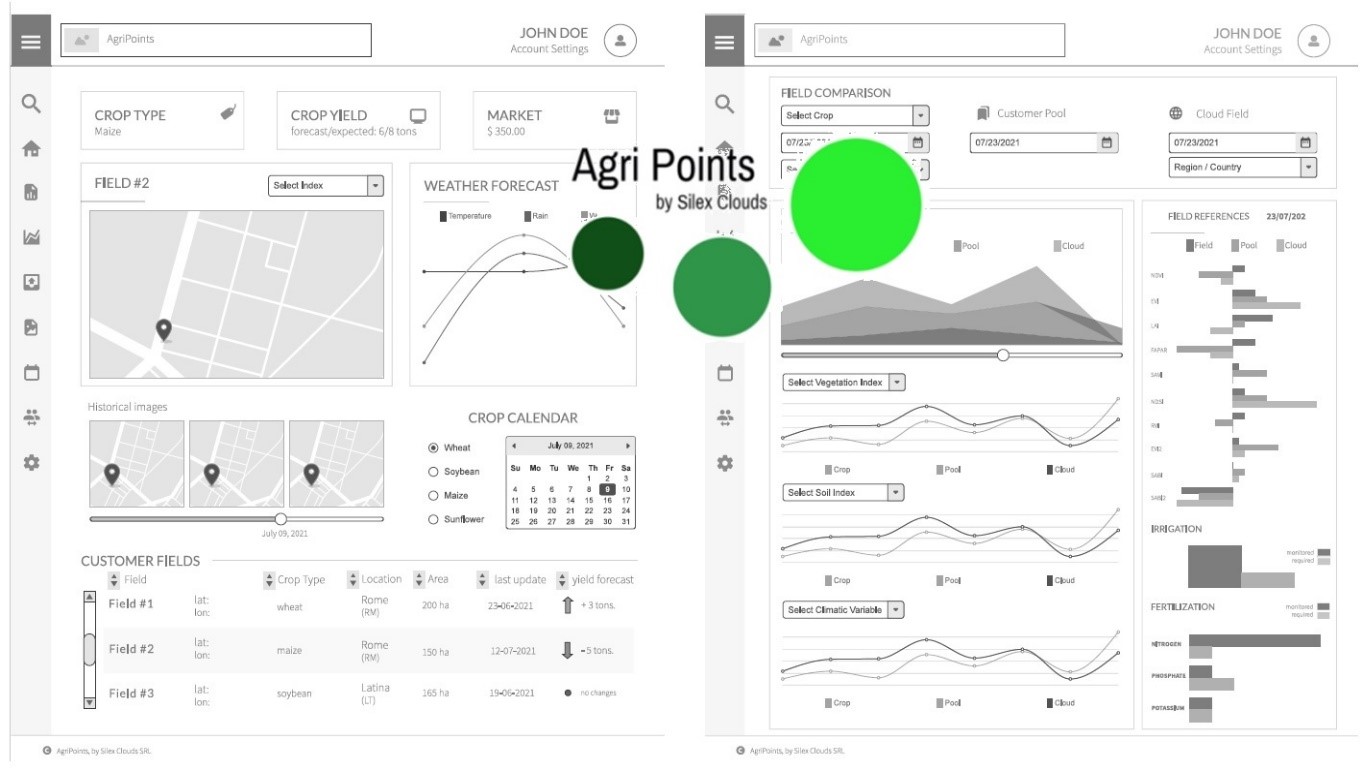
The core web interface reflects main user preferences, collected during surveys and meetings. Patterns from multi-temporal EO-based products can be visualized comparing different fields of interest, evidencing crop growth anomalies, climate conditions, etc. From the portfolio interface the user can select the products of interest, from a list containing vegetation and soil indices, monitoring periodicity, required spatial resolution and the preferred delivery method.
Space Added Value
AgriPoints applies data acquired by several EO satellites. The generation of the portfolio involves the acquisition and processing of imagery from available Copernicus services and commercial satellite image providers.
The added value of AgriPoints is based on current EO Systems, which give accessibility to daily datasets covering wide areas of interest and allowing the simultaneous monitoring of multiple and dispersed fields. This enables the comparison of different fields’ growth status by highlighting eventual anomalies.
Current Status
The KickStart activity, has been successfully concluded. The system architecture was designed and a first prototype was developed. A survey was sent and filled out by potential early adopters from different countries representing different customer segments.
A reference price has been analyzed while at the same time cash-flows forecasts under different potential scenarios capturing diverse market shares have been developed.
The next version of AgriPoints solution will be enhanced by the support of IT companies and in-situ sensor providers which will advance the overall system architecture and will grant, in the close future, further market penetration.