
Objectives of the service
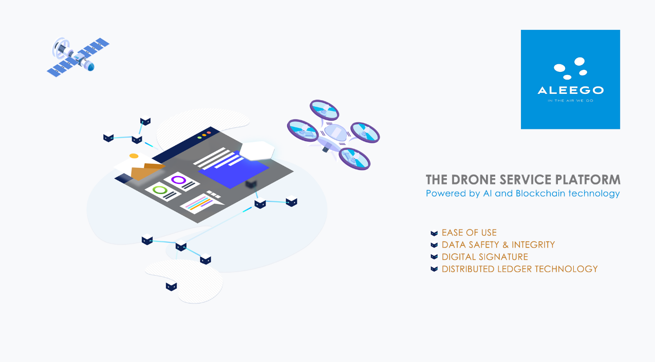
Companies are delaying their adoption of drone services due to complexity and concern about data safety. ALEEGO developed an online platform combining ease of use and data integrity.
Enabling users to create and manage their Unmanned Aerial Vehicle (UAV) mission, our platform introduces the benefits of Blockchain technology to secure data transfer and immutability.
Users and their needs
Based in the Czech Republic, ALEEGO already conducts drone inspections in Poland, Slovakia and Serbia for key players in the construction, agriculture, logistics or energy industries.
Our platform is for demanding companies, experienced UAV pilots and Civil Aviation Authorities (CAA) wishing to minimize risk and complexity while maximizing time management and productivity.
The main challenges faced by companies wishing to inspect their assets using drones are:
- Complexity:
It is extremely complex for a company to successfully plan a UAV mission, obtain the required flight authorisation from CAA, conduct the flight, process the data collected and create a qualitative report.
- Data safety:
Data collected during a mission are confidential. Companies fear that they could be stolen or used by third parties.
- Data integrity & immutability:
In case of an incident and due to the sensitive nature of UAV missions, users need to be able to submit indisputable original mission documentation.
Service/ system concept
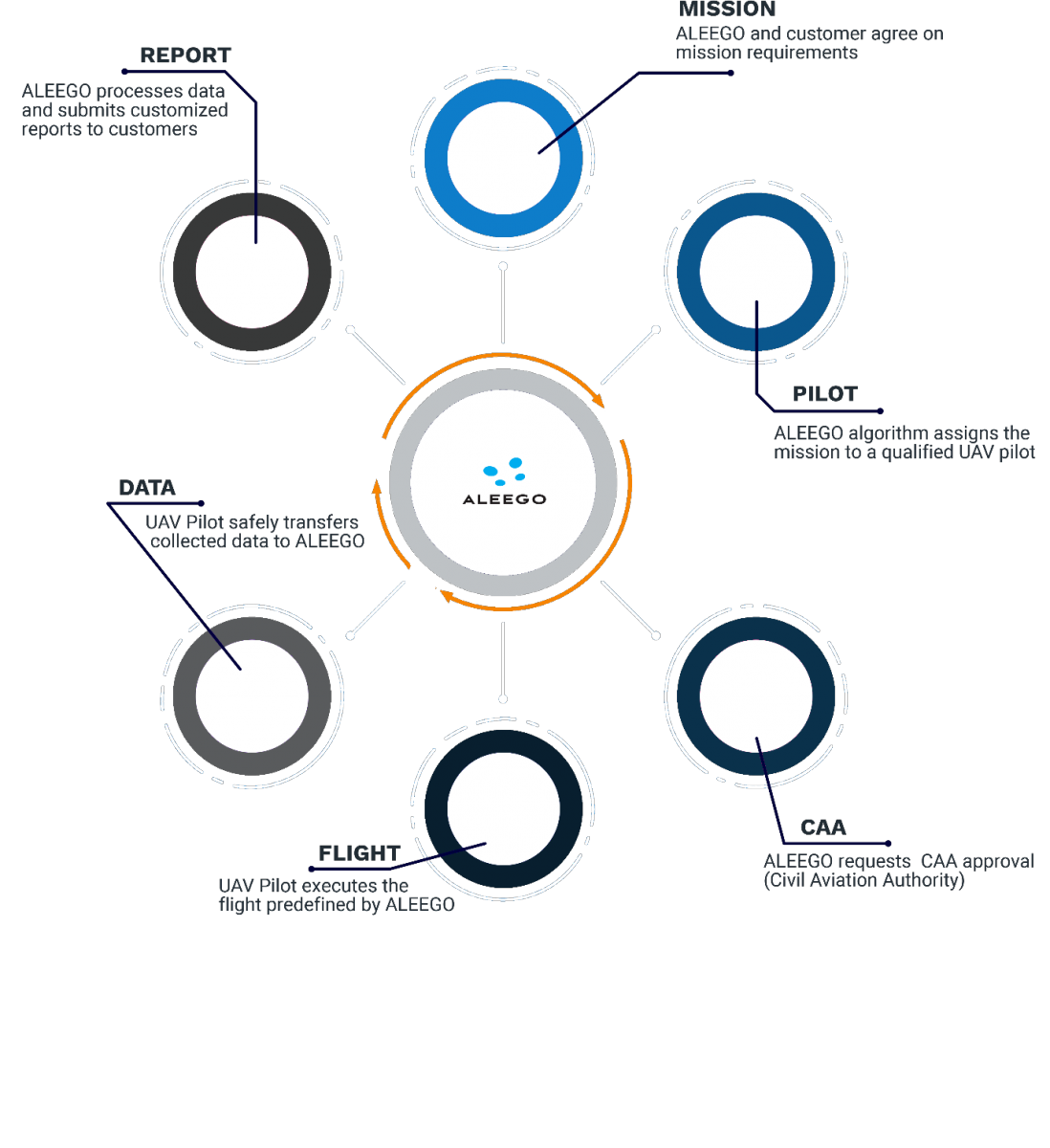
ALEEGO customers are now able to order a UAV mission in few clicks only. Our algorithms assign a pilot with best matching experience and equipment.
After obtaining the required flight authorisation from the CAA, the data are collected and post-processed. A qualitative and comprehensive report is then created and delivered to the end-customer. This process solved the complexity challenge faced by our customers and prospects.
Space Added Value
Our UAV flight paths will be defined using European Geostationary Navigation Overlay Service (EGNOS) and Global Positioning System (GPS). The accuracy of the positioning signals sent out by GPS (with a precision up to 1.5 meters) will be improved by EGNOS.
The integration of Earth Observation using Copernicus Sentinel-2 with 10 meters resolution and the frequent updates will add layers to conventional UAV mapping using the high temporal resolution, where we can obtain revisit time of 5 days.
These space technologies will allow us to define the road mapping, develop our autonomous flight software, request flight permission from CAA and accurately produce a qualitative report to our customers using Global Navigation Satellite System (GNSS) signals and verify flight path.
Current Status
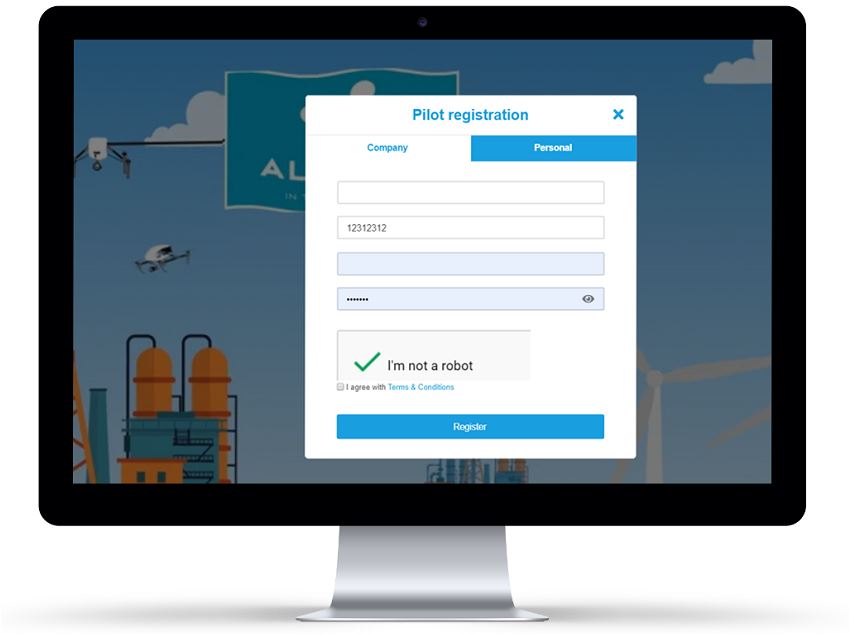
Companies and pilots are already able to order/accept and manage their UAV missions on ALEEGO online platform.
We successfully implemented the planned feature enabling users to timestamp and keep a fingerprint of sensitive documents on the blockchain.
Another important feature we have implemented is the Mission Audit Trail. Once a document (signature, flight approval, flight path…) is time stamped with an immutable fingerprint on the blockchain, we still had to solve the question:
How can we guarantee that the process itself is not hacked?
To solve this potential weak point, we have added the audit trail feature. Now every action taken on the platform leaves a trace that is also added to the blockchain. Users are able to download documents along with the full history of actions related to it.