Objectives of the service
AmmonEO will use Earth Observation (EO) products to monitor ammonia emissions from agriculture, primarily from UK animal farming. This is the potential catalyst for improved low-emission farm management practices.
Ammonia is a key air quality pollutant with impacts on human health and the environment. In the UK, agriculture accounts for 87% of national ammonia emissions, with >75% directly attributable to meat production. However, accurate measurements of emissions from agricultural sources are both difficult and expensive.
Project objectives:
-
Consider potential of satellite data to constrain ammonia emissions.
-
Assess reliability to inform emission estimates at farm scale.
-
Validate User Requirements.
-
Explore potential for services to better meet government objectives and information needs of livestock producers.
Our approach represents significant innovation over existing practices, which are based on ground sensor networks and average emissions models across large areas.
The end goal is to provide a commercial service to businesses and governments that will enable them to quantify and locate ammonia emissions at high spatial resolution over large areas, more frequently, reliably and in sufficient detail to inform changes to management practices.
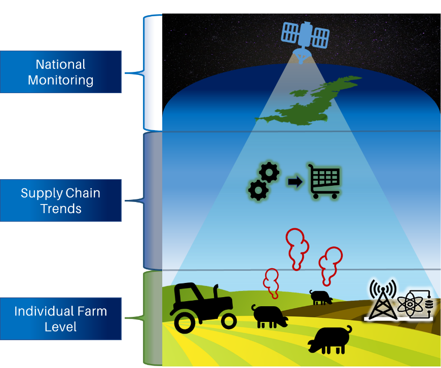
Users and their needs
The basic service provided will be of interest to a wide range of end users:
-
Governments: wishing to meet National Emission Ceilings targets, with ammonia being the most problematic target.
-
The Farming community: is keen to adopt sustainable farming practices and mitigate activities that contribute to atmospheric ammonia concentrations.
-
International Funding bodies: are keen to ensure that international aid programmes do not negatively impact the environment.
-
The Retail Sector: is keen to ensure that the supply chain has an environmentally sustainable footprint. Buying from providers that can demonstrate the adoption of mitigating practices would meet this requirement.
-
Philanthropic organisations: are keen to fund projects / services that help to understand how human activity negatively impacts the environment.
Service/ system concept
The service will be heavily dependent on the collection and analysis of new satellite imagery. Once this imagery is collected, we will apply basic processing to the imagery (ortho rectification, ATCOR) and advanced techniques (proprietary models developed for the identification and mapping of ammonia) to deliver the service.
Space Added Value
This service will utilise Earth Observation assets. A range of current satellites can be used for technical validation. We also have relationships with upcoming satellite operators that will have appropriate capability in the coming years. It is through these and similar operators that we will be able to scale the service to regular coverage capability.
The service will complement current national models, adding improved spatial and temporal information feeds.
Earth Observation satellites have the potential to meet the requirement of end users, with the ability to acquire imagery for most of the planet.
Current Status
As a result of this project, we have successfully validated the proposed approach to AmmonEO, gathered detailed and invaluable input from key stakeholders in our target market segments and key customer/user organisations for the future service.
We have also developed a roadmap for the next steps after conclusion of this feasibility study, with a clearly scoped plan for in-practice technical validation. We have provided an outline financial model and commercial roadmap to show our current understanding/expectations of how this service will develop over the coming years.
Prime Contractor(s)