
Objectives of the service
Cycling and light transport has been growing rapidly as an efficient solution to moving people and goods around cities and has been accelerated by government backing to reduce pollution and congestion as well as technological advances in e-bikes, cargo bikes and connectivity. However, navigation for these forms of transport remained poor, with big mapping companies (Google etc) still seeing it as a niche market with complex technical challenges to be addressed relative to their core automotive markets.
This project developed great navigation embedded into the products and services of businesses which use or provide 2 wheeled vehicles (e-scooters, motorcycles). This makes it easier, safer and more convenient for people and goods to travel by light, 2-wheeled transport rather than by cars, vans and trucks.
Beeline has built an end-to-end navigation service which can be fully integrated into business customers’ own bike-based products and services. The following is included:
- Best-in-class routing optimisation, tailored to use-case and vehicle
- Customisation of routing profiles and areas to customers’ needs
- Navigation guidance system and interface specifically designed for 2-wheeler use cases, via GPS+motion sensor fusion
- B2B platform for easy integration into customers’ native apps via SDKs and APIs
Users and their needs
User and needs:
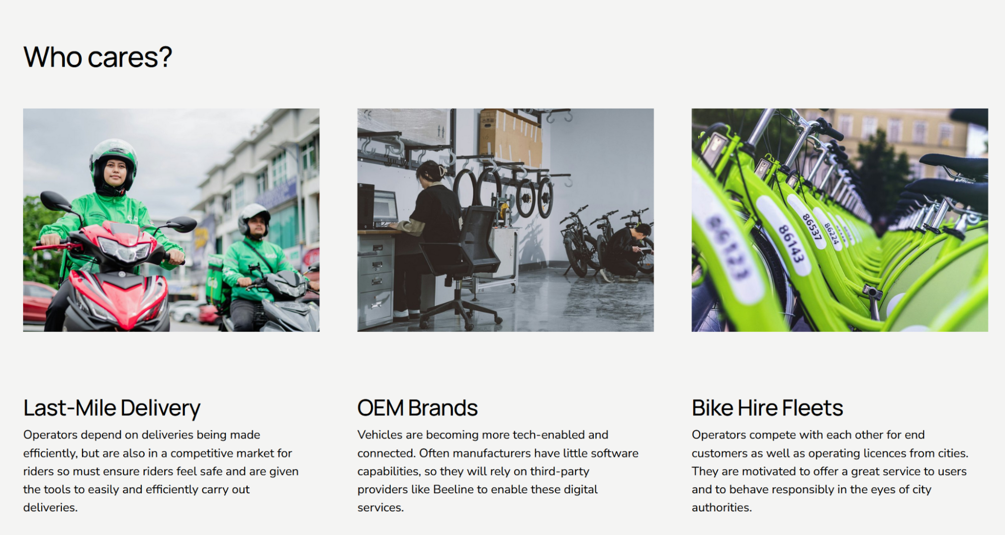
- Logistics providers using bikes for delivery - Bikes/e-bikes/cargo bikes are being used increasingly for delivery in cities as they are cheaper and faster in urban environments. These operators depend on deliveries being made efficiently, but are also in a competitive market for riders so must ensure riders feel safe and are given the tools to easily and efficiently carry out deliveries.
- Operators of shared bike/scooter fleets - Both docked and dockless sharing systems have been growing in popularity over the last 5-10 years as they are seen as a convenient solution to urban mobility. These operators compete with each other for end customers as well as operating licences from cities. They are hence motivated to offer both a great service to users and to behave responsibly in the eyes of city authorities.
- Manufacturers of motorcycles, e-bikes and e-scooters - For manufacturers of connected e-bikes and motorcycles, integrated navigation has been increasingly becoming an important component of the wider digital product offer and a point of differentiation in a market where end-users increasingly expect connected features comparable to those available in other transport sectors. As 2 wheeled vehicles become more tech enabled and connected via apps, manufacturers are in a position to be able to offer digital services as part of their offering. As motorcycle and bike manufacturers are not traditionally tech businesses with software capabilities, they tend to rely on third-party providers to enable these digital services.
For all groups of users, the frustrations have been around not having high quality navigation fit for specific purposes as well as having to switch between various apps and services to get any form of navigation at all. Beeline’s customers are global.
Service/ system concept
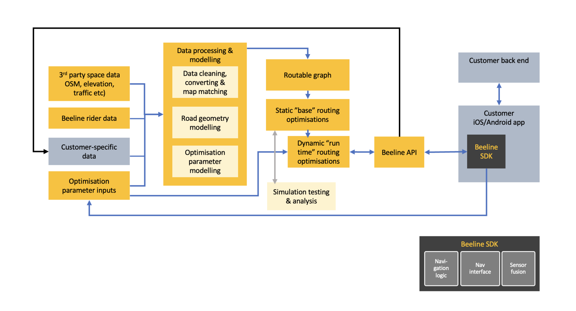
The Beeline B2B bike navigation system processes space data relevant to (e)bicycle and motorcycle riders (e.g. road surface, rider feedback, traffic speeds) and provides routing optimisations specifically designed for vehicle and use case. For example, an e-scooter commuter may wish to use safe cycle infrastructure but avoid rough surfaces such as cobbles. Whereas a cargo bike delivery rider will want to optimise for speed and is confident riding in heavy traffic but must avoid narrow gateways.
The processing and storage of data is handled on AWS computers and servers. Routes are then provided at run time, when requested by the customer. This allows for a completely dynamic routing service in which any routing optimisation can be provided. They do not have to be fixed in the system (as they previously were with the Beeline consumer navigation service). The route is delivered to the customer via API, at which point the Beeline navigation SDK guides the user through the route to their destination, using Beeline’s navigation logic and interface along with sensor-fusion enhanced location and orientation data.
Space Added Value
Space technology/assets used:
- Geolocation road feature data - Openly available or purchased feature data used to feed into routing algorithms and define routes optimised for purpose. Data used to define weightings for speed, safety or pleasantness of route to provide best routes for purpose.
- Recorded GPS location, speed and motions sensor data - Using live GPS location data of a user’s current journey to guide them. GPS speed data used to understand speed through junction types. Combining GPS and motion sensor data to understand road surface quality. Recording user feedback with GPS location as a space dataset feeding into the mapping and routing algorithms. Combining all of these space datasets and applying modelling to them allows Beeline to provide optimised routes for customers’ needs.
- Earth observation - Digital elevation models and other earth observation data (e.g. air quality, elevation data, land use data) to feed into routing algorithms.
GPS location for sensor fusion algorithms - Using GPS location to combine with motion sensor data to provide enhanced location and orientation accuracy.
Current Status
The technology has now been fully developed, as specified in the requirements of the project and has been validated through successful pilot testing. While the technology has been developed to be able to serve B2B customers, we have adopted the same technology in our consumer business (for technical efficiencies) and this is now being used to better serve our 70k+ motorcycle and cycle MAUs.
Through this project we have developed positive relationships with several motorcycle OEMs and Tier 1 technology suppliers including Bosch (others under NDA), and have signed a significant commercial contract to provide our technology to a cycling partner.