
Objectives of the service
Support an efficient monitoring of ecological land use to ensure a high food supply chain integrity with farmed areas from the very beginning. The ecological food market is a global growing market and relies on certification standards which are often expensive to monitor and to control. With the BioDiv Checker, ‘navama – technology for nature’ developed a new service in cooperation with Naturland e.V. to improve the integrity at the start of the ecological food supply chain. UAV and Satellite Imagery are analysed to validate certification requirements as e.g. area of farmed land versus “nature” or size of fields and plausibility of harvesting amounts.
Users and their needs
All actors involved in the supply chain of natural and bio food have an interest to ensure the right ecological farming with a high degree of nature conservation at the start of the supply chain and subsequently to have the right farmed eco product in the supermarket shelf. This is especially important for eco farmed products in areas difficult to access such as shrimp aquacultures in mangrove forests or tea plantations in rain forests.
The application focus was on farmers who are Naturland certified and eco food traders who buy products from these farmers before the products are sold in the German retail market.
Customers and partners are currently based in Germany, Indonesia, Vietnam and Ecuador.
Service/ system concept
Analyze UAV and Satellite Images based on own developed methods to gain field or aquaculture pond sizes, forest compositions, forest health and tree heights. All parameters measured are part of certification standards to ensure an ecological and sustainable land use.
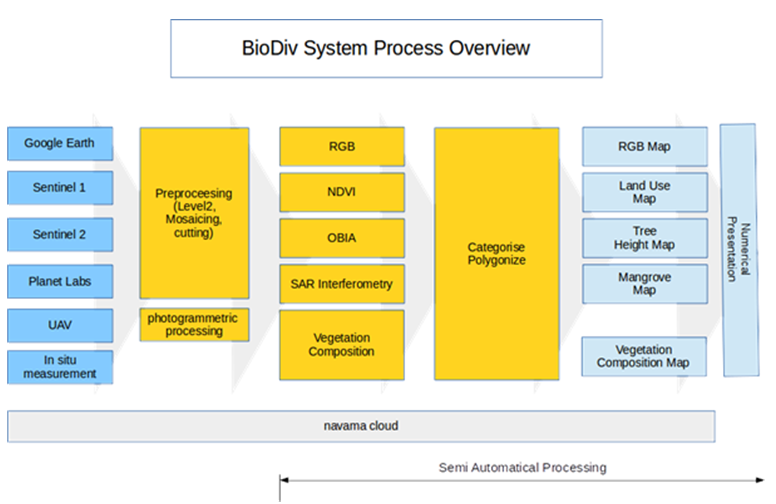
Figure 1: Process Overview of the BioDiv Checker
Space Added Value
Space Assets used are GNSS, Sentinel-1 & -2 Imagery, Plejades (50 cm resolution) and images acquired from commercially available, low-cost UAV (Unmanned Aerial Vehicle) systems.
The methods compete with onsite measurements done by certifier engineers, i.e. processes which are expensive, time consuming and often difficult to realize in a statistical relevant way.
Current Status
The feasibility study has been concluded successfully in June 2018. A basic commercial process is established.
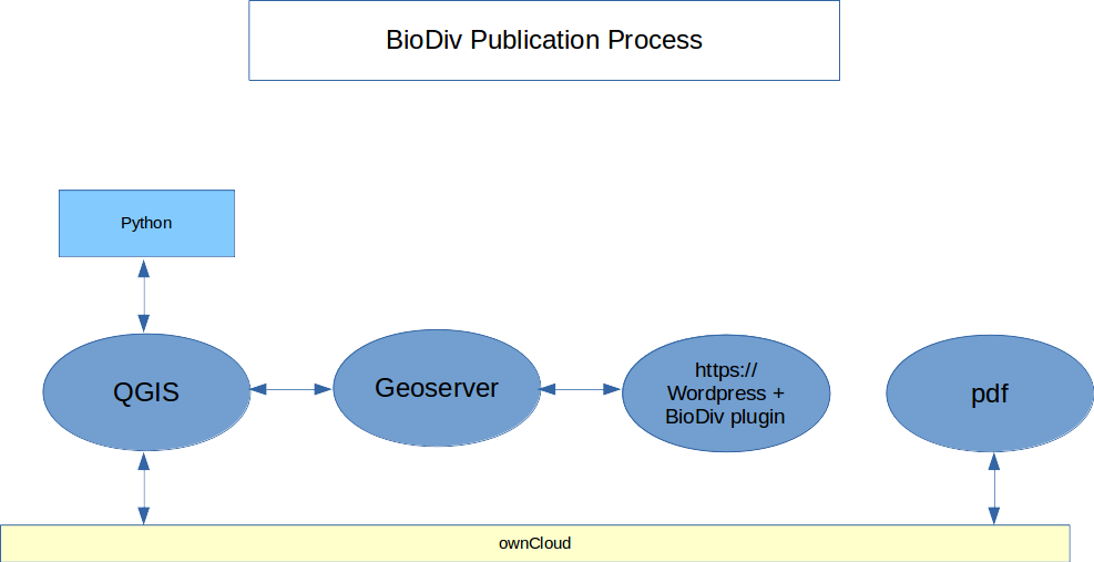
During the feasibility study navama analysed regions of partners in Bangladesh, Vietnam, Indonesia and Ecuador. Figure 3 shows an analysis of aquacultures in Indonesia to quantify pond sizes. The final presentation of results of a remote sensing analysis are made available as an interactive map in a browser. Here, image structures can be selected, and then information like pond area, mangrove type and mangrove area are displayed. The interactive map results are also available as pdf report.
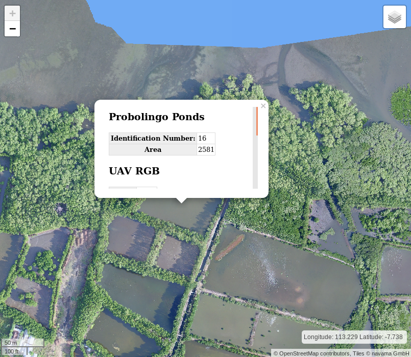
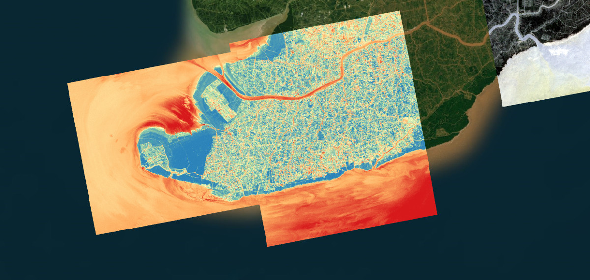
Figure 3: Merged Geotiff image of UAV scans from shrimp aquacultures in Indonesia.
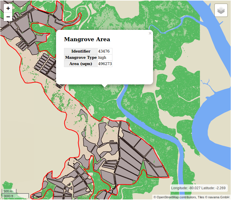
Figure 4: Shrimp aquacultures in Ecuador and analysed mangroves in the surrounding.