Objectives of the service
Water scarcity is a global problem, which affects citizens, governments, industries and agriculture. Growing population and climate change cause catastrophic water shortages in many areas of the world.
Around 50% of potable water that is distributed in the Middle-East and Africa is leaked or stolen and accounted as loss or non-revenue. Water is polluted and quantities and qualities of the source of life are out of balance. On top of this, the value of water is distorted. In areas where shortage is, consumption can be excessive or ten times higher than the global average — but water abstraction is not measured nor controlled and significantly undervalued. This needs to be solved.
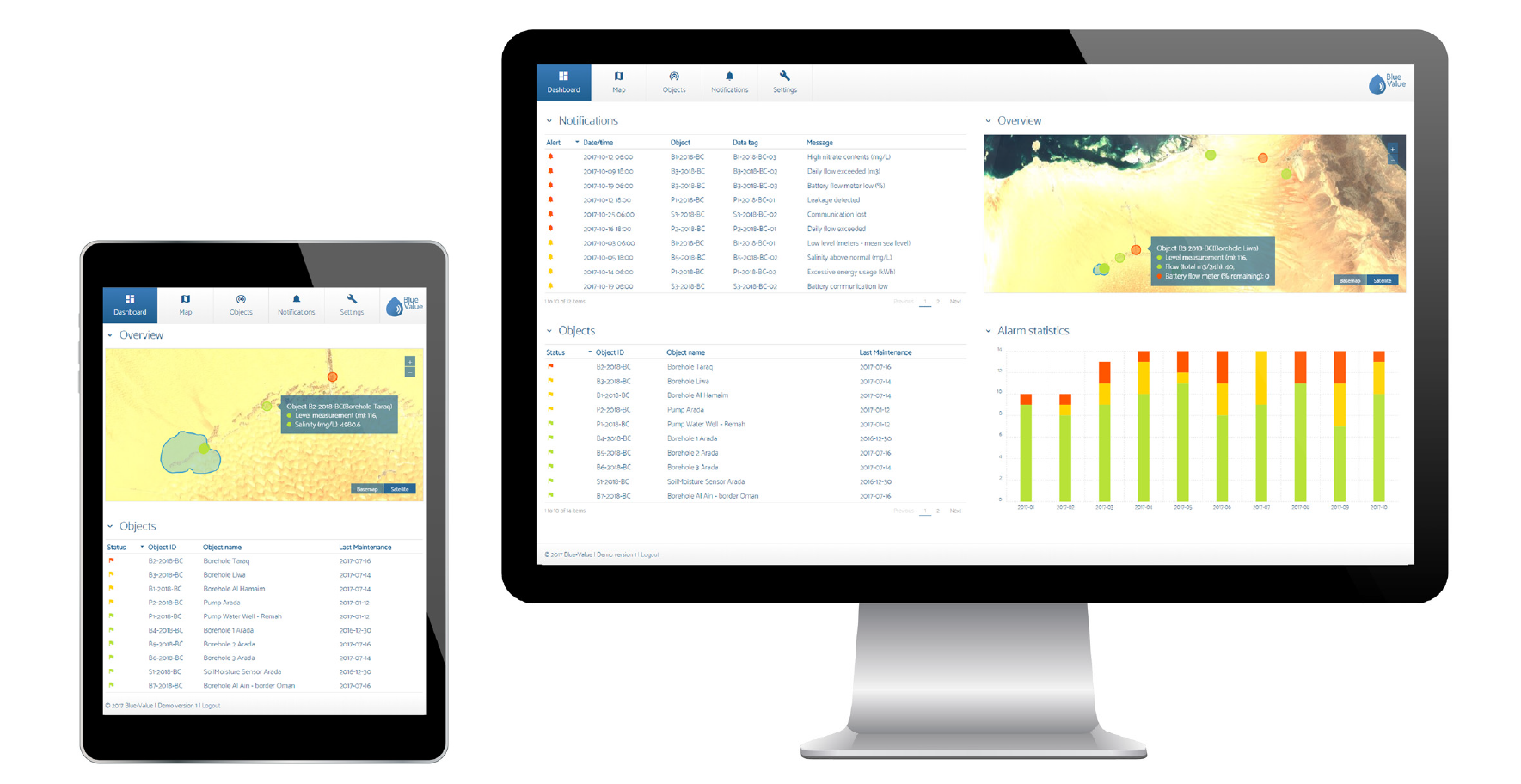
Blue-Value is an integrated monitoring software concept for water infrastructure in arid regions. It gathers Internet of Things (IoT) sensor data and combines this with satellite imagery and infrastructure information to deliver insight into water usage, water quality and environmental effects.
The Blue-Value platform will provide tailored information to our customers through an intuitive web application, task-based mobile apps and automated alarm subscriptions.
Users and their needs
Our concept will be developed for:
- Private companies in food/beverage, mining, construction and agricultural industries
- (Hydro) engineering consultancy companies, telecom & IoT service providers
- Environmental agencies, waterboards, utilities
Main user need:
- Accurate and dynamic information for water management
- A dashboard that turns complex data into valuable insights
Arid regions with (potential) water problems, such as the UAE, Spain, USA, parts of South America, Africa and Australia.
Service/ system concept
The Blue-Value platform allows users to measure quantitative and qualitative aspects of water and enables an integrated water resource management service. By continuously measuring relevant parameters of water, various organisations and industry can monitor risks and optimise water management.

Space Added Value
Satellite Earth observation
New satellite Earth observation assets enable yearly, monthly, or even weekly data of areas globally. With optical and radar data, we can measure changes in vegetation, water bodies, ground structures, environmental effects caused by water level changes, temperature, effects of droughts, and soil moisture.
Satellite communications
Sensors in remote places can be connected using satellites, using traditional satellite IoT solutions from Thuraya or Inmarsat and new generations of satellite IoT constellations.
Integrating satellite Earth observation, IoT data and other geo-information sources into meaningful water risk indicators is one of the key capabilities of Blue-Value.
Current Status
The feasibility study was completed on 31 July 2018 and the activity confirmed commercial viability of freshwater information service based on IoT and EO technologies.
The most experienced players in this industry, i.e. water sensor manufacturers and many others, have confirmed this viability. However, long sales cycles are foreseen and will be mitigated by diversifying our offer to the industrial customer segment. The industrial market segment has confirmed needs for this service and we conclude with a commercially viable business model.
The activity will continue as an IAP demonstration project called 360blue.
Prime Contractor(s)
Subcontractor(s)


