Objectives of the service
In maritime surveillance, the users suffer from a lack of means, particularly in a country like France which has the second largest sea front in the world. In addition, the current means have drawbacks: satellites do not always offer the resolution, visibility and flexibility required, manned aircraft have the disadvantage of the cost of operation, and big drones for surveillance do not have a clear regulatory status to operate in civilian areas.
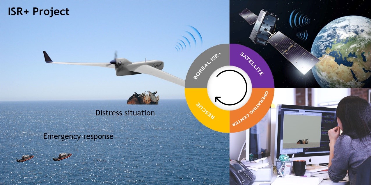
Thanks to its endurance of 800km, BOREAL drone system has the capability to support the surveillance of large areas in the maritime and land domains (forests & deserts). This project aims to demonstrate that using a SATCOM link can enhance the range of surveillance operation of BOREAL: up to 300km from the starting point compared to the actual 60km permitted by the classical ground RF system.
The benefits for the customer are to provide a competitive solution compared to aircraft or helicopter, a lower level of noise for a better efficiency in surveillance operations, and finally human risk reduction: no operator on board.
Users and their needs
End customers are either Industrial actors concerned with infrastructure and operations security or public institutions (navy, coast guards, military, national or European agencies…) who have the mission to ensure citizens safety and regulations control. Users and their needs can be broken down into different domains:
Military: support military missions for Intelligence, Surveillance and Reconnaissance on a real-time basis.
Border security & control of illegal activities (Governmental): increase surveillance of inland (forest) and maritime borders due to illegal immigration, illegal activities, fishing regulations
Crisis management (Governmental): support situation awareness in emergency conditions to support decision making
Maritime Search and Rescue (Maritime Affairs): support situation awareness in emergency conditions to support decision making for Search and Rescue, monitoring and control of human activities
Environmental monitoring and human activities (NGO): better assessment of forest and maritime environment and wildlife protection
Industrial Infrastructure monitoring and site security (Oil & gas companies): improve security of exploitation site and pipelines.
Service/ system concept
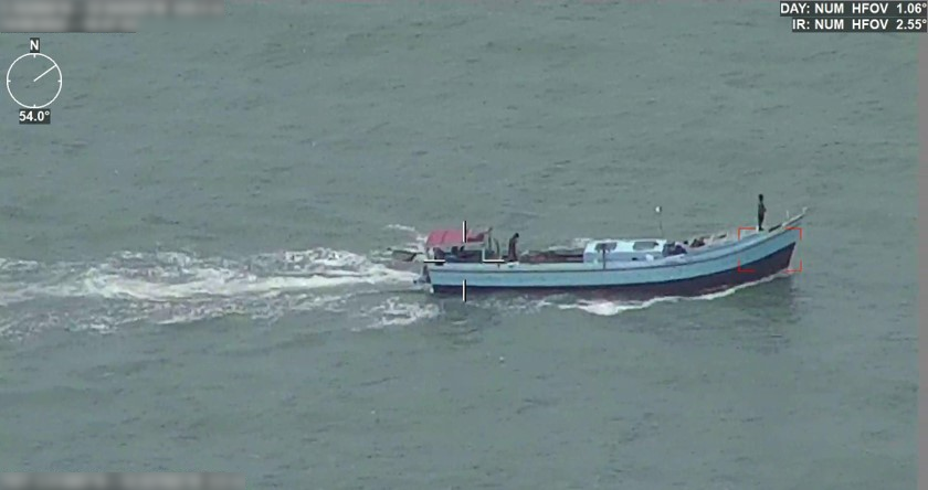
The service concept can be described through the example of maritime safety and rescue at sea: to dispatch appropriate means of rescue for a ship in distress with damages onboard and potential marine pollution. In that case, the role of the drone BOREAL embedded in the operating centre is highlighted. When an alert is given, it is advisable to send as quickly as possible to the area a mean of assessing the incident to answer to the following questions: what is the precise position of the incident? Are there people in immediate danger? Is there a risk of pollution? What are the emergency resources to be implemented? In this case, sending the BOREAL ISR+ is a determining element in the chain insofar as it will allow questions to be answered within a very short time (<1 hour).
Space Added Value
The space data and technologies used in the present system have three origins:
Satellite communication from the ground: The technology relies on a fixed dish pointing toward a geostationary communication satellite like INMARSAT to ensure internet connectivity and to relay of the data flow of the RF antenna towards the remote centre: this means that the drone operates in direct line of sight conditions of the antenna (no obstacle of relief or vegetation) and less than 80km approximately. This configuration allows maximum throughput for the system (4.5mbps).
Satellite communication from the drone: the function is to permit to directly connect the drone with internet for communications with the remote centre. This is determinant for the actual system to be able to operate more than 80km from the ground antenna or behind obstacles.
Earth observation from satellite is earth observation, in visible imagery or radar. It is considered as a complementary source of information providing data at very large scale (100 to 1000km) but at low resolution and at low frequency. However, earth observation by satellite is a key feature for the system has a primer to indicate where to send the drone to recover a more detailed information.
Current Status
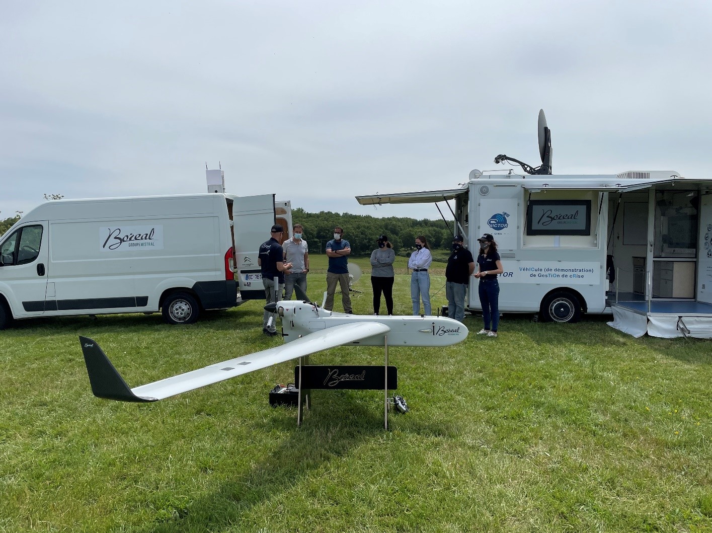
In the frame of the feasibility study, BOREAL has performed a successful proof of concept with CNES (CESAR’s platform).
The method used in this POC consists in demonstrating that it is possible to operate a gimbal camera remotely, with a high-speed SATCOM link as a means of connectivity to the Internet. To do this, the resources of the CNES CESAR platform have been used, which offers an equipped van (energy, remote screens, network resources, satellite antenna) which makes it possible to point an antenna towards the INMARSAT satellite.
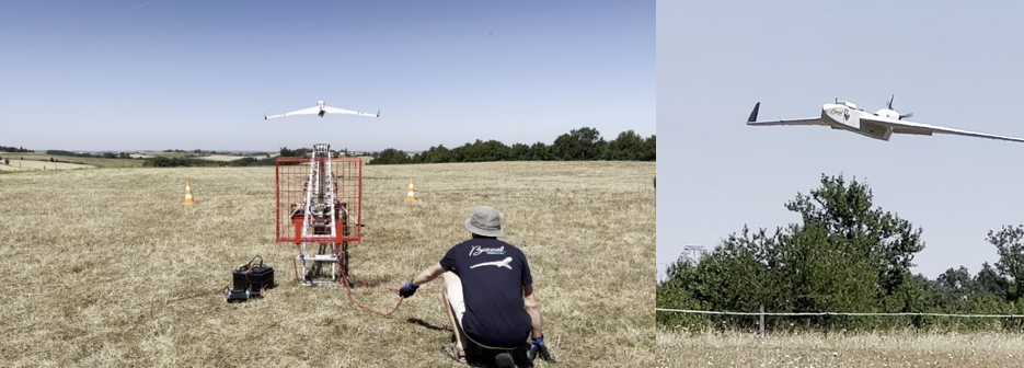
Another POC was carried out to demonstrate the possibility of transmitting images directly from the drone via SATCOM. This POC was carried out in collaboration on the one hand with ATMOSPHERE which provided a CERTUS terminal for the IRIDIUM constellation, and on the other hand with the CNES CESARS platform which provided a UAV200 terminal for an INMARSAT geostationary satellite. In both cases, in-flight operation was nominal for image transmission.
In August 2022, we carried out a maritime surveillance campaign in French Guiana as part of an extension of the BOREAL ISR+ project. The goal was to present the capabilities of the BOREAL drone system for maritime surveillance and illegal fishing use cases and to initiate local collaborations with future partners. The campaign made it possible to obtain feedback which will be useful for future deployments of the system.