Objectives of the service
The agricultural sector in Poland and in other European countries embraces irrigation at a growing pace. In many regions precipitation is insufficient to ensure optimal development of crops. Progressing climate changes also significantly affect the situation by disturbing water balance, which results in repeated droughts.
Most farmers manage irrigation without any investment in decision support systems or only with use of very basic solutions. Although larger farms install soil probes, due to their relatively high price farmers usually use only one sensor per field or just one sensor per farm, which does not produce spatially representative measurements.
Combination of farmers’ own experience, soil sensors data, potential evapotranspiration (ET) data and weather forecasts usually ensures a good irrigation management but requires a lot of attention and advanced skills from farmers or growers.
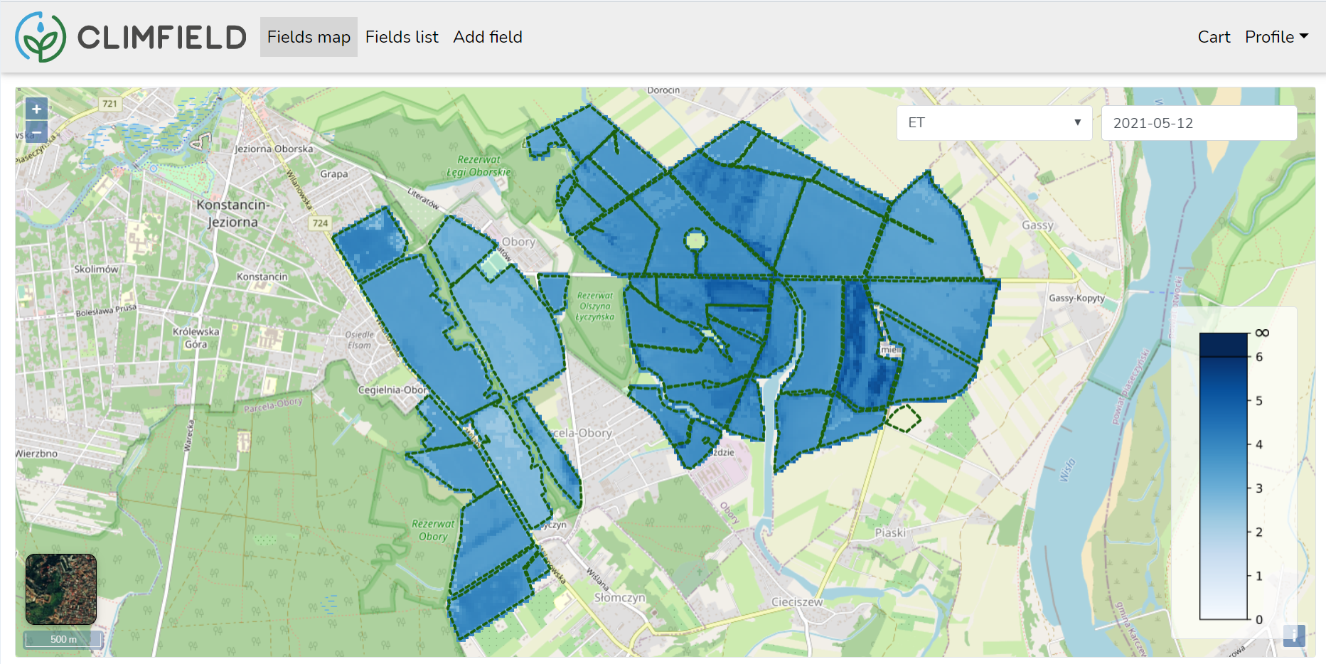
As a result of the ClimField project, a service named IRRIGET (www.irriget.com) was developed and launched on the market. It significantly improves the process of decision-making related to irrigation and water management at farms. EO-based calculations of evapotranspiration and water balance at sub-field spatial resolution, crop monitoring and weather forecasts enable more efficient and sustainable water management.
Users and their needs
As the service is addressed to farmers and growers irrigating field crops they were involved in the service development and in pilot operations. This relatively homogeneous group (taking into account the requirements) can be divided into the following categories:
- Farmers cultivating traditional field crops:
- irrigating potatoes (the most important group in the context of the service validation and commercialisation);
- irrigating crops other than potatoes - mainly cereals and maze.
- Farmers cultivating vegetables:
- with water requirements similar to potatoes, such as onions, ground tomatoes and cucumbers;
- with water requirements other than potatoes, such as beans, peas, etc.
Those groups equally care about the high quantity and quality of crops. Their requirements are as follows:
- information on evapotranspiration and water balance in sub-field resolution;
- information on vegetation response to local conditions (incl. water stress);
- near real-time data access;
- reliability of information.
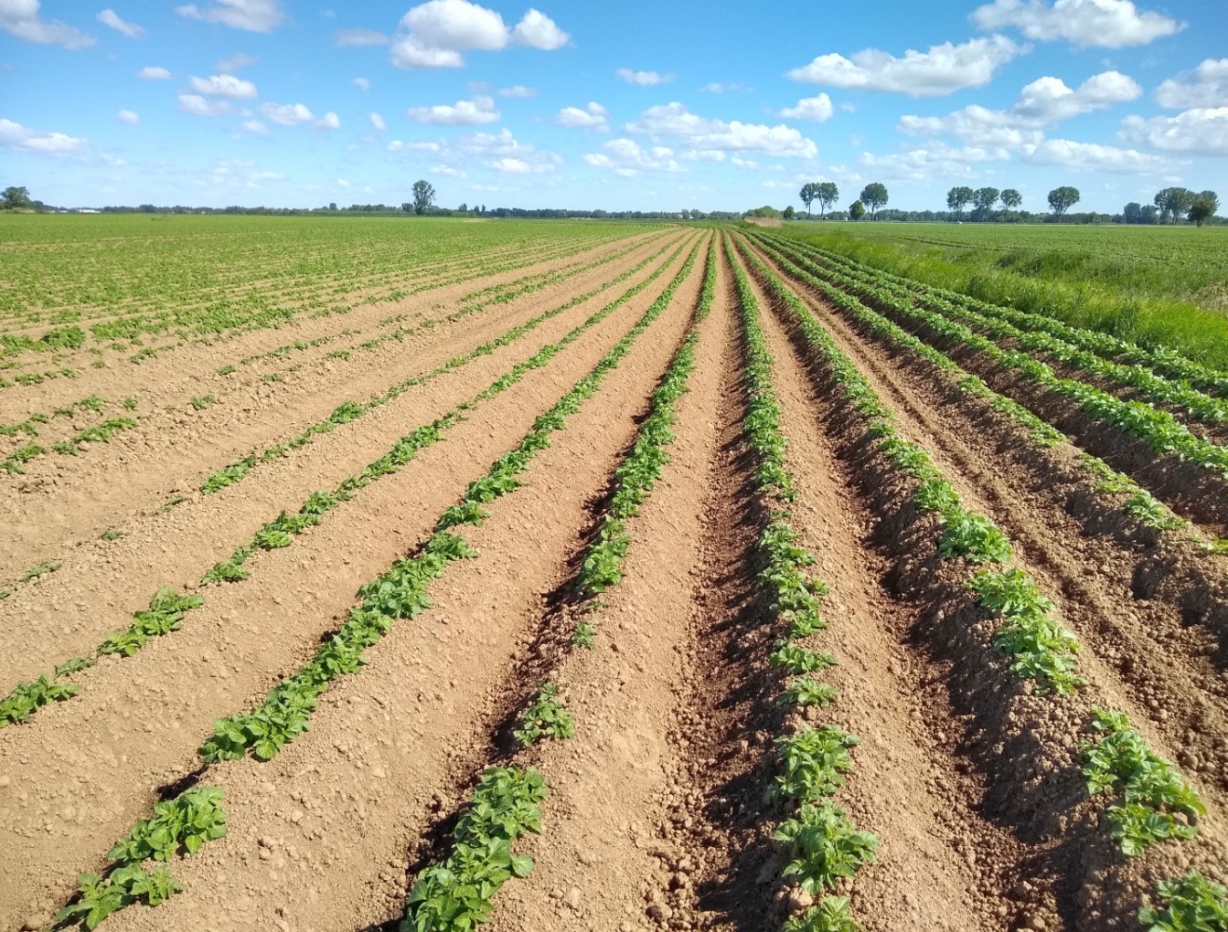
Potato field at the beginning of the growing season.
Service/ system concept
The IRRIGET service integrates features important for farmers – such as:
- The information on water balance and vegetation indices in sub-field scales enables precise monitoring and identification of problematic areas as well as spatial optimisation of irrigation, without installation of soil probes;
- Data on ET and vegetation conditions with high spatial and temporal resolution provide the information on actual reaction of plants to deficits in water balance;
- The information on current and forecasted ET and water balance as well as other weather elements facilitates irrigation planning for the consecutive days;
- The calculation of real ET (not potential ET, as it takes place with use of weather data only) enables more optimal irrigation, better adapted to the actual in-field conditions.
The service concept is based on integration of free data provided by Copernicus Programme (mainly Sentinel-2 and Sentinel-3 imagery, land cover map, EU-DEM) together with output of weather parameters modelling and forecast as well as data on irrigation treatments provided by a user. The main task is to calculate water balance in a sub-field spatial resolution, which gives farmers and growers the possibility to assess water loses that should be supplemented by irrigation.
Space Added Value
Earth Observation primarily contributes to the service: low- and high-resolution multispectral Sentinel-2 and Sentinel-3 data are applied as input for models calculating water balance, water demand of plants as well as for monitoring a response of crops to water deficits.
In addition to raw EO data, the service also uses products available in frame of Copernicus Land Monitoring Service, such as land cover and DEM.
Current Status
The project lasted from February 2020 to November 2021. First, survey-based and direct consultations took place in order to analyse problems that farmers and growers face during irrigation planning and management. It enabled the service architecture adjustment to real and most important needs of future users and clients. In order to validate accurateness of early versions of algorithms, the proof-of-concept was implemented and its output thoroughly analysed.
In parallel, a field research was conducted for two growing seasons in order to acquire reference data necessary for further algorithms parameterisation and validation of ET modelling results. For this purpose continuous monitoring of ET, weather parameters and soil moisture was conducted on the test field during the entire growing season.
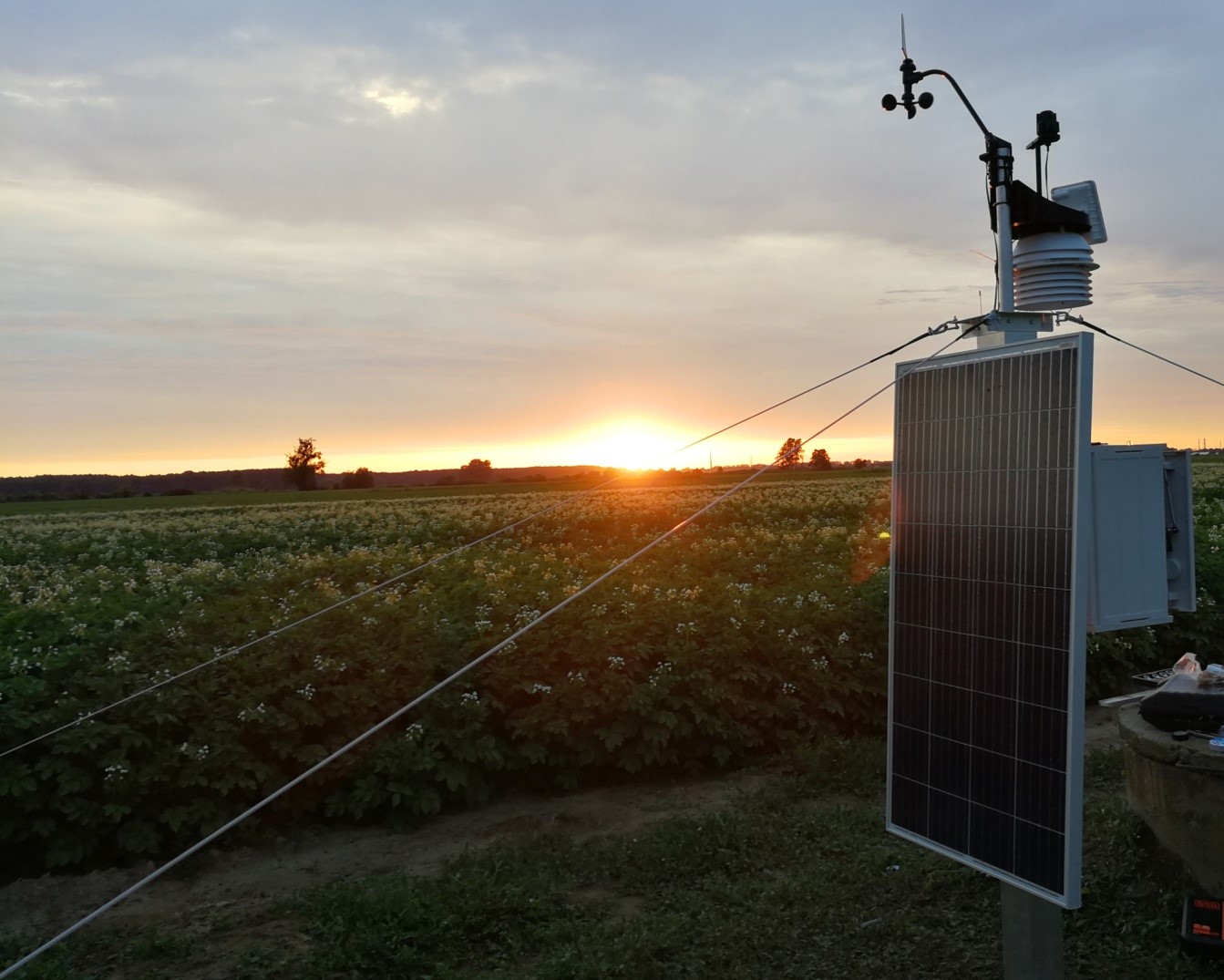
Weather station located in the potato field.
After positive substantive validation of the data processing methods the service development phase took place, which ended with factory acceptance tests and extensive site acceptance tests. Currently, the service is operational and available commercially here: www.irriget.com.