
Objectives of the service
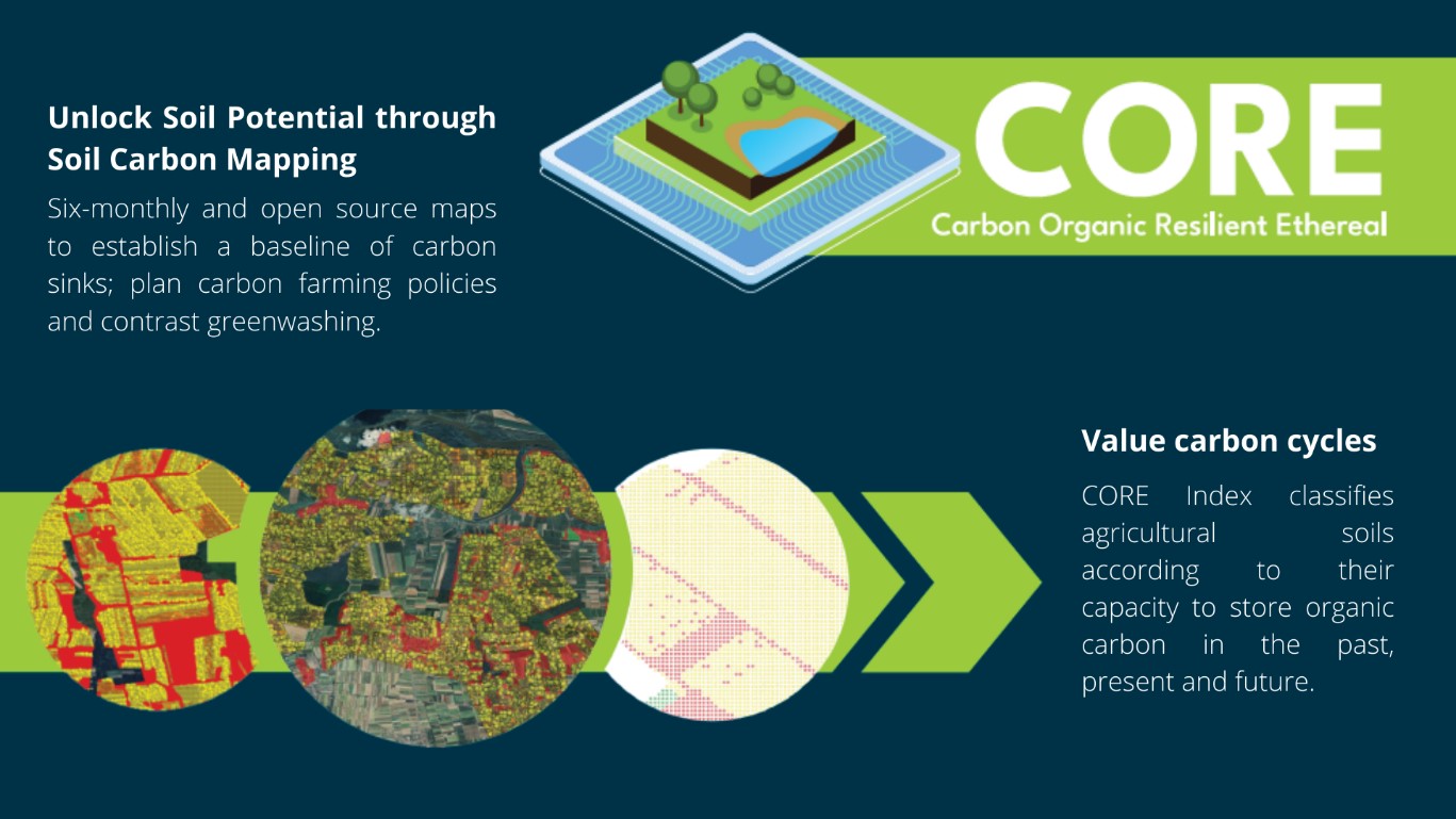
CORE – Carbon Organic Resilient Ethereal aims to create an open-source map to classify soils according to their capacity to store organic carbon in the past, in the present and in the future and to facilitate carbon farming initiatives and investments.
Users and their needs
CORE aims to target:
-
farmers who want to start carbon projects and can use the map to forecast their future revenues from carbon farming. In this way, initial diagnosis cost to detect the eligibility of agricultural lands are reduced and small farmholders can have access to carbon markets
-
national/European authorities who can use the map to orient and plan their policies and fundings to specific areas and to monitor their implementation. Moreover, the map, by creating an updated benchmark will help authorities to contrast double claiming and greenwashing
-
stakeholders in the carbon market who can use the map to define reliable and trustful standards (certifying bodies) and orient their investments (industries that need to offset carbon emissions)
Service/ system concept
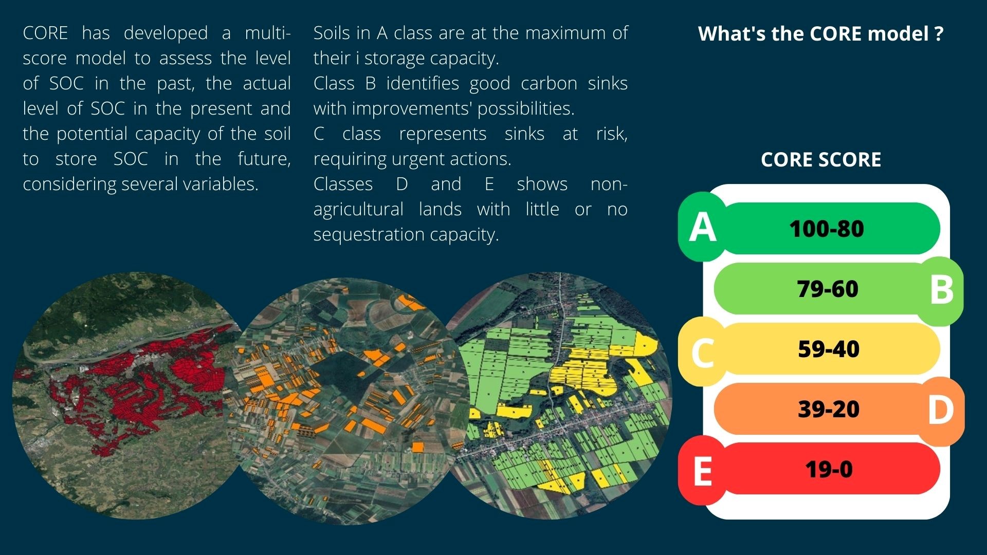
CORE will release every six months an open-source map that classifies agricultural soils according to a 100 points scale. This scale assigns a maximum of 30 points for the “ethereal” carbon stored before the beginning of the carbon project; a maximum of 40 points for the “organic” carbon stored at the beginning of the carbon project and a maximum of 30 points for the “resilient” carbon that is expected to be store in the future according to the implemented agricultural practice.
Space Added Value
CORE utilizes Sentinel-1 for monitoring temporal variations through backscatter data, which reflects changes in water content and crop structure during phenological development. Sentinel-2 is used to distinguish land use, while Sentinel-3 (Modis historical data) is mainly used to study vegetation-related aspects like Gross Primary Productivity (GPP) or Net primary production (NPP) to determine the energy fixed by autotrophs and their respiration, which is equivalent to biomass increments per unit land area and time. This approach, compared to current carbon projects, allow to have a historical record of agricultural soils and to predict future responses.
Current Status
Three pilots have been conducted in three different areas and on three different agricultural lands:
-
permanent crops in Italy
-
rotational crops in Croatia
-
mixed land with both permanent and rotational crops in Germany.
This has allowed the calibration of CORE algorithms and index and the classification of the above-mentioned areas. New lands are expected to be tested soon (arable crops, urban lands, seabeds).
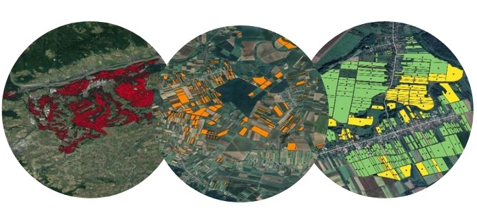
The maps show 3 piloted areas in Germany, Croatia and Italy classified according to the CORE model.
Prime Contractor(s)