Objectives of the service

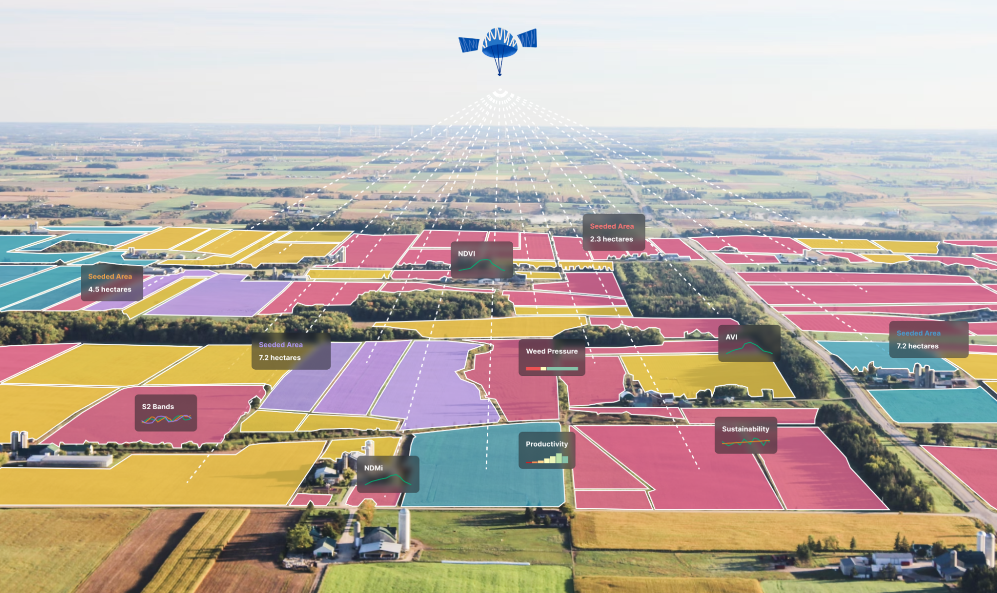
All precision farming services and in-field analytics start with accurate field boundaries and seeded acres. Unfortunately, existing field boundary data is outdated and inaccurate, which affects the entire agricultural value chain from pre-production to grain-processors. Large scale boundary data is managed through national agencies (Cadastral): Land Parcel Identification System for all 27 EU-regions and the Common Land Units in the US are 16 years old. As boundaries and seeded acres change every year, existing data becomes increasingly unreliable and inaccurate. We discovered 20% of all field boundaries in Norway are inaccurate, affecting €1 billion in annual subsidies. In the 27 EU-regions this affects over €45.5 billion subsidies annually, which are based on existing boundaries.
Current Problem: currently the only way to declare whether a parcel (field boundary) is eligible or ineligible for basic subsidy payment is by the National and associated Regional Paying Agencies conducting manual controls, both through on-spot controls (field visits) and also on the AMS-web based map-system, this process is very time consuming and costly for the agencies. The basic definition of whether a parcel is declared as ineligible or eligible depends on the type of agricultural land it is. Currently, the CAP in the EU has a yearly budget of €59 billion, where the IACS (Integrated Administration and Control Systems) stood for 82.9% of total CAP expenditure (in 2020) which includes the “control” component, i.e. there is a need and demand from the agencies and EU to lower the administrative cost and burden. Additionally, considering the current cost and budget of “checking eligibility” of boundaries, only approx. 5% of all parcels and field boundaries submitted for subsidy payments receive controls and verifications, meaning ~95% are still left unchecked.
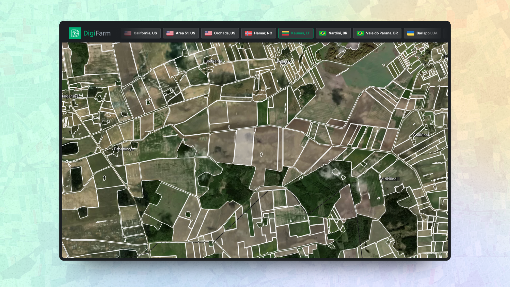
Our Solution: Our solution leverages the latest advances in AI and remote sensing, in order to provide the agencies an automatic, cost-effective and simple solution for checking and verifying whether a particular parcel (field boundary) is eligible or ineligible for subsidy payments, i.e. DigiFarm would develop the solution on top of our already existing delineated field boundaries and seeded acres (in-season) using the deeply resolved Sentinel-2 at 1m per pixel resolution. Additionally, the solution and subsequently data derived and delivered to the agencies and controls would include the type of land, i.e. land cover classification, arable land, pasture etc. (total of 10 classes). This would significantly reduce the cost, administrative burden, time as well as increase the accuracy and speed the farmers would be able to receive their subsidy payments (which significantly would decrease the financial burden typical farmers face during the year as well as increase their liquidity). Also, as there would be a reduction in the number of on-spot controls conducted, this would also reduce Co2 emissions, as an example Lithuania conducted 7,000 on-spot controls (field visits) where the cost is approx. €350 per visit (i.e. €245,000 per year) and considering an average on-spot control is 75km and 241g Co2 emission per km, the total potential to save and reduce would be (considering could reduce by 90%) is 114 tonnes per year (in Lithuania alone).
Users and their needs
DigiFarm’s end users are farmers and growers while DigiFarm’s paying customers are B2B and B2G partners across the entire agricultural value chain, ranging from FMS-providers (Farm Management Software), crop insurance, financial institutes (banks), soft commodity based traders, food processors/retailers, land management, government agencies (agriculture). Our models will help our clients (and users) optimise prediction capabilities, logistics, crop-yield forecasts, determining in-season crop-damage, reduce operational costs and increase revenue, creating stability to the sector. The primary application field is within agriculture and specifically precision agriculture, however, the data and models DigiFarm delivers have significant use-case and value-add for the entire agricultural supply-chain from pre-production all the way through retailers. The targeted primary market of users are the EU-regions while our secondary market includes North America, and Latin America.
In this contract extension project the objective is to work closely with the subsidy agencies, i.e. National and Regional Paying Agencies in order to support and optimise their in-season controls and monitoring of subsidy payments directly to farmers and growers throughout the 27 EU-regions.
The largest part of the CAP budget (roughly €59 billion per year) is managed and controlled through its Integrated Administration and Control System (IACS). IACS is based on reference parcels within a GIS environment to allow the identification, location and administrative cross checks of the agricultural parcels claimed by European farmers.In the EU-region the majority of the agencies and govts. operate with a 2-3-year orthophoto image cycle which is what is used as the basemap for the farmers (subsidy applicants) to draw and declare their boundaries every year (in web/mobile application), which means, that during GSAA (Geospatially Aided Application) submission process farmers used 2-3 years old orthophoto images and also that our LPIS is constantly not up to date, as boundaries and planted area change every year, i.e. farmers are drawing on 2-3 year old imagery data.
Farmers are not trained or sufficiently skilled to “draw” or delineate field boundaries into GIS (Geographical Information Systems), web or mobile apps, this leads to incorrect parcels, including common issues such as:
-
Not declaring/delineating wet spots in fields (not eligible for subsidies)
-
Not declaring stones, trees or permanent objects internally in the boundary
-
Not declaring planted area below the shadow-line of trees, on outer edges of the field boundary
-
Not drawing all “vertices”, meaning all geo-points (single lon/lat) of every corner of boundary, normally farmers will draw four corners
This causes a significant number of issues in the declaration of this data, as local and national subsidy control agents has to manually correct and check all of these boundaries and issues, which is the biggest reason for: (a) the delay in subsidies, i.e. farmers declare in April/May and does not receive grant-subsidy payments until the following year, i.e. February/March (depending on the region and country) (b) cost factor encountered in the verification process, i.e. as agencies have to control this manually and declare any issues, which causes a significant administrative burden, questionable subsidy penalties to specific cases.
Service/ system concept
DigiFarm is already actively working with both B2B and B2G clients in the agricultural vertical, this includes over 60 corporate partners where we deliver services and solutions through APIs and have a SaaS business model, where we charge our clients based on consumption of service and area (in hectares), these services include primarily the following four data-layers:
-
Field Delineation Model: automatic detection of field boundaries and seeded acres
-
Deeply Resolved Sentinel-2 imagery at 1 meter per pixel resolution in growth seasons and on-demand
-
Land cover classification and eligibility detection (service being developed in this ESA project); ability to detect in-season different classes of field boundaries linked to eligibility codes from the CAP/EU-commission guidelines including: pastures, tree crops, arable land or non-eligible land (among others)
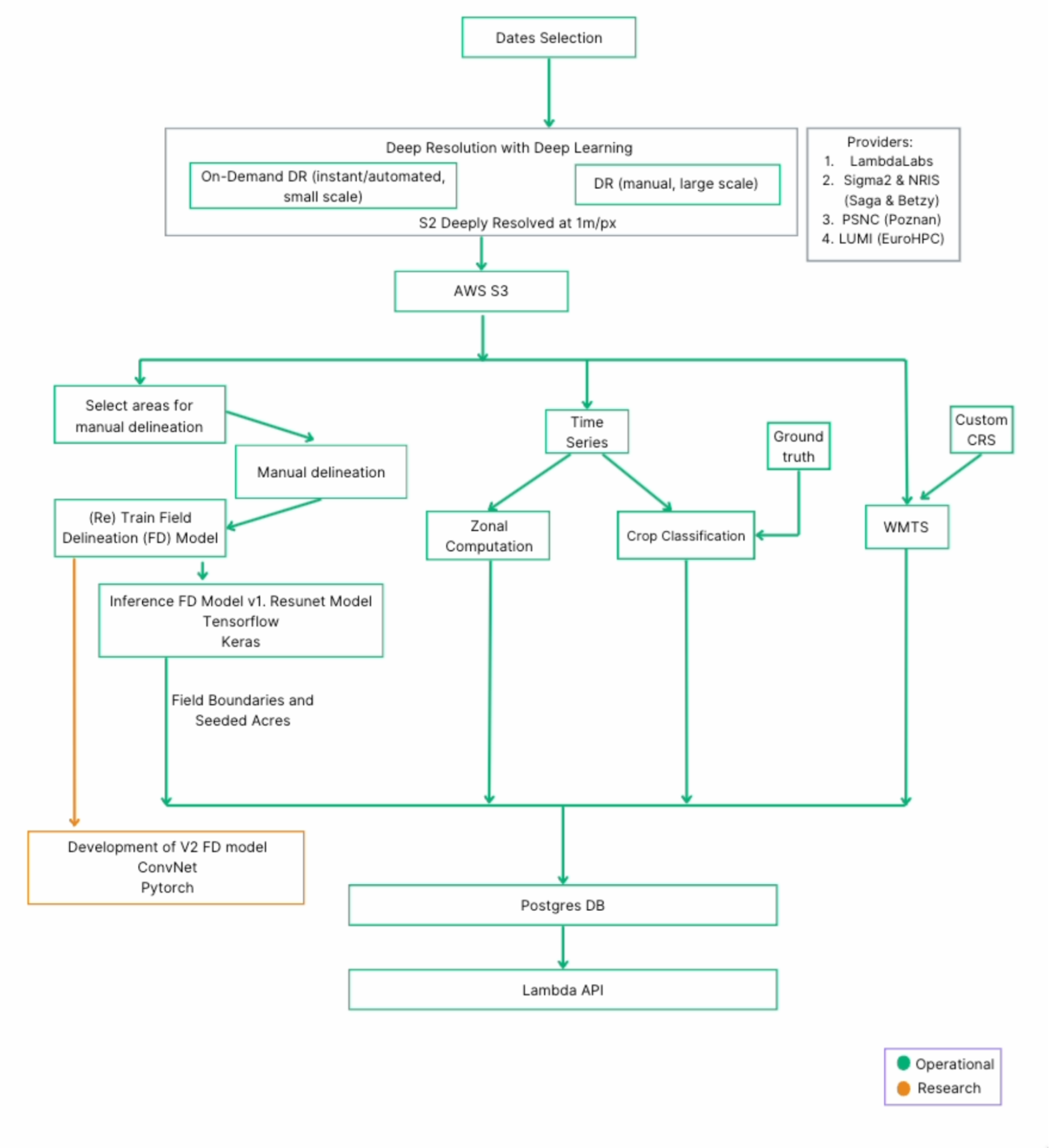
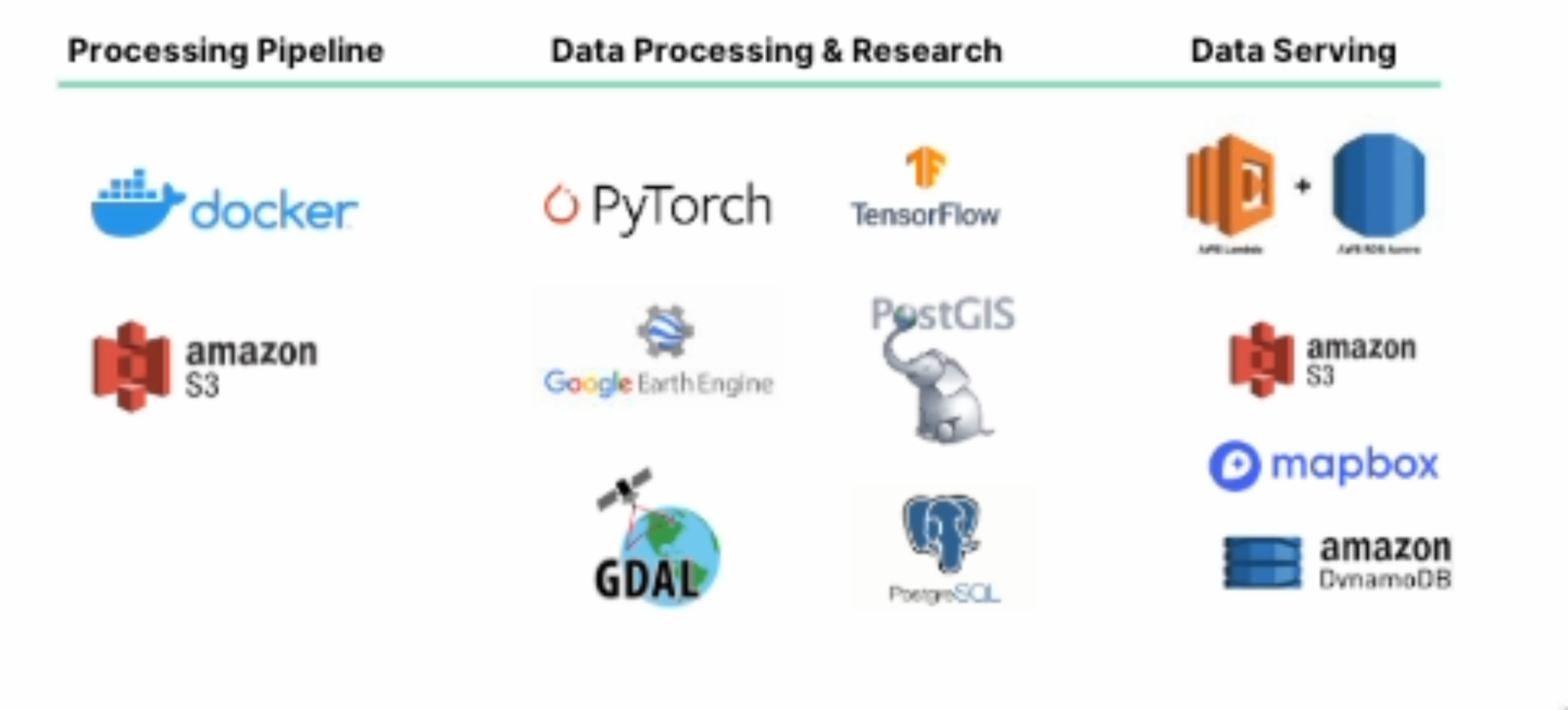
These services will be delivered through various API endpoints directly into our clients digital solutions, enabling them to run their analytics and algorithms on top of our baseline data. Here is a high level level overview of the system architecture:


Space Added Value
A critical component of our model input is EO-data, in particular, DigiFarm has developed its own proprietary model for automatic deep-resolution of Sentinel-2 (L1C/L2A) from its original source of 10 meter per pixel spatial resolution to 1 meter resolution across 12 spectral bands, this is the base input imagery data layer for our automatic field boundary and eligibility/land cover classification model. The ability to have the high temporal (and spatial) resolution represents a key aspect of the ability for us to deliver highly accurate and timely models throughout the growing season, where EO-data is the most effective data source. DigiFarm has developed a proprietary deep neural network model for deep resolving Sentinel-2 downscaling it from 10m to 1m resolution, which is crucial for analysing field sizes smaller than 2 hectares, which represents over 83% of the world's agricultural fields. The system can create multi-temporal data which has significantly improved the accuracy of our Field Delineation Model results and accuracy.
Current Status
DigiFarm successfully completed an ESA Commodities Kick Start in June 2021 as well as successfully completed a Demonstration Project with ESA in October 2023 and is currently in a Contract Extension Project which is an extension of the original Demo Project (Title: “CropCloud”). DigiFarm currently has 55 corporate clients in over 20 countries and secured 1.1M EUR in revenue during 2023 with clients such as: KWS, Limagrain, CNHi, Bayer Crop Science, National Lithuanian Paying Agency (NMA), Austrian National Paying Agency (Agrarmarkt AMA) and Yara among others.


