Objectives of the service
The main objective of the project was to build a dam motion monitoring service platform, called SUMMIT, based on GNSS and InSAR and demonstrate the advantages of combining both techniques to monitor dams and their surroundings. In order to achieve this objective, the following activities were planned:
- Define the user needs and monitoring requirements
- Develop the architecture that fulfils the requirements
- Run a pilot demonstration to assess the performance and advantages of the service in an operational scenario
Users and their needs
As infrastructures become more complex and safety concerns gain in importance, the Structural Health Monitoring becomes a discipline of capital importance.
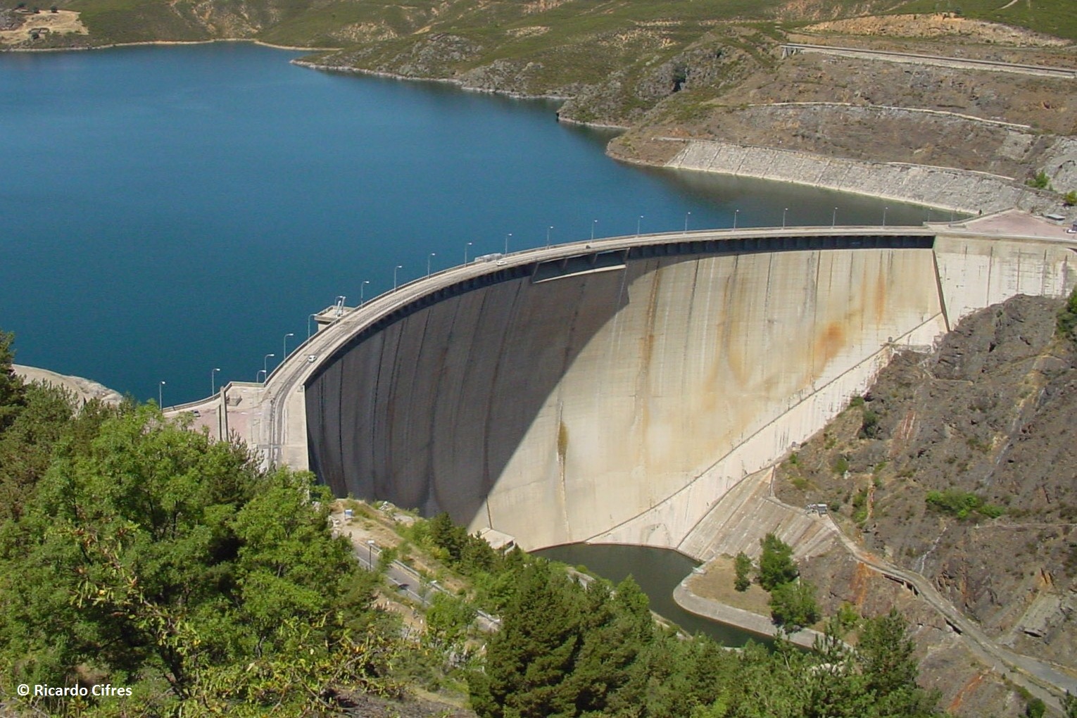
Dams are infrastructures that are potentially very dangerous as they hold a huge amount of water with tremendous destructive power. Dam failure can lead to massive loss of life and capital. Hence automatic monitoring techniques that allow early warning on unexpected events bring a high level of confidence to the dam managers.
In order to achieve a really useful and reasonably automatic early warning system, several features are of great importance: careful selection of representative measurement points, robustness in the measurement system, continuous data acquisition, automated data analysis and behavioural modelling.
Service/ system concept
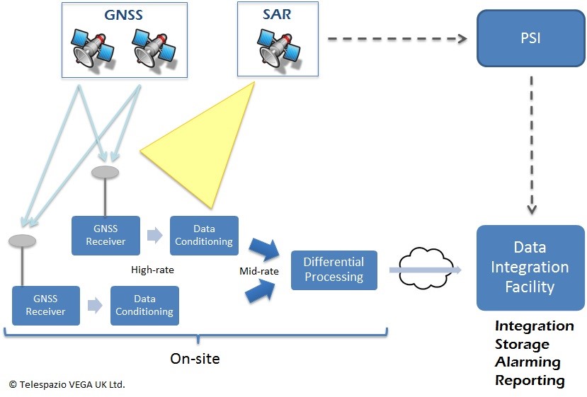
The service concept is to integrate GNSS 3D monitoring of a discrete number of points in real time, combined with long-term wide area ground movement monitoring provided by InSAR, to deliver a complete displacement monitoring of both, the dam body and the surroundings (abutments, slopes, etc.).
The complete system is divided into the following subsystems.
- GNSS Subsystem
Comprises all the hardware and software to acquire and process GNSS measurements in order to obtain the motion vector of each target point.
- SAR Subsystem
Includes SAR image interferometric dataset, InSAR processing capabilities for ground movement analysis and monitoring over dam site and surrounding areas. It requires the installation of on-site artificial corner reflectors (CRs) to guarantee the correct integration process of PSI based measurements and GNSS stations.
- Integration Subsystem
Interfaces with the previous subsystems in order to put together both data sets for further processing, correlation and reporting.
Space Added Value
Space techniques provide reliable measurements with minimum on-site equipment and different approaches that deliver robustness.
GNSS is used to autonomously compute 3D motion vectors of a number of points.
InSAR complements GNSS providing ground deformation measurements over a set of points, named Persistent Scatters.
A great advantage of this technique with respect to standard instrumentation is that it enables the user to detect movement in points where such movement is not expected. Since it requires no ground installation it can assess motions in un-instrumented areas and using historical archives can provide information about past motions on a site.
For remote locations lacking other means of communication, Satellite Communications, provide global data accessibility.
Current Status
The project completed successfully in 2018. Achievements included:
- Successful development of a new product and market-ready service; completed and introduced into the Telespazio product portfolio.
- The SUMMIT controller software is Telespazio owned IPR. This is combined with COTS GNSS & communications products to make the SUMMIT System from which the service is provided.
- During the Project, long-term service demonstrations were set up at the following dams;
- Benagéber dam, Valencia (Spain)
- Arenós landslide, Valencia (Spain)
- Albarellos dam, Orense (Spain)
- Telespazio joined the British Dam Society (BDS) in September 2017. This has given closer interaction with dam owners, operators and regulators in England, Scotland and Wales.
- Telespazio and partners presented the SUMMIT product and service at several international events important for the Large Dams community including ICOLD and BDS events.
Telespazio has been awarded a tailings dam monitoring project in Peru which started Q2 2018. Telespazio will provide SUMMIT installations and InSAR deformation studies on tailings dams.
Prime Contractor(s)
Subcontractor(s)