Objectives of the service
DEDALOS has been designed to bring to market a low-cost, lightweight and low energy consumption IoT solution for deformation monitoring and early-warning of hazards induced by geophysical phenomena (landsides, subsidence, sinking, etc.) or by man-made activities (excavations, injection/extraction of natural gases, etc.). One of the priority needs of the actual system is to provide continuity of service in areas of the world where ground based telecommunications are missing or unstable especially after dangerous events (i.e. earthquakes). In this frame DEDALOS SAT project aims at the improvement of the DEDALOS system providing a satellite data transmission interface as backup for standard ground-based (mobile phone) network. A careful analysis of the information to be transmitted has been carried out in order to minimize data rate which is critical for cost reduction and data flow optimization. Dedicated data compression techniques have been implemented. GALILEO GNSS data (multi-constellation approach) has been integrated in order to improve reliability of service when visual impairment due to mountains or buildings may degrade the precision of GPS alone.
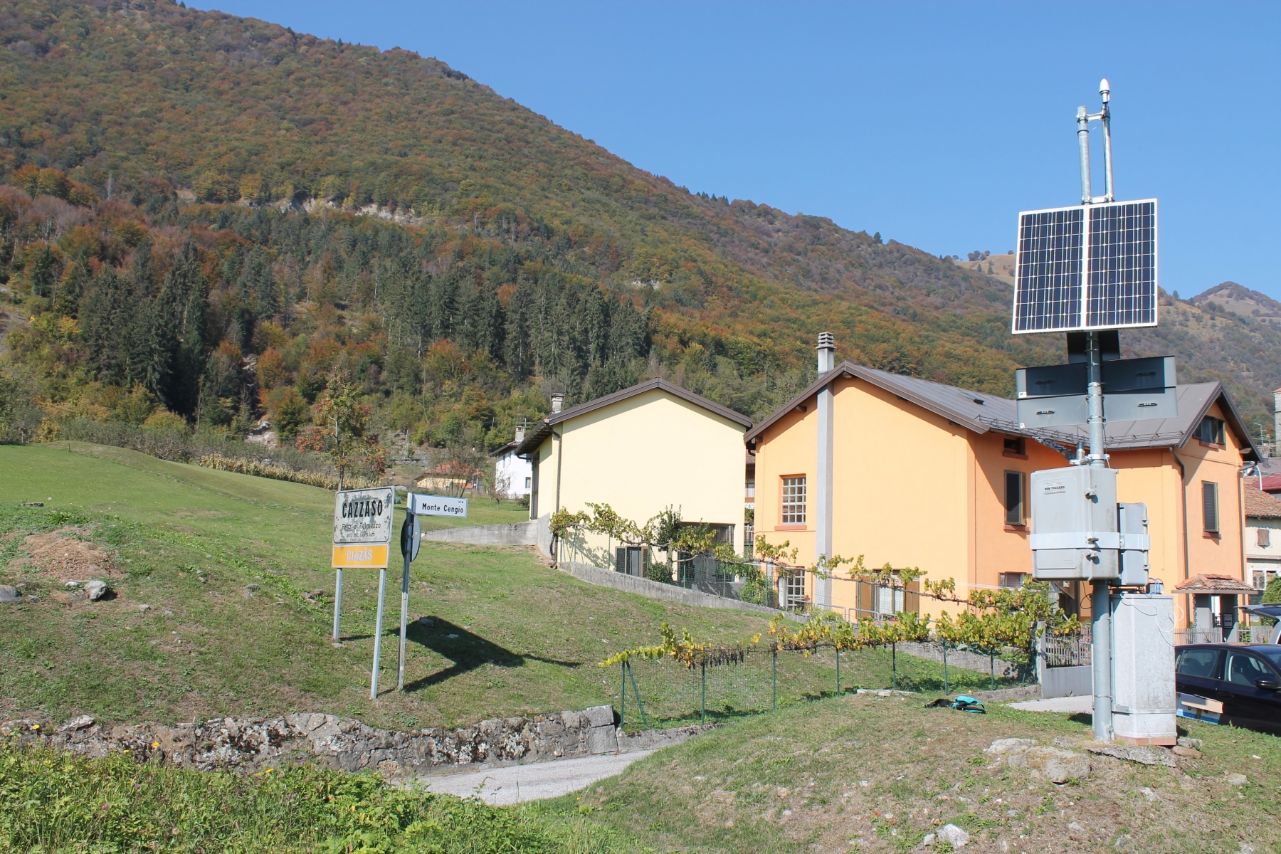
DEDALOS SAT has been installed on two test sites. The first one is located in Friuli-Venezia-Giulia region in Italy, on a landslide threatening a small village near Tolmezzo (UD). Here two DEDALOS SAT monitoring points have been installed on the slope instability (see figure 1) while the reference/gateway (with satellite antenna) has been placed within pre-existing monitoring instrumentation.
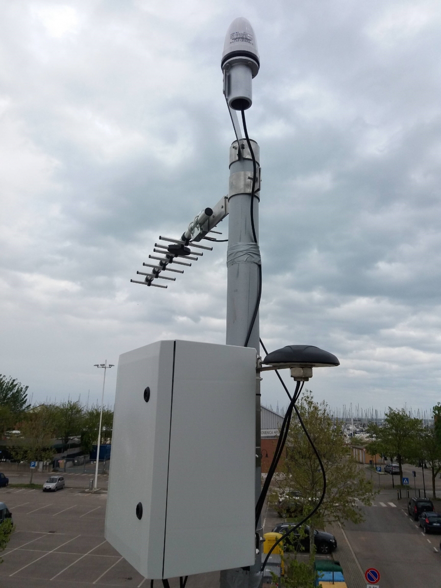
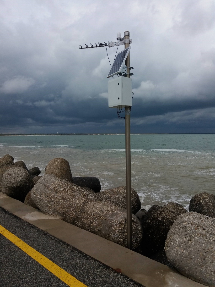
The second DEDALOS SAT installation is in the Port of Ravenna, where evidences of strong subsidence have been previously measured through other instrumentation. Three monitoring points have been installed, on two breakwaters (figure 2) and on one building at the marina (gateway, figure 3).
Users and their needs
The targeted user communities and market sectors are:
- Oil & Gas;
- Energy;
- Utilities;
- Transport;
- Building;
- Financial;
- Telecommunications;
- Central and local public administrations;
- Universities and Research Centres.
The user needs are:
- Monitoring and early-warning of:
- natural hazards;
- critical infrastructure/sites e.g. pipelines, gas storage sites, geothermal energy plants, dams, towers and high voltage pylons, historical buildings and archaeological sites, bridges, viaducts, railroads, motorways, quarries, ports.
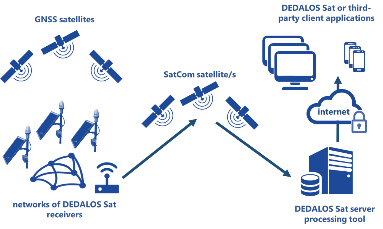
Service/ system concept
DEDALOS SAT is composed by:
- GNSS receiver to be installed on a critical infrastructure and allowing to measure continuously the ongoing deformation. The GNSS receiver is based on commercial off the shelf GNSS chipset able to acquire GPS and GALILEO observables.
- System for wireless transmission of data from each point to a master gateway station provided both with ground based telecommunication capabilities (GPRS/UMTS modem) and a backup satellite modem. This provides the service continuity in case of lacking/instability/failure of ground-based networks;
- Server SW:
- acquisition in real time of the data transmitted by the sensors;
- multi-constellation (GPS+GALILEO) data post-processing for the computation of displacements with update rates from 1 hour to 24 hours;
- calculation of telemetry measurements (e.g. battery and solar panel voltage, quality of data transmission, quality of acquired GNSS signals, etc.);
- publication of the measurements through REST web-services;
- automatic generation of periodic PDF reports relevant to the status of the monitoring network;
- automatic generation and transmission of alert messages for the early-warning of possible anomalous displacements based on pre-set thresholds.
- Client SW (dashboard) for remotely viewing and analysing data published by the server (displacements, telemetry, early-warning configuration, etc.).
Space Added Value
DEDALOS SAT integrates the benefits of satellite navigation assets (Galileo and GPS) and satellite communications. DEDALOS SAT solution is a very low cost GNSS single frequency system with similar performance to expensive dual frequency systems. Galileo increases the continuity of the service with respect to GPS only, especially in harsh environments, where infrastructures or mountains create sky visibility impairment.
Moreover, the very low power needs due to the single frequency, enables the use of small battery packages and very small photovoltaic panels (20W-50W) in order to guarantee a very reliable system on 24/7 operations.
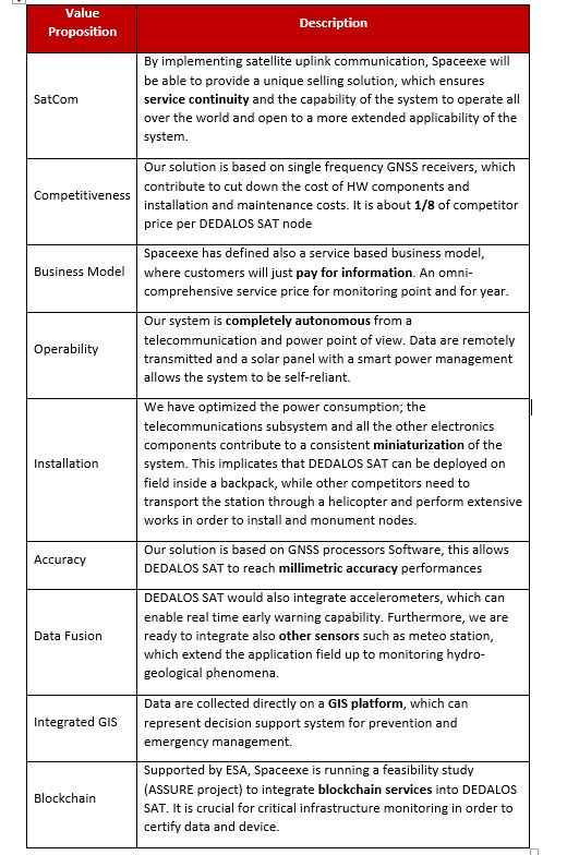
DEDALOS SAT Value Proposition:
Current Status
The project started in February 2018 and was completed in August 2019.