Objectives of the service
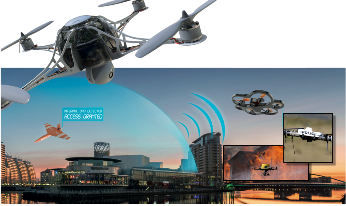
DroSecMa extends the enterprise perimeter to include the airspace and provides enhanced security and operations (large corporations, critical infrastructure, financial institutions, etc.).
Exponential increase in capability and reduced costs have made drones (UAS / UAV / RPAS) a truly disruptive technology. Their capabilities may be leveraged to significantly improve enterprise operations and reduce costs. However, the sheer number of drones and their capabilities also represents a growing threat (either accidentally or with malicious intent).
DroSecMa provides the ability to mitigate the threat presented by drones while leveraging their capabilities for enhanced surveillance and inspection. Drones may be used in ways that are much more efficient and in situations where human interactions may be problematic, un-safe, not cost effective, or impossible. DroSecMa services can be used stand-alone or as part of a higher-level customer system.
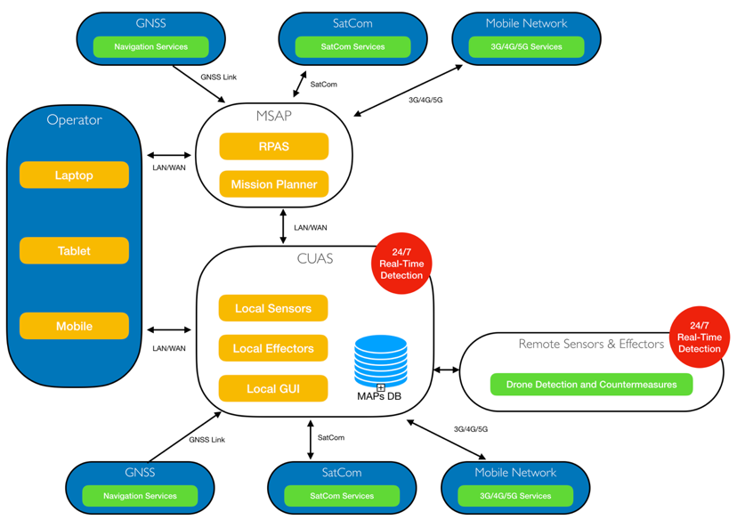
- escCUAS™ (CUAS/Counter-UAS): use of multi-sensor technology to accurately detect, identify and track intruding drones. This capability also provides automated or manual countermeasures (note: active countermeasures may not be legal)
- escMSAP™ (MSAP/Multi-Service Aerial Platforms): provides state-of-the-art drone technologies for surveillance and inspection, manual or fully autonomous operations and beyond the visual line of sight (BVLOS) (if permitted)
- escPNTTM (Positioning, Navigation, Timing): highly accurate Positioning, Navigation, Timing (PNT)
- escSRCTM (Secure and Resilient Communication): autonomous communication channel switching, leveraging SATCOM
- escLOS-CUAS: (Localization Optimization System – Counter UAS): Optimizes the positioning of sensors to detect drones while avoiding interferences and attenuation.
Users and their needs
Typical DroSecMa users:
- public safety (federal and national police forces, prisons, …)
- government buildings (embassy, legislative buildings …)
- critical infrastructure (airports, rail, power, …)
- event venues (sports arenas, concert venues, …)
- large industrial plants (automobile, high-tech manufacturing, chemical production …)
- individual properties (skyscrapers, high-profile private homes, …)
Each user has unique requirements. However, the majority have a fundamental
set of basic needs:
escCUAS™: High potential threat or consequence due to incident
- 24/7 real-time threat minimum of false alarms
- Reliable documentation, tracking and data logging
- Situational awareness (flight paths/live video)
- Provides airspace protection, including runways and other critical infrastructure at airports
- Countermeasures (as allowed)
- Finding the optimized positions of sensors for detecting drones
escMSAP™: Increased security and operational efficiencies
- Reliable/resilient and secure communications (escSRCTM)- multi-path data links with fully automated switch-over between cellular networks, Wi-Fi and SatCom, for TM/TC processing, Command & Control and live video streams
- Link QoS prediction
- Encryption of communication and stored data
- Robust GNSS module (escPNT™) provides an affordable, small, light, low-power solution (low SWaP) to centimeter accurate positioning in GNSS challenged environments, providing measures against GPS jamming or spoofing
- Autonomous and BVLOS operations (as permitted)
- Safety features (parachute, transponder, RETURN HOME function etc.)
esc Aerospace is a small, agile product neutral systems integrator and product developer with the depth of experience of a large corporation. Our size, low overhead, extensive solutions partnerships and global reach enable us to meet the highest complexity technological challenges and meet our clients need with best value solutions.
DroSecMa is not regionally limited and can be used world-wide. We currently support customers in Europe and North America, with plans for South America and Asia in the near future.
Service/ system concept

DroSecMa provides enhanced enterprise security and operational efficiencies by integrating drone detection and countermeasures (CUAS) services and drone surveillance and inspection services (MSAP).

Services are tailorable and user defined to provide the utmost functionality and flexibility.
LOS – CUAS:
Surveillance and protection of airspace from unwanted drones using RF sensors such as RADAR, Radio Frequency (RF) Analyzers, Acoustic Sensors (Microphones), etc. An optimized system is designed based on the wireless interferences in the area and the physical objects in the area. The interference sources in the area are mapped using a heat map and the radio propagation prediction is done with the objects. The results of which is combined to find the localization of the sensors around the area.
QOS Prediction:
The Quality of service in an area for each of the communication channel is predicted with the radio propagation prediction. Each of the relevant properties of each channel is predicted and scaled down to a common value across every channel. This scale is then compared to predict the best channel that can be used in the area ensuring the best channel for communication at all points.
Space Added Value
|
|
Added Value |
|
|
Satellite Communication |
Satellite Communication will provide data and communication links
|
|
|
GNSS |
|
|
|
EGNOS/EDAS/D-GPS/RTK |
|
|
Current Status
The DroSecMa Demonstration Project team has successfully completed the Final Review (FR) and thereby completed the project in time and budget. DroSecMa has several active installations and demonstrations at customer sites and it has entered the
commercialization phase. The project continued with CCN#1 and CCN#2 and they have completed the Final Review (FR) and Final presentation (FP).


