Objectives of the service
The ENTEL project is designed to support energy network operators (electricity, gas, solar and wind) in the planning, construction, and operation of their infrastructure. It uses AI processing of Earth Observation (EO) and geospatial data to provide timely, actionable insights capable of addressing the operational needs of energy networks. The service helps improve operational efficiency, reduce the risk of failures and damages, and achieve compliance with national regulations. It provides updated information on the right of way for maintenance activities, risk reduction, and regulatory compliance.

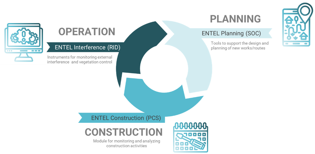
The service is mainly based on satellite EO data and supports three main lifecycle stages: the identification and selection of optimal route for a new infrastructure during the planning, the monitoring and control of interferences by human activities that may damage and compromise the operational functionality of an operating station/line, and the control of vegetation providing critical analytics to map vegetation dynamics.
Currently, ENTEL focuses on energy infrastructures by a complete set of solutions designed to support the logic of the energy corporates' departments, but it has the potential to be extended to mobility and communication networks in the near future.
Users and their needs
Large infrastructure operators manage costly assets over vast geographic areas, requiring inspections that are expensive and time-consuming. These inspections are crucial for gathering information on infrastructure status, right of way, and surrounding territory to reduce risks and comply with national regulations. Additionally, developing energy infrastructures in complex environments demands optimized routing to minimize interference with populated areas, critical land uses, and other networks such as roads and railways. Key needs include:
-
Efficient, cost-effective inspection processes for infrastructure and territory.
-
Compliance with national regulations while mitigating risks.
-
Optimized routing to reduce conflicts with urban areas and critical land uses.
-
Large-scale mapping and monitoring to identify critical areas for detailed inspections.
-
Access to satellite Very High Resolution (VHR) images for in-depth analysis.
To address these needs, ENTEL engaged Italian Transmission System Operators (TSOs) and Distribution System Operators (DSOs) as reference users. They cooperated in supporting the analysis of customer problems/needs, in providing insight about their operational process, and in evaluating the benefits produced by the service by directly using ENTEL’s functionalities within a pilot stage.
Service/ system concept
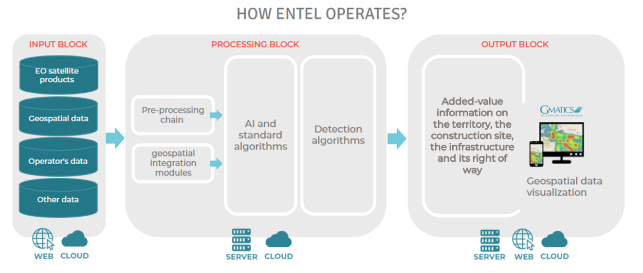
ENTEL exploits the automated processing capabilities of Earth Observation data through Artificial Intelligence algorithms. The ENTEL project proposes a combined use of HR and VHR satellite data, Open data, and other geospatial data as part of a methodology that provides added-value information related to the characteristics of the territory, urban features, territorial and administrative constraints, man-made changes of the land cover and vegetation dynamics. Moreover, ENTEL supports a smooth and easy integration within customer operational procedures.

Space Added Value
Currently, infrastructure operators mainly use seldom and non-uniform Earth Observation data and Geo-Information within planning, operation and management. Through ENTEL, EO data are efficiently exploited, in combination with various other data, for supporting the infrastructure life-cycle. The proposed service approach uses different data from EO satellites as a remote and reliable source of information, impacting on several service key points. EO satellite data, from both optical and radar sensors, provide specific added values in terms of multitemporal information on, for example, characteristics of the territory, land use, urban features, changes, and vegetation parameters. Moreover, all the EO data information is processed in a fully automatic manner in order to make possible the smart integration of the different workflow steps.
Current Status
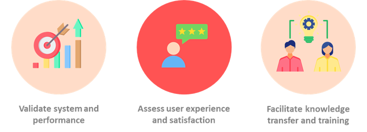
The project has successfully completed the pilot stage phase thanks to the involvement of the key end-users. The outcomes of this stage, assessed through a comprehensive set of KPIs, provide clear evidence of the service’s effectiveness in supporting infrastructure management for large-scale energy networks. The results confirm ENTEL’s capability to meet key operational objectives, provide meaningful improvements in efficiency and risk mitigation, and meet user engagement goals. The outcomes moreover set out ENTEL’s relevance as a trusted tool for infrastructure operators, and its potential for broader adoption.


