
Objectives of the service
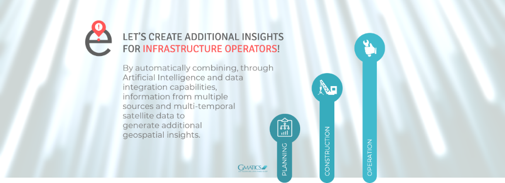
Image credit: GMATICS S.r.l, Project: ENTEL
The ENTEL project enables the development of an innovative service that combines information derived from Earth Observation satellites with various geospatial data (including public source information and customer proprietary data) to improve the effectiveness of large infrastructure (electricity and gas pipeline) operators' activities within networks life-cycle. In particular, ENTEL supports the infrastructure companies in planning and construction stages of a new line and supports the management of the asset during infrastructure operation. Through the exploitation of various AI algorithms and the data integration capabilities, ENTEL provides automatic and systematic added-value information related to man-made changes according to multiple user scenarios.
Users and their needs
Large infrastructure operators deal with the management of costly assets deployed over very wide geographic areas. Inspections of grids are an expensive and time-consuming activity, needed to be performed for getting useful information about the status of the infrastructures and of the relevant right of way both for maintenance activities, risk reduction, and complying with national regulations. ENTEL enables solutions for infrastructure operators by supervising the operations and providing indication on where performing more detailed inspections and investigations.
Based on the existing cooperation relation, ENTEL has involved Italian DSOs (Distribution System Operators) as reference users for its implementation. DSOs cooperate in supporting the analysis of customer problems/needs, in providing insight about their operational process, in evaluating the technical results produced by the projects and, most important, in assessing the cost benefits of a possible ENTEL operational service.
Service/ system concept
ENTEL exploits the automated processing capabilities of Earth Observation data through Artificial Intelligence algorithms, and pay-per-use cloud services (business scaling-up). The ENTEL project proposes a combined use of HR and VHR satellite data, Google services, Open data, and other geospatial data as part of a methodology that provides added-value information related to man-made changes and a smooth and easy integration within customer operational procedure. The resulting application services will be characterized by high performance/price ratio.
The ENTEL outputs are expected to be provided to the management department of operators, their operation staff and field workforce.
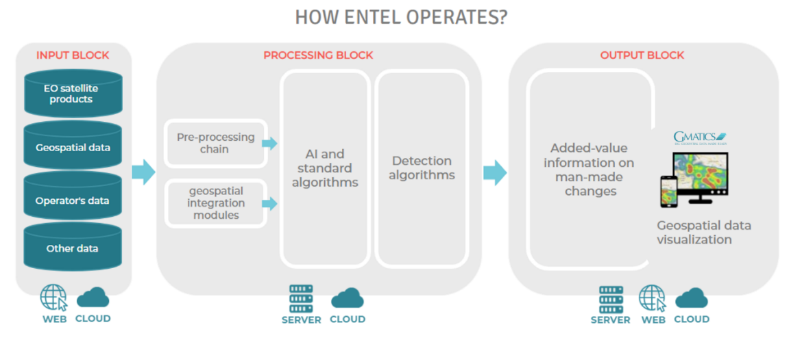
Image credit: GMATICS S.r.l, Project: ENTEL
Space Added Value
Currently, infrastructure operators mainly use seldom and non-uniform Earth Observation data and Geo-Information within planning, operation and management. Through ENTEL, EO data are efficiently exploited, in combination with various other data, for supporting the infrastructure life-cycle. The proposed service approach uses different data from EO satellites as a remote and reliable source of information, impacting on several service key points. EO satellite data, from both optical and radar sensors, provide specific added values in terms of multitemporal information on man-made changes. Moreover, all the EO data information are processed in a fully automatic manner in order to make possible the smart integration of the different workflow steps.
Current Status
The demonstration of the technical feasibility of the ENTEL service, based on the exploitation of satellite data with different resolution and from multi-spectral and SAR sensors, has been demonstrated. The involvement of our reference customer has provided good results in terms of in the field verification.
Based on these results, the testing of a pre-operational service will continue in 2021 and additional features have been requested by various end-users in relation to adding new elements/scenarios to be detected and for integrating additional data sets.
A system architecture capable of implementing different workflows, responding to different user scenarios, has been designed and is ready for development within a future demonstration project.