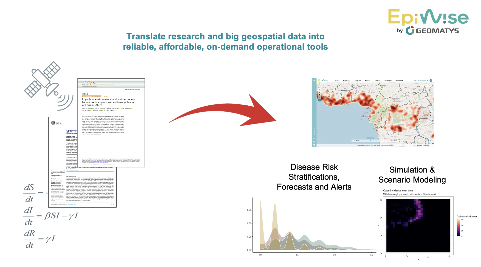
Objectives of the service
Epiwise strengthens epidemic preparedness and response through precise, location-specific risk assessments for emerging diseases, starting with infectious pathogens such as Ebola and Dengue. It integrates Earth Observation (EO) data and global change predictions with epidemiological models to produce dynamic risk maps, simulate outbreaks, and forecast trends. These outputs guide decisions on resource allocation, optimal vaccine trial site selection, and targeted surveillance by identifying high-risk areas and predicting future risks due to changes in the environment and human activity. The secure web interface ensures timely access to data-driven insights.
Users and their needs
EpiWise serves stakeholders from public health agencies, global health organisations, health-related industries, and industries such as tourism and travel which are impacted by public health risks. Since climate-sensitive health risks affect nearly all populations to some extent, the stakeholders targeted are widely distributed – from local health authorities in Africa or Europe to multi-national companies with global reach. These users need accurate, timely risk evaluation to plan vaccine deployment, develop diagnostics, and manage outbreaks. Epiwise provides risk projections, clear data visualisations, secure data integration, and scenario modelling to facilitate faster, time-sensitive and evidence-driven public health decisions.
Service/ system concept
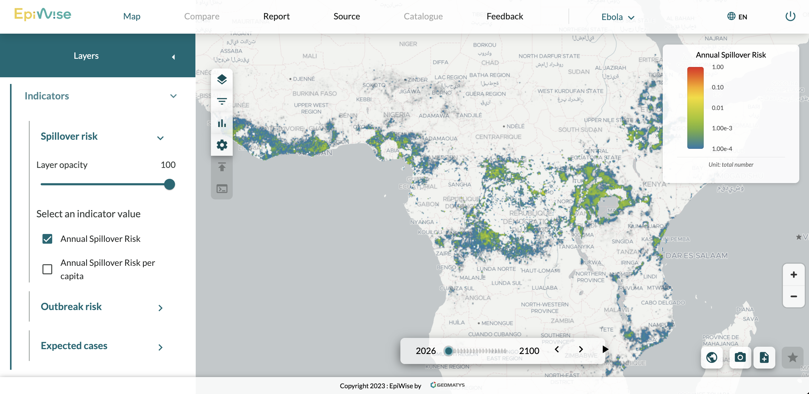
EpiWise functions as an Integrated Decision Platform (IDP) for epidemic risk mapping. It brings together geospatial Big Data (e.g., high-resolution human population estimates from Gridded Population of the World (GPW), GRID3, and other locally structured census data; local meteorological data and CMIP6 global climate data; and land cover from fine local (Urban Atlas) and global (MODIS) scales) with epidemic risk models from academia to address infectious – and in time, also non-infectious – diseases impacted by global change. Its key features include population stratification for current and future outbreak risks which can be viewed through across both space and time, disease spread and scenario modelling, and creation of indicators combining diverse data sources. A user-friendly interface allows decision-makers to explore risk maps, access real-time data, and derive evidence-based actionable insights to better prepare and respond to global health risks without the need for technical expertise.
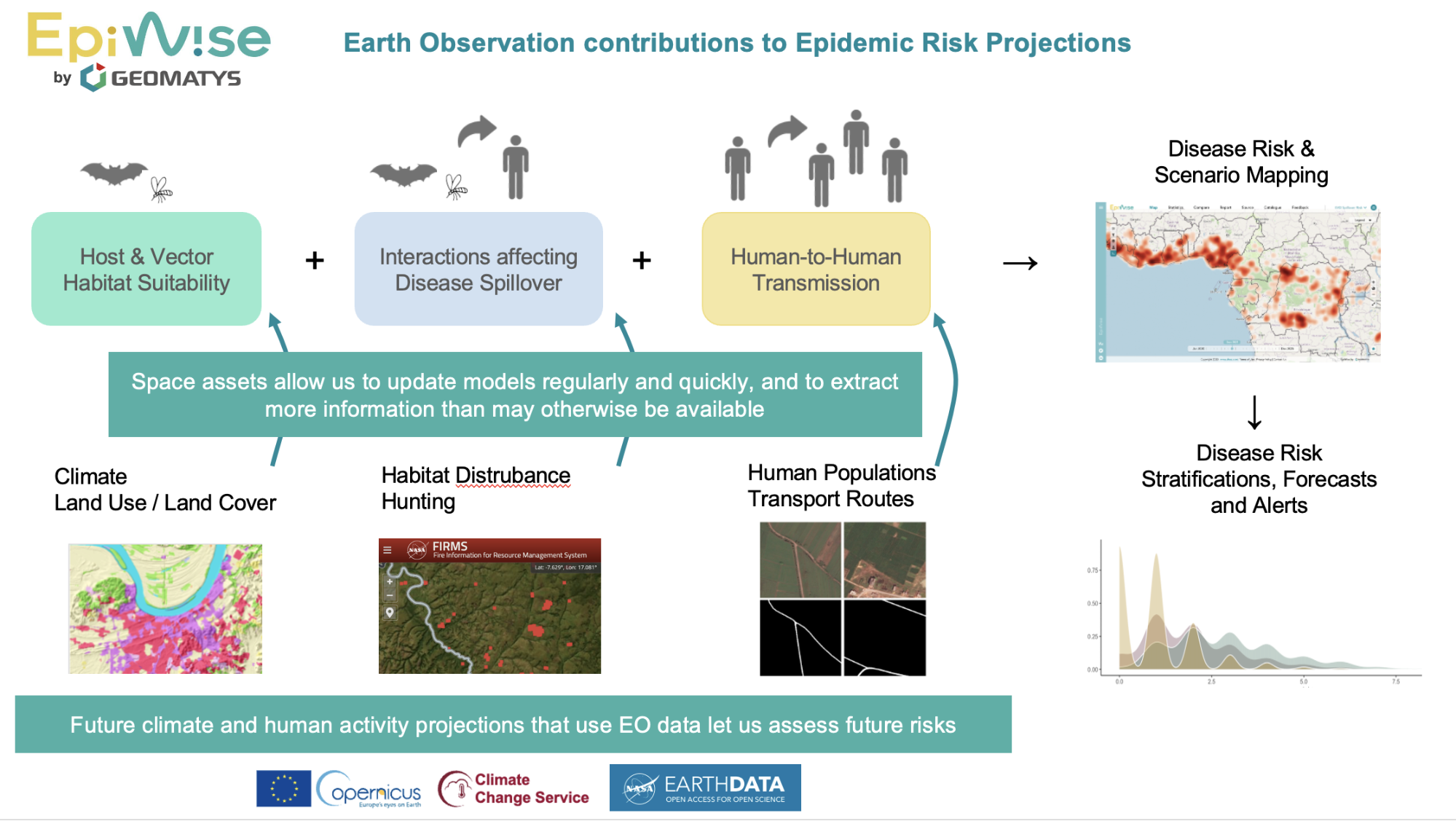
Space Added Value
EpiWise uses Earth Observation (EO) data to enhance the accuracy and timeliness of epidemic risk assessments. The platform uses EO data from open geospatial data sources such as Sentinel, MODIS, and Copernicus Climate Change Service to improve predictive accuracy by tracking environmental, climatic, and human activity changes – all key factors in disease emergence. For example, host habitat fragmentation is tightly associated with Ebola spillovers, while temperature and humidity patterns are the main driver of Dengue outbreaks. EO data offers broad coverage, quick updates, and critical insights, especially in areas lacking in sufficient surveillance capacity. EO data also play a key role in projecting future climate and population features, with machine learning algorithms deployed to predict complex spatio-temporal trends.
Current Status
On 24 March 2026, the EpiWise Demonstration Project passed the FAT-SAT Milestone Review for Version 1 of the solution, including Essential Services for Ebola Risk products, and is now cleared to officially start the first pilot with users.
The Development team has built out the graphical interface for the front end and is now busy testing a new back-end datalake that will replace the current infrastructure to facilitating automated updates.
The Disease Modelling team has received positive reviews on its first publication (submitted to the peer-reviewed journal Epidemics) for the Ebola Transmission model underlying its Ebola Outbreak Risk and Expected Cases indicators. They will also be presenting their work and soliciting early adopters at the upcoming Global Congress of the European Society of Clinical Microbiology and Infectious Diseases (ESCMID 2026) in Munich in April.
The next milestone is the FAT/SAT for Version 2, which will add Advanced Services for Ebola Risk products as well as Essential and Advanced Services for Dengue Risk products, currently scheduled to take place around September 2026.