
Objectives of the service
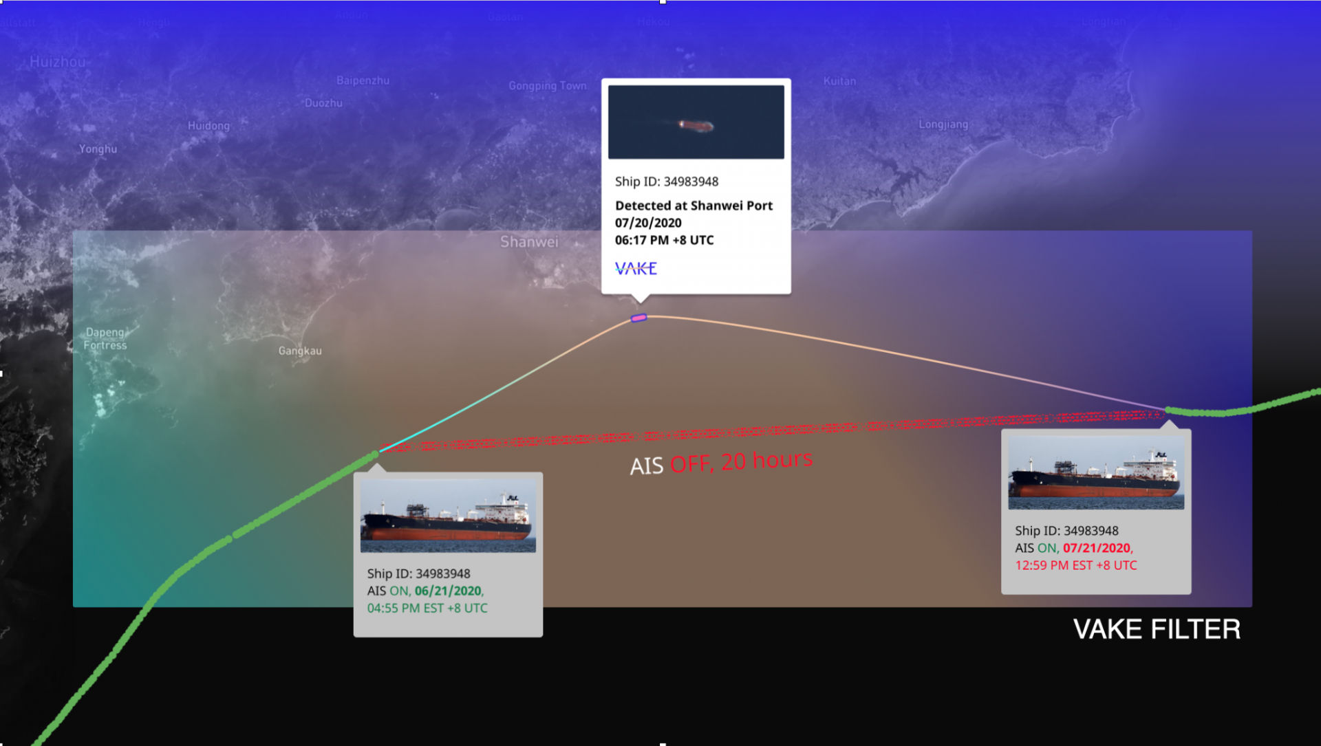
In recent years there have been significant efforts going into the detection and revelation of Illegal, Unregulated, and Unreported fishing activity. These efforts have mainly been applied to analysing AIS (Autonomous Identification System) vessel traffic, the downside being that any nefarious actors can turn their vessel trackers off.
This problem is not new, and there exists no one solution to solve it. A challenge that Vake sees with existing solutions is that their entry point is one satellite image of a problematic area. What information can we get out of the image at hand?
In FEST we put Vake’s approach to test, where the entry point is specific ships, having tracks with known gaps, anomalies or uncertainties. This is a big data approach, made possible by clever usage of the vast amount of Sentinel-2 data available. This way we don’t waste time analysing irrelevant images, but rather scan for images coinciding with anomalous behaviour.
The tasks in the project included analysis of various vessel tracks suspected to be involved in illegal and unregulated activities, and the project was able to obtain images of these vessels based on historical vessel tracks.
Users and their needs
Through the activity, multiple target groups and users were identified with regards to detection of fishing activity from satellite imagery - including those industrial/commercial use cases with similar or overlapping needs:
- NGOs
- Working both on high-level analysis of fishing activity as well as information and evidence collection for specific vessels and activities
- Government Agencies
- Coast guards, Coastal Administrations etc. working on controlling and patrolling activities within their EEZ lacks tools to efficiently cover the vast ocean areas they are responsible for
- Offshore Assets Owners
- Offshore Assets are threatened by (fishing) activity from vessels with their AIS turned off
In all of these cases the users indicated interest both for
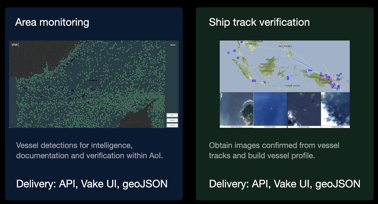
- Area monitoring, where vessel detections and analysis is performed for a specific Area of Interest (AoI)
- Vessel tracking, where specific vessels are of interest, both to verify known tracks from AIS and to uncover hidden activity and anomalous behaviou
Service/ system concept
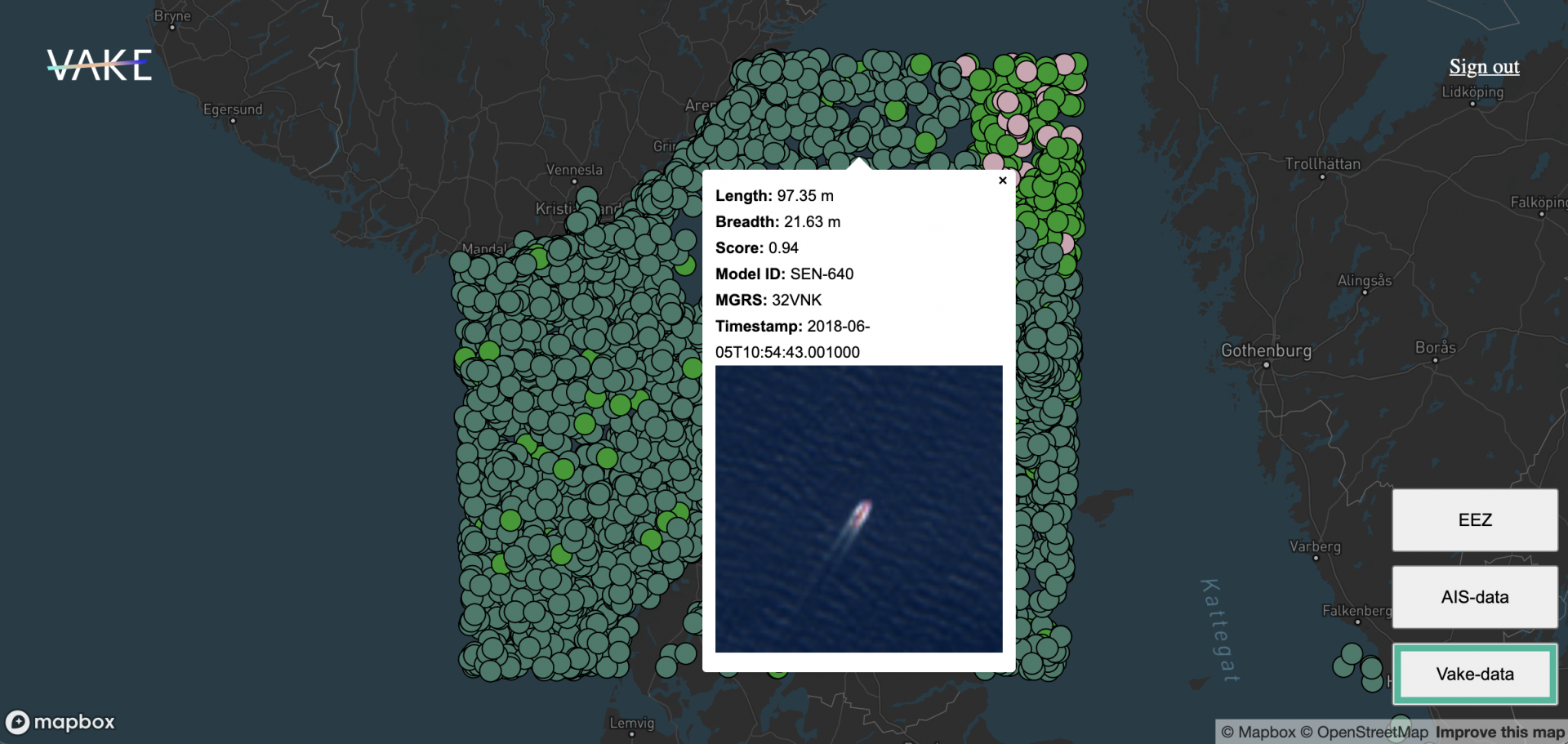
The service developed through this project is built around supporting the users existing work logic, and there is no requirement to use the Vake web interface to access our data and insights. Rather, we prefer to facilitate the use of our data externally, within the tools that they already use and love. This meant developing a data API in a flexible and widely supported format, which also enables our insights into how users interact with our data.
The service comprises both Area Monitoring and Vessel track verification. For Service and Product provisions and distribution of these results, Vake’s service architecture has been utilised according to the flow chart figure.
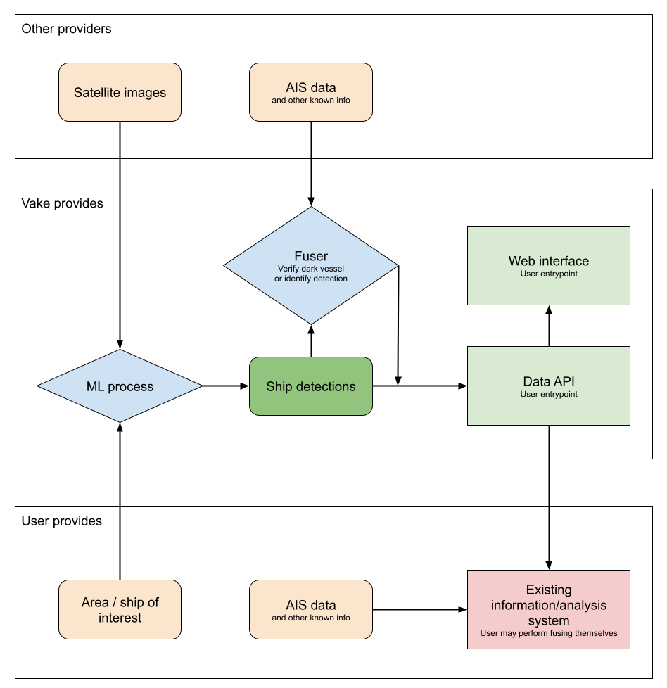
The service architecture can be further utilized and extended for new projects related to IUU fishing, and for efficient distribution and integration for other use cases and applications related to dark vessel track detection and vessel track verification. Vake has continued to develop the system after the project finished, further automating the user capabilities and delivering new levels of insight.
Space Added Value
Vake’s service and the work related to IUU fishing analysis has utilised multiple space assets, where Sat-AIS and EO satellite imagery are the main ones. The main source of EO imagery is Sentinel-2.
The value added by space assets makes up the main part of the value proposal for the project, as it would not be possible to perform analysis and extracting insights without the satellite imagery. Unlike the existing vessel tracking system, the AIS, satellite images represent a non-cooperative source of detection.
Current Status
Vake’s vessel detections in Sentinel-2 imagery is a service in operation, and can be used for both Area Monitoring and Vessel track verification on a global basis where there is image coverage. The data and insights analysed can be accessed in a web interface or integrated into other systems by use of Vake’s API.
If this capability is of interest, either for IUU fishing analysis, other environmental activities happening at sea, or any other use case related to verification of vessel movements or dark vessel detection, you can reach out directly to Vake through their webpages or book an introductory meeting to learn more about applications and performance.
The final review for the kick start activity was held on 27th of April, 2021, and Vake intends to deliver a proposal for a Demonstration Project in 2022.