Objectives of the service
The main objective of the GEMS service is to revolutionize the field of emission monitoring, providing a comprehensive and reliable source of data on air pollutants and greenhouse gases.
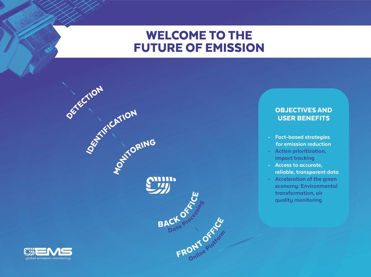
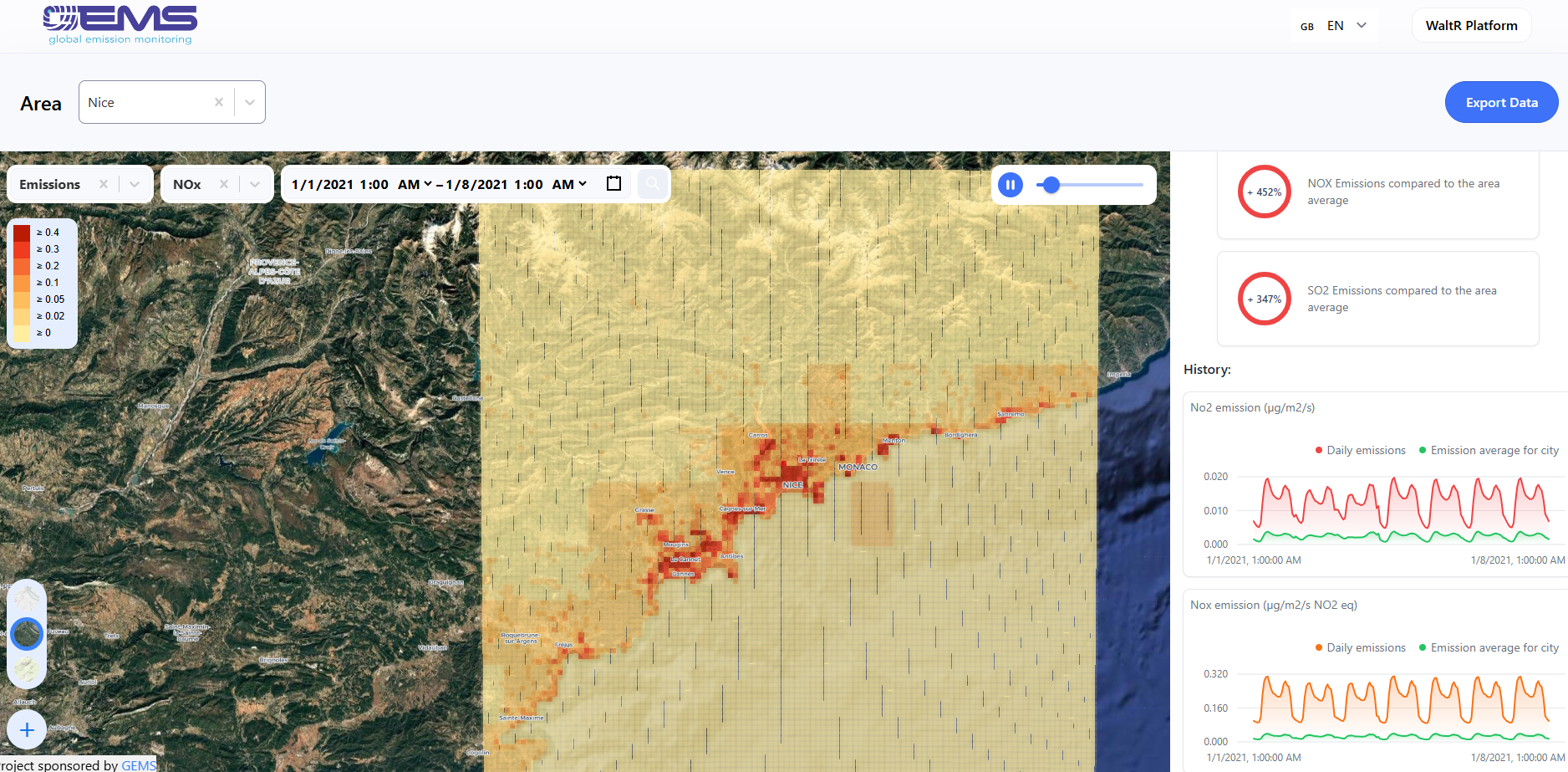
Unlike traditional concentration measurements, GEMS focuses on emission levels. Identifying sources and monitoring their rates over time enables users to develop fact-based strategies for emissions reduction, prioritize actions, and assess the impact. GEMS project, aim to develop further the capability of tracking emissions globally, for a variety of customer segments, using satellite data and information from the Copernicus services. Additionally, the processes set in place create automations and streamline delivery channels through a full digital platform and an online portal. We create a comprehensive system for detecting, identifying, and monitoring emissions of NOx/NO2 and SO2.
The system
-
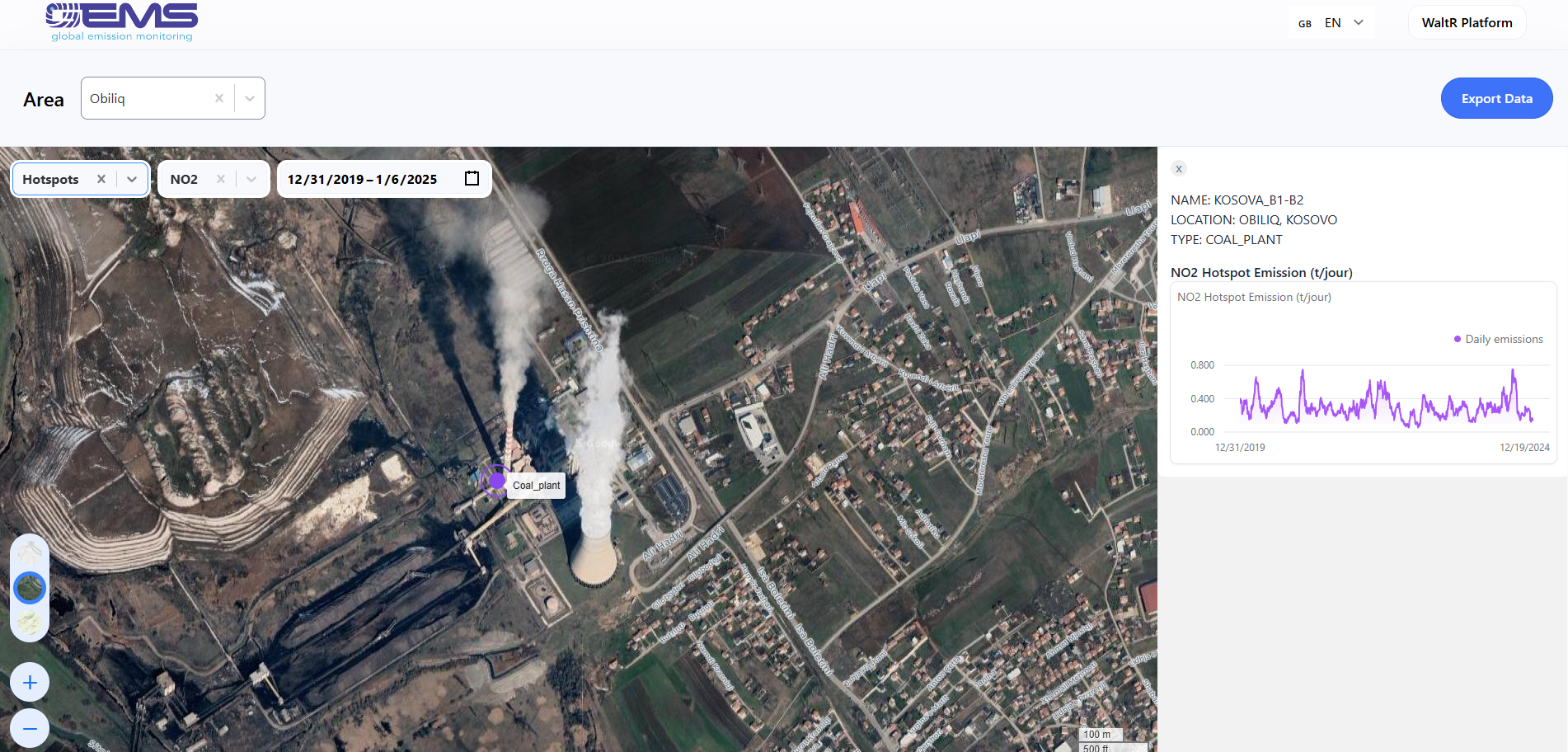
focuses on hotspot emission detection, which involves identifying the location of significant emissions and providing estimates of the emission rate. This is designed to help customers pinpoint emission sources more precisely.
-
can attribute detected emission hotspots to specific sources or owners. It assigns ownership using publicly available declarations, which are expected to cover around 90% of cases.
-
includes rate monitoring for both hotspot emissions and surface emissions with a precision of approximately ±10%.
Our long-term goal is to offer data for all pollutants and all sectors through a global, trustworthy, and affordable register of GHG and AQ emission accessible on-line.
Users and their needs
Although GEMS data products he primary users of the GEMS service include Sustainable Finance, the whole value chain of Green Industry businesses investing in environmental transformation, and regulatory bodies and agencies involved in outdoor air quality monitoring.
These users have diverse needs, such as:
Assessing Environmental Risks: Identifying and managing climate-related risks in their investment portfolios or underwriting decisions.
Sustainable Investment: Ensuring that investments align with ESG goals and contribute to emissions reduction.
Risk Mitigation: Reducing exposure to companies or projects that fail to comply with environmental regulations.
Complying with Emissions Regulations: Staying within emissions limits for NO2/NOx and SO2 to avoid fines or shutdowns.
Improving Operational Efficiency: Reducing emissions by optimizing production processes and minimizing leaks.
Sustainability Reporting: Providing accurate emissions data for ESG reporting and demonstrating progress toward sustainability goal.
Monitoring Emissions Compliance: Ensuring industries, municipalities, and transport hubs (e.g., ports, airports) comply with emissions regulations for NO2/NOx and SO2.
Reporting to Stakeholders: Providing emissions data to government bodies, international organizations, and the public
Service/ system concept
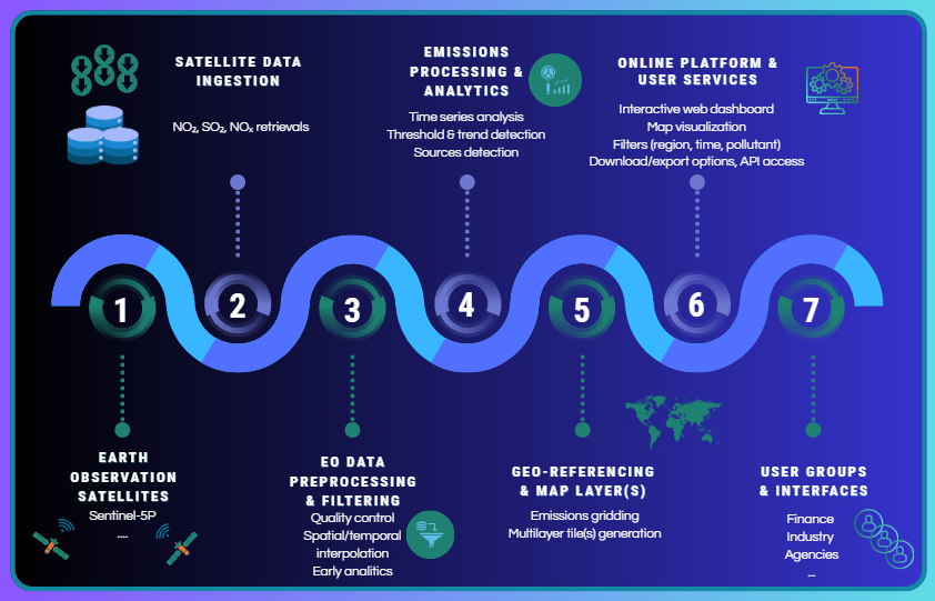
The GEMS service is a unique and comprehensive platform that combines satellite data with scientific algorithms to monitor and analyse global emissions of air pollutants and greenhouse gases.
The innovation of GEMS lies in its integration of business and science, with a focus on localized emissions data rather than just national-level data. The technical entrepreneurship behind GEMS ensures efficient processing, programming, and infrastructure management.
It consists of a "back office" utilizing reliable Copernicus EO data and advanced algorithms for data processing, as well as a "front office" offering an interactive webservice for easy access to processed emission data and key indicators. The service automate these components to a great extent making it efficient and user-friendly. The subscription-based model allows users to access lifetime data on emissions, as well as reliable metrics and key indicators.
Space Added Value
The proposed service needs Satellite Earth Observation of the atmospheric pollutants. The required data will be sourced from the Copernicus Atmosphere Sentinel operational missions: Sentinel 5 Precursor (S5P TROPOMI), Sentinel 4 (S4 UVN + MTG/IRS), Sentinel 5 (S5 UVNS + IASI-NG). Sentinel 4 and Sentinel 5 missions will be launch in 2024/25. Pilot service will preliminarily rely on S5P. The TROPOspheric Monitoring Instrument (TROPOMI) is onboard of satellite S5P, that was successfully launched in October 2017. TROPOMI is a spaceborne nadir viewing imaging spectrometer, which provides measurements of atmospheric trace gases at daily global scale with unprecedented level of detail, introducing new areas of application.

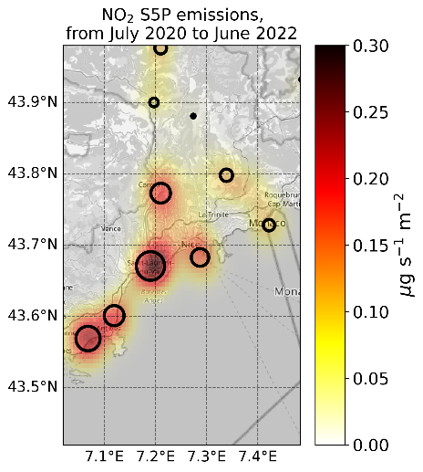
This space asset will have unique added value for providing real time information on neighbour pollutions, and global vision. It provides a unique spatio-temporal coverage for proposing global survey services for pollution emission. In addition, with respect to in situ or ground-based measurement networks, space data provides an integrated view of the atmosphere, allowing to capture the entire amount of pollutant for retrieving source emission (providing that the accuracy and the spatio/temporal sampling of the data is sufficient).
Current Status
The project is concluded, and the portal has active users and is ready to onboard new. We are able to monitor hotspots and surface emissions in European areas and globally according to needs. Moreover, detection of polluting areas and/or hotspots across Europe can be performed with high accuracy and serve different use cases and enable further research and policies.
The service is and will be actively evolving, with aim of adding functionalities to the system that derive from the large and quality amount of data available and can directly serve wide and different segments. For this we are looking for pioneer users that wish to onboard early our service with beneficial terms and costs.
We are at your disposal for any additional information, and we will be happy to demonstrate the service to interested organisations.