Objectives of the service
The aim of the project is to develop a product supporting the detection of uncontrolled leaks in water distribution network by using the latest technical achievements, including satellite and aerial imaging with the help of artificial intelligence algorithms. Currently, many of the companies distributing drinking water face problems related to large losses at the stage of sending it to end users. The project aims to take into account environmental parameters in the leak detection process such as changes in terrain, changes in vegetation rates and the formation of unusual reservoirs and wetlands.
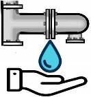
The main problem is hidden water leaks from transmission networks. Pipe damage occurs slowly and often remains hidden for a very long period of time. The smallest, hidden leaks can cause unexpectedly high water losses. Therefore, it is very important to detect leaks as early as possible so that it is possible to effectively eliminate water losses and the resulting damage.
The proposed system (application combining GNSS and EO products) consist of a platform supporting regional and national water distribution companies struggling with uncontrolled or even unknown leaks of drinking water from the network.
Users and their needs
Analysing the market, it can be seen that the length of the water distribution system in Poland is over 300,000 km long, and the number of connections is almost 6 million. Water consumption in Poland is nearly 1 300 hm3 per year by households alone. Each water distribution company is affected by the problem of water leakage at the stage of its distribution.
The main group of customers who will pay for the end product are water suppliers (User group A) involved in the transmission and distribution of water. According to recent reports, the number of Polish companies potentially interested in the presented solution from the sector defined as "collection, treatment and supply of water" in Poland is 1,877. The problem of leakage detection is also present in other types of networks, our solution may also be of interest to managers of e.g. heating or sewage systems.
Indirect beneficiaries of our project can be all users of drinking water supplied by water supply companies (User group B). Firstly, the reduction in network failures results in less frequent water shortages. Secondly, network failures cause temporary shortages in access to water. Thirdly, smaller leaks can affect the stable price of distributed water.
Service/ system concept
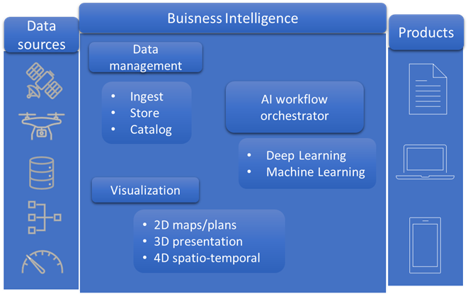
The proposed product can be offered as a service in the SaaS (Software as a Service) model. The main functionality can realize advanced multicriterial analysis. They can be based on many data sources. The crucial data can come from the ESA Earth observation component as satellite products from the Sentinel mission. The service can be based on Geospatial Artificial Intelligence (GeoAI) architecture and Deep Learning algorithms. Satellite imageries from Sentinel 1, 2 and the new products provided by Sentinel 3 mission can be used to implement these tasks. The data can be supplemented with historical data on previously existing long-term water leaks from the water supply network.
Space Added Value
The project concerns the construction of a platform for locating leaks in water supply networks using artificial intelligence algorithms based on satellite, aerial imagery, and navigating options with the use of Global Navigation Satellite Systems (GNSS). The proposed product is based on two critical programs carried out by ESA: Earth observation under the Sentinel missions and GNSS global positioning systems. The proposed solution envisages exploiting the synergy of the products offered by the Sentinel project with the Galileo and EGNOS satellite navigation systems to provide users with integrated geo-information.
Current Status
The Kick Start of the project has been completed. Conducted studies have confirmed the great potential of using Sentinel satellite products to detect incidents, such as leaks in the water supply network. During the work, data on historical leaks for the city of Olsztyn were acquired. Based on these, radar and optical sensor data were retrieved from Sentinel 1 and 2 missions, and a series of analyses were carried out for changes that could indicate a leak. Height changes based on NMT and SRTM data readings were analysed, and changes in the RGB visible band in the original resolution images and those corrected using the latest sharpening algorithms were examined in detail. In addition, the results were verified against data acquired from UAV missions (optical RGB, multispectral, laser scanning). This allowed confirming the high usefulness of satellite data in this area.
Prime Contractor(s)