
Objectives of the service

The GeoInsure project stands at the heart of a Romanian initiative aimed at transferring the knowledge acquired by Terrasigna in its over 15 years of Earth Observation based research activities and platform development into the operational domain of the (re)insurance market.
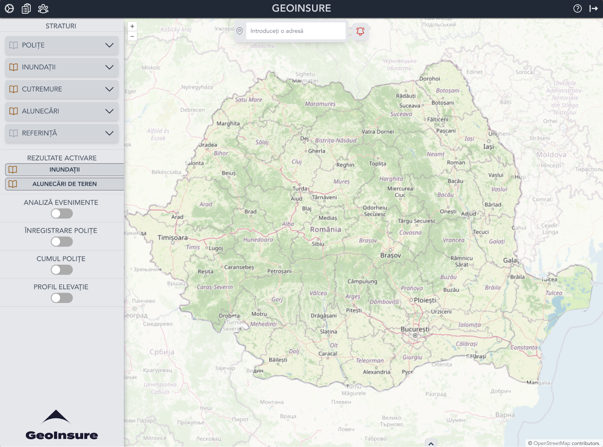
Today, GeoInsure is a ready-to-use exploitation platform custom designed as a full stack of harmonized geo-services and geodata products for the specific requirements of the (re)insurance private sector with an emphasis on natural catastrophes (NatCat). All functionalities have been designed and thoroughly tested in close collaboration with two representative companies of the Romanian insurance market to identify best responses to real life situations in terms of form and timeliness vs. costs, as required by the market.
Furthermore, to address as many potential beneficiaries, GeoInsure is made available through 2 types of contract service: (1) full installation of the GeoInsure platform on the client infrastructure and (2) access through a web browser to the GeoInsure intuitive and user-friendly web-service.
Users and their needs
GeoInsure was designed for the (re)insurance market active in the NatCat sector. Requirements implementation was thoroughly tested by two representative Romanian oriented companies, with great results. The requirements were discussed in detail with both pilot users, as well as with additional potential beneficiaries. They can be summarised as:
-
Readily access, spatial and temporal navigation through all data available;
-
Geocoding of beneficiary’s portfolio;
-
Various filtering functionalities on policies portfolio;
-
Seamless interoperability with beneficiary’s systems;
-
Notifications on abnormal/high environmental parameters values (precipitation values, water levels etc.);
-
Storage of data for at least 90days;
-
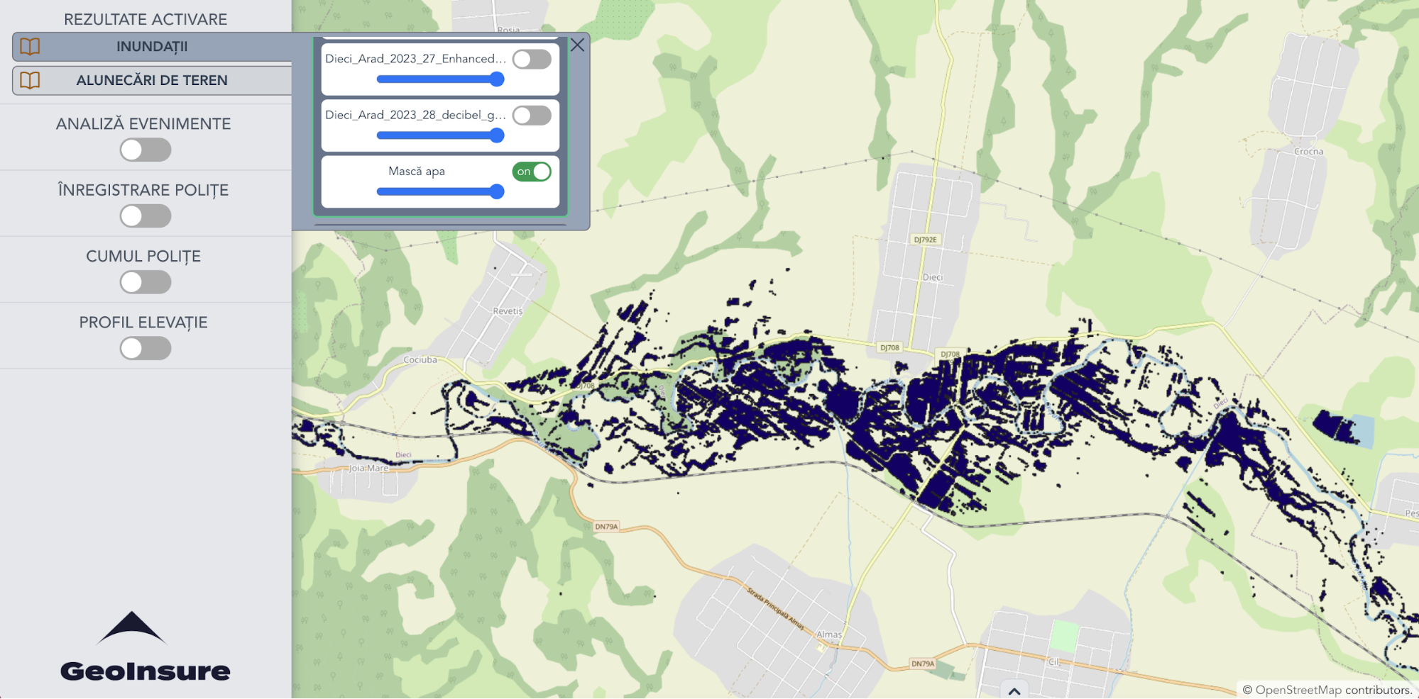
Seamless activation of damaged areas analysis using satellite imagery and access to results through GeoInsure;
-
Ingestion/mirror of geospatial data from the beneficiary;
-
Bespoke training, detailed documentation of GeoInsure data and functionalities.
Given the geographical interest of the pilot users, GeoInsure was focused on the Romanian territory. Also, the graphical user interface and the tutorials are written in Romanian. However, this is by no means a limitation of the service developed. All GeoInsure materials are to be completely translated to English in the near future. Given the architecture of GeoInsure and the pervasiveness of Earth Observation, the team has no difficulties in refocusing the data component on a different territory.
Service/ system concept
GeoInsure brings complete capabilities of a state-of-the-art geospatial component to any existing system an insurance company might have. The platform architecture follows the model proposed by ESA initiative EO Exploitation Platform Common Architecture. Following this architecture - the design choice - GeoInsure is built upon distinct macro-components, that represent logical collection of components that have similar or strictly related functions and implement a homogeneous set of processing services, making it highly versatile. The GeoInsure platform development was based on state-of-the-art open source libraries and components that were already validated by the community and the industry. Additionally, all platform software components are licensed under a permissive license approved by Open Source Initiative (OSI), making sure that the license is not in conflict with the existing open source libraries reused by the platform. This design choice has significant advantages over proprietary software of which we enumerate a few: (1) potential vendor lock-in situations due to the poor support for standardised file formats and web services; (2) not cloud native; (3) not possible to modify or adapt the modify the core functionalities of the modules (the solution is not open source) and (4) high yearly licensing costs.
Space Added Value
GeoInsure builds on two main services: (1) readily access through a wide range of bespoke functionalities to a diverse set of detailed documented reference map layers (harmonized for the client’s region of interest), periodically updated and (2) pre-post NatCat event analysis.
GeoInsure pillars are functionality and data. Functionality refers to architecture elements of the system and services and its practical implementation. Data refers to all datasets, products and services, geospatial or not, that have been uploaded, ingested or mirrored into GeoInsure. Significant and constant efforts have been invested into identifying and preparing relevant data for the targeted beneficiaries.
Earth Observation is at the core of GeoInsure shaped by the available relevant data products and imagery, employed in the extraction of relevant information (flooded area, landslide, earthquake damages etc.), as well as for the reference base maps. The data provision plan is assembled by the main categories considered: territorial reference (base maps, digital elevation model etc.), floods (precipitation values, water levels, potentially flooded areas etc.), earthquakes (epicentres, peak ground acceleration values etc.) and landslides (soil moisture anomalies etc.). Data providers range from Copernicus Services, to national authorities, from community data (ex. OpenStreetMap) to research data and to Terrasigna’s produced data products.
Current Status
At the end of the project, GeoInsure is a ready-to-roll to market Earth Observation based geospatial tool, bespoke for the (re)insurance sector, focused on Natural Catastrophes/extreme events insurance market. It is a state-of-the-art, TRL 7 modular Earth Observation exploitation platform allowing seamless integration with beneficiaries’ operational workflows and systems through its highly customisable API.
Due to the geographic focus of the insurance companies Terrasigna collaborated to design GeoInsure, the data component is focused on Romania. However, considering the pervasiveness of Earth Observation coverage, the team can easily refocus on a different geographic coverage of the reference geospatial data products, as well as the commercial market.
Prime Contractor(s)