Objectives of the service
As a continuation of the GeoSHM Feasibility Study (FS), we have taken into account the technical and administrative issues identified from the FS stage in order to formulate the objectives that truly reflect the real end user requirements through extensive engagements with essential stakeholders, mainly in the UK, the US and China. The inability to provide essential information on the response of the entire bridge, as well as loading forces and their distributions, such as numbers, types and locations of vehicles on the bridge and their weights etc., proved to be a significant problem for the bridge operators. Another drawback included the data and system outages, which were due to the lack of a stable and reliable mechanism for data acquisition and IT facilities. Currently, the system configuration is only designed to meet the FRB requirements – this needs to be further developed for the Demo Project to accommodate other bridges, with their particular requirements. Users such as bridge masters also struggled with the lack of a simple but effective data strategy that can advise for decision making either for maintenance or operational routines. These issues have been resolved by the development of event-driven smart triggers to control sensors to sample data at different rates and an effective GeoSHM Analyst tool to extract essential information regarding the bridge health condition. Considering these user problems, the main objective of the GeoSHM Demo is to provide an upgrade of the existing GeoSHM installation on the Forth Road Bridge which addresses the technical and administrative issues identified in the FS and to develop a scalable system comprised of innovate methods which can be tailored to accommodate the specific needs of different clients through installation of GeoSHM to two Yangtze River Bridges in China.
Users and their needs
Targeted User Communities:
- Bridgemasters & Infrastructure Managers – individual representatives of bridges and other infrastructure operators
Involved in GeoSHM: Amey, BRDI/China Railway, London Transport Authority, Hammersmith Bridge, Severn Bridge, Network Rail, ARUP, Aecom,
- Public authorities – transport authorities, highway agencies & governmental department in the UK and China
- Involved with GeoSHM: London Transport Authority, Transport Scotland, Network Rail, China Railway, Ministry of Science and Technology of China, National Administration of Surveying, Mapping and Geoinformation of China, , Chongqing Surveying and Mapping Institute in China, Yangtze River Scientific Research Institute in China
- Engineering and Maintenance Contractors – consulting & contracting engineers
Involved in GeoSHM: UbiPOS, Stonex, Aecom, Flint and Neill, Arup, Strainstall, Moniteye, Leica
- Academics and researchers
Involved in GeoSHM: Universities and research organisations in China and the UK
User Needs:
- Reduce the cost of bridge maintenance by implementing a more targeted and smarter approach to inspections
- Implement automated, practical and cost-effective solutions to assess bridges operational conditions and identify structural damage
- Generate deflection data that provides more accurate guidance, which can pinpoint necessary refurbishment, and thus avoid huge unnecessary costs
- Install a monitoring system that can be integrated with existing monitoring technologies and visual inspections, allowing for cost savings, and wider monitoring potentials
- To design data collection, transmission and handling with specific focus on whom the data is destined for, and how it is used
- Access to the system should be easy and low-cost
- Systems need to be marketed and explained in frank detail. Limitations and benefits need to be detailed
- Solution needs to be flexible enough to cater for specific needs of individual users or user groups
Targeted users are based in China and the UK initially with intention to explore the European, Asian and the US markets.
Service/ system concept
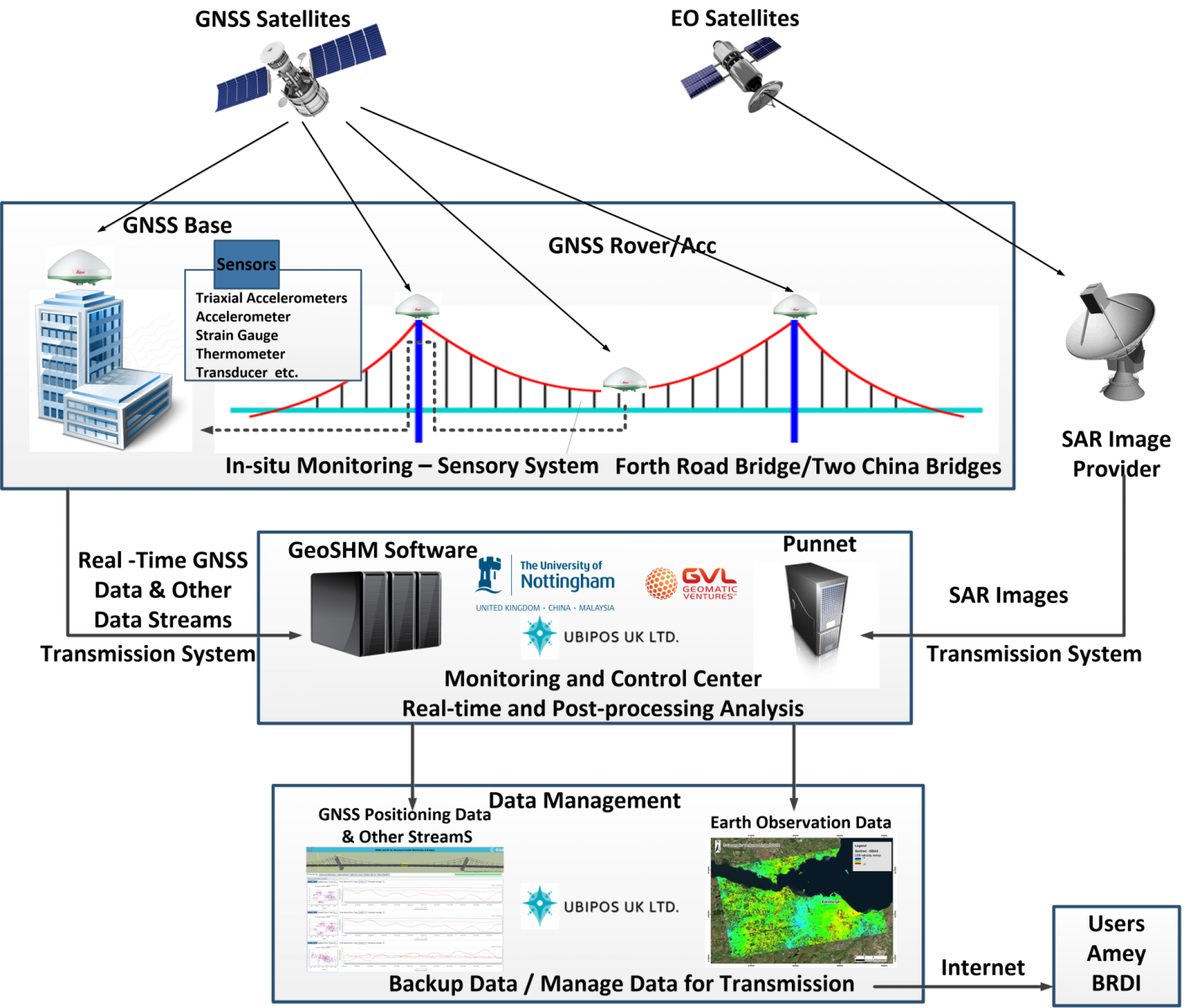
The GeoSHM Demo Project uses two space technologies (GNSS and EO) and is augmented extensively with terrestrial sensors as shown in the following figure.

The main aim of the system developed is to measure and quantify all the excitations, which are applied on a structure, to estimate the behaviour of the structure based on the measurements of its response and finally to evaluate its function based on the correlation of the input and output data, and make comparison with theoretical designed thresholds of the structure function. Thus the entire architecture of the system is based on the monitoring of the induced excitation of the structure and the corresponding response, for the evaluation of the structure behaviour according to pre-defined models of the structure. When the service is deployed the users have the capability of carrying out instant diagnosis to the structural health condition of their bridges.
The Building Blocks of the GeoSHM system:
- The sensory sub-system – includes the sensors for monitoring
- The data acquisition and transmission sub-system – includes the units for the acquisition of the data using data loggers
- The monitoring control sub-system – consists of two main units: i) the pre-processing unit of the data and ii) the real-time and post-processing data
- The structure evaluation and notification sub-system– the measured response and measured loading is used to trigger warnings to the bridgemaster when thresholds exceed
- The data management sub-system – defines the management of the input data files and the outcomes of data processing with the final reports
Space Added Value
The space assets involved are:
- GNSS technology (GPS, Galileo and BDS satellites) – part of all five building blocks
GNSS receivers are installed on critical points of the structures in order to provide the representative, continuous and accurate estimation of the displacement time-series of the structure.
- The remote Earth Observations (based on InSAR data) – part of building blocks 2-5
EO data are used in a post-processing mode, focusing on the monitoring of the ground motion of the surrounding area of the structure for the detection of potential ground subsidence and assessing their impact on the safety of bridges. GNSS and InSAR data are integrated when possible in order to baseline the accuracy of the estimation of potential differential subsidence of the structure and for the calibration of the estimated displacement of the bridge pylons. The two techniques are operated independently, so if one fails the other one can cover the monitoring of the structural environment. The outcomes of the GNSS and EO data provide an integrated picture of the soil-structure system, which can improve the maintenance of the structure and the design of potential modifications, with the information generated from other monitoring sensors such as accelerometers, inclinometers, strain gauges, anemometers, thermometers, etc. GeoSHM could provide the information about the interaction of ground motion, dynamic loading and structural response, which cannot be achieved with any other existing SHM solutions.
Current Status
The GeoSHM Demo project has been completed and successfully performed the final review on 26 April 2019 at ESA Harwell Campus (ECSAT) in the UK. The project started with the Kick-Off Meeting with BRDI in Wuhan, China on 31 May 2016 at which two bridges for the project were identified: Wuhu Yangtze River Bridge and Zhaobaoshan Bridge in Ningbo China. China Daily of Science and Technology and the University of Nottingham also published news releases to announce the GeoSHM Demo Project’s Kick-Off. Moreover, during the project 9 GNSS receivers, two accelerometers, three anemometers and two inclinometers were installed on the Forth Road Bridge. Two GeoSHM-Lite sensors, first of such a type around the work, have been running since November 2018. A dedicated GeoSHM User Interface (UI) empowered with GeoSHM Data Strategy and Analytics has been implemented. The GeoSHM system is processing data from two other bridges in China which form a new business model of GeoSHM, i.e. processing third party data as a service provider. To explore the GeoSHM exploitation opportunities a GeoSHM demonstrator has been set up at the world’s largest news agency, Xinhua Agency, to the congress personnel who are attending annual conferences, to maximise its impact. A clear business development has been developed and around 14 GeoSHM-Lite sensors have already been ordered to be installed as the demo systems on a large dam (the third largest arch dam in the world) and a few high-rising buildings in Shanghai.

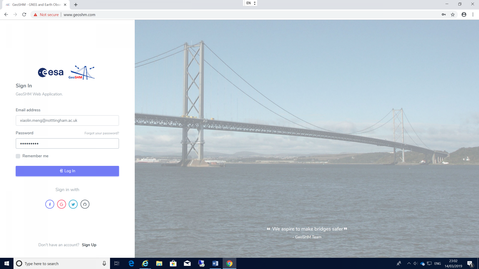
GeoSHM User Interface
Prime Contractor(s)
Subcontractor(s)


