
Objectives of the service
GridEyeS is a AI service for operation control, maintenance, and planning teams in electric utilities.
It enables electric companies to:
- Move from manual time based line inspections to risk based inspection by using AI that identifies high-risk areas to more efficiently allocate resources.
- Minimizing line inspection cost and time
- Reduce the risk outages and wildfire
Users and their needs
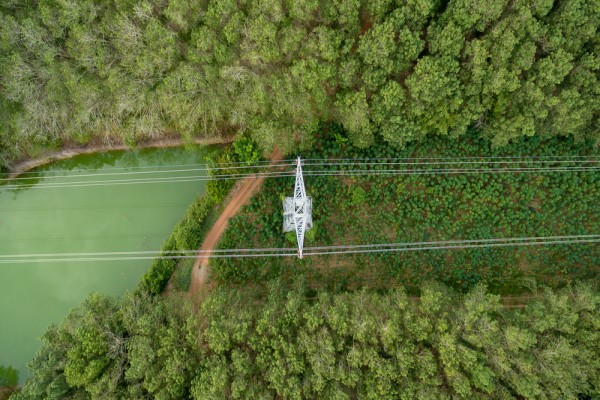
To ensure reliable power supply, grid companies need to inspect their grid at least once a year to identify high risk trees, damaged poles, and transmission lines. This is a costly and time consuming task, especially in remote areas. Here the vegetation management teams often face complicated terrain, making inspections with drones and helicopters more difficult. In tropical regions, teams struggle with rapid regrowth requiring inspections several times per year driving costs up. Furthermore, the amount of resources available to do the inspections is limited. This may lead the grid companies not to reach reliability expectations. GridEyeS improves the scale, frequency and cost efficiency by creating a prioritized list of actions to execute aided by AI and satellites.
Service/ system concept
Vegetation Management (VM) is a significant maintenance expense for many power transmission and distribution companies. Traditional Vegetation Management operational practices face more challenges due to the lack of situational awareness on vegetation in the wake of climate change and increasing extreme weather events. The advancements in high-resolution satellite imagery and AI-based analytics encouraged the GridEyeS team to close the loop with a solution for continuous data-driven vegetation monitoring. GridEyeS is an automated platform for monitoring power lines right-of-way using high-resolution satellite imagery and other available data such as LiDAR and aerial images to characterize vegetation's risk in various weather conditions.
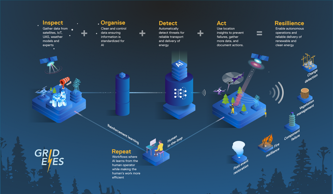
GridEyeS reduces the cost and time of electric lines inspection significantly by replacing ground-based crew, helicopter, or drones inspection with satellite data analytics. The initial results show the potential of the GridEyeS in precisely characterize vegetation in various landscapes.
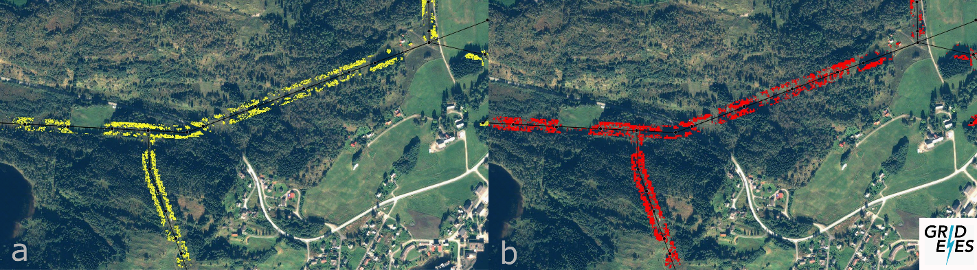
The image shows how GridEyeS AI output (b) is with high agreement with LiDAR survey data (a) captured from the same region.
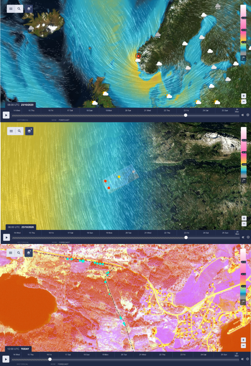
These three snapshots from the GridEyeS platform shows the multilayer interactive map regarding vegetation condition, satellite data and weather.
Space Added Value
The space assets utilized in the GridEyeS is earth observation data from optical satellites and GPS positioned observations and infrastructure. Use of satellite remote sensing and advanced analytics can deliver economic, safety, and other utility industry benefits in areas such as vegetation management, disaster response, and asset monitoring.
The advantage of using satellites for Grid Inspections
- Larger coverage than helicopters and ground personnel
- Rapid, scalable deployment
- Flexibility
- Relatively low cost of reconfiguration and maintenance
- Low latency from image capture to user insight
- Lower CAPEX than helicopters and personnel
- Environmental benefits with reduced use of helicopters and cars
Current Status
Feasibility study completed and a follow-on demonstration project is under preparation.