Objectives of the service
The aquaculture market is the world’s fastest-growing food producing sector, with production close to 80 million tons annually. Fish farming provides the world with 17% of its animal protein. The complexity of aquaculture is greater than agriculture because the farming is done in water, not with water. Therefore, the monitoring and detection of water quality is crucial to achieving successful and healthy yield in aquaculture.
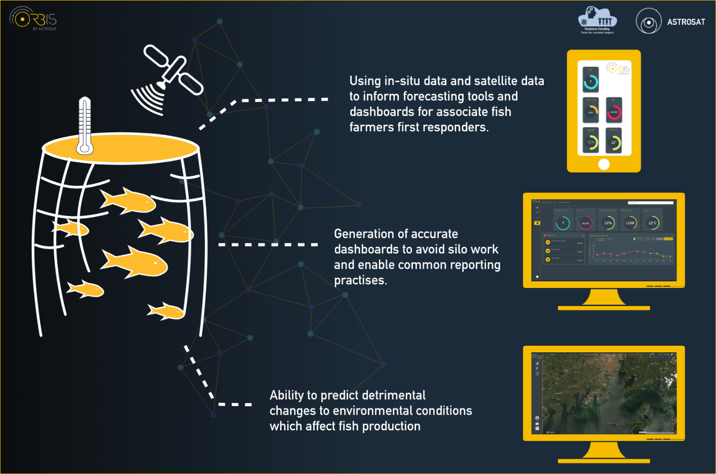
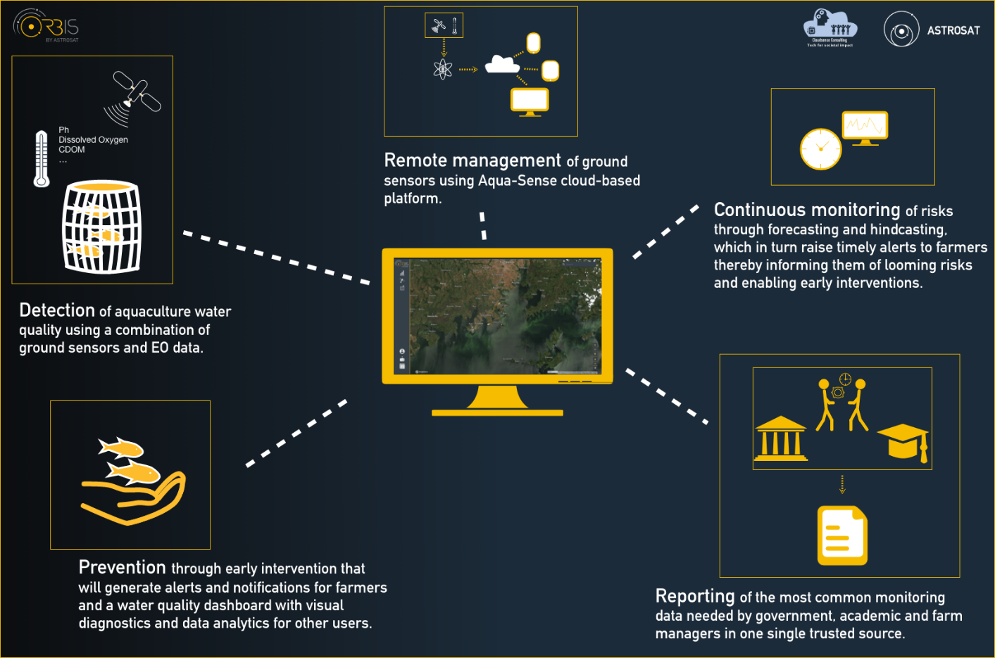
By combining the insights from Earth Observation data produced by Astrosat and changes to parameters relating to water quality detected by Aqua-Sense, this technology-led feasibility study tested and enabled:
-
Detection of aquaculture water quality using a combination of ground sensors and EO data.
-
Remote management of ground sensors using Aqua-Sense cloud-based platform.
-
Continuous monitoring of risks through forecasting and hindcasting, which in turn raise timely alerts to farmers thereby informing them of looming risks and enabling early interventions.
-
Prevention through early intervention that will generate alerts and notifications for farmers and a water quality dashboard with visual diagnostics and data analytics for other users.
Users and their needs
The H2Orb Feasibility Study tested critical assumptions for a monitoring and alert tool that combines satellite and ground sensor data to help the Ugandan aquaculture industry create productive and sustainable fish farms, whilst safeguarding the aquaculture livestock through improved fish health.
H2Orb is targeting four user communities: private aquaculture farms, cooperative aquaculture farms, academic and governmental communities. As a result, the service is designed for a wide range of roles, from fish farmers and managers of aquaculture farms to regulators and researchers.
In order to alleviate some of the most pressing challenges currently faced, H2Orb sets to address the following needs:
-
Reducing of fish livestock mortality rates
-
Improving livestock protection and welfare
-
Enabling remote farm management and saving costs
-
Improving digitalisation, data-handling practices and cross-sector collaboration
-
Sustaining of communities that depend on the livestock trade income
This is achieved through continuous and autonomous monitoring of water quality parameters, coupled with complex forecasting and hindcasting models and an early-warnings alert system. Advanced digitalisation is made possible by introducing a single data-sharing platform, simultaneously enhancing transparency and collaboration.
Service/ system concept
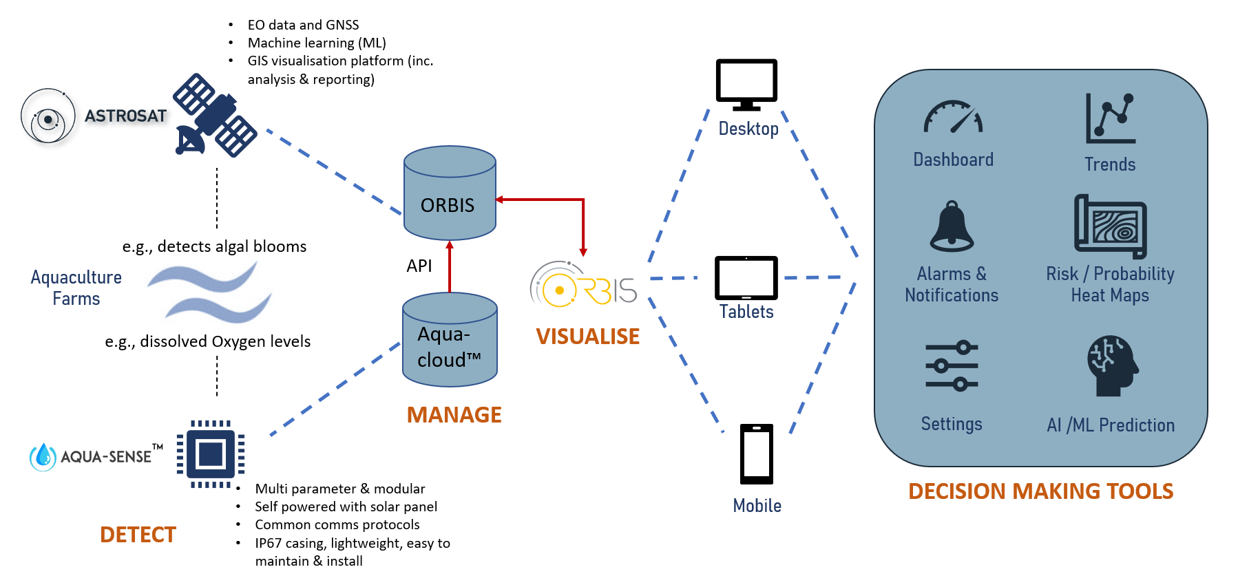
H2Orb will deliver timely, accurate, actionable intelligence to end users in a format that meets their need. They will receive live water quality data from in-situ sensors located in the fish cages as well as situational awareness from satellite data that monitors the surrounding environment. This will enable them to not only understand what is happening in the fish cages and meet their statutory reporting requirements, but will give them early warning of changes to water quality allowing them to mitigate the effects in a timely manner.
Depending on the user, this could take the form of text alerts on a mobile phone, monitoring key data parameters on a mobile friendly web page, or full analysis capabilities and a full suite of geospatial analysis tools on a laptop or desktop computer.
Space Added Value
For water quality monitoring and analysis, we use a variety of earth observation satellite data including multi-spectral data from Sentinel-2/MSI and Sentinel-3/OLCI and SLSTR. Data is pre-processed using the Sentinel Application Platform (SNAP) and we use the analysis toolkit “yt”, originally developed for analysing astrophysical simulations, for data processing and analysis. We make use of the C2RCC (Case 2 Regional Coast Colour) neural network model in determining water quality properties. We also make use of ERA5 weather data from the Copernicus Climate Change Service.
User engagement to date has clearly identified that users not only require accurate and timely information concerning what is happening within individual cages, but in order to enable timely decision making, they need to understand what is happening in the wider area around the cages. Our engagement has confirmed that if significant events such as algal blooms or green islands can be identified with sufficient time for farms to take action, then losses can be mitigated. Satellite data has the potential to solve this problem in a way that isn’t feasible with ground sensors alone.
Current Status
The Feasibility Study has now concluded. Two requirements gathering visits have been made to Uganda allowing discussion of requirements with the UKs Department for International Trade mission, Ugandan government agencies, large and medium scale fish farms and cooperatives. A final visit was then made to demonstrate elements of the proof of concept gathering valuable feedback from a wide range of stakeholders.
Water quality sensors have been built, configured and tested including multiple live tests of data transmission from fish cages in Lake Victoria.
Our data science team has investigated the use of satellite data to monitor water quality and historic events that have occurred in Lake Victoria. They have evaluated the use of satellite data to identify "floating islands" of vegetation, measure chlorophyll concentration and other parameters that pose a risk to fish health. Finally they have developed models to forecast algal blooms and water temperature using a combination of satellite-derived water quality data and weather forecasts.
Planning is now underway for a follow-on Demonstration Project to be undertaken in the coming months in Uganda.
Prime Contractor(s)
Subcontractor(s)