Objectives of the service
IMMAGINA supports existing Law Enforcement Control Rooms and Public Safety Bodies with state-of-the art features in:
-
call-taking and support for citizens asking for help,
-
early warning and mass alerting,
-
Fire prevention and management
-
Investigation support
-
Interaction between Operation Centres and patrols or intervention teams.
Many Law Enforcement, fire, civil protection structures already have IT systems for managing calls and monitoring the territory, however they find it difficult to enrich their activities with cutting-edge services, which require a huge effort of technology, data sources and devices. IMMAGINA offers an already designed and operational platform that can interface with existing systems to fill missing tools.
The functionalities range from aerial remote sensing - based on a network of aerial vehicles, UAVs and satellites - for the control of the territory, waste spills and gatherings of people, to mobile-based tools to receive live video from the place of intervention. Intelligent crowd monitoring and analytic-base investigation systems for image recognition are included.
The platform also aims to improve the interaction between Contact Centres and the callers, helping impaired people and supporting foreign interlocutors. Finally, a modern mass notification system has the purpose of disseminating alerts and communications to the population.
Users and their needs
IMMAGINA is intended to serve the operators and coordinators of the Law Enforcement, Fire Departments and Civil Protection services during their monitoring, crisis management and prevention activities.
In these sectors, it is essential to have a real-time point of view on the intervention scene, both through images and videos and through sensors.
In the case of forest fires, for example, satellite technologies combined to forest fire simulator can provide fire forecast data that are continuously updated as the situation evolves, but also indicate in advance risk areas and critical situations on the observed terrain.
Furthermore, Public Safety is in dire need of technological data sources, for example to monitor crowds, to carry out automatic image analysis AI activities and, in general, to guarantee a complete and accurate response to emergencies.
All this must then lead to the ability to relate correctly with citizens who ask for help and to keep citizens informed.
IMMAGINA intends to offer access to these features in a cost-effective and scalable way.
Control Room operators will be capable to:
-
interact more effectively with people who call the emergency numbers;
-
use land and air video sources to assess the gravity of the situation and observe the activities in progress;
-
send mass alerts to the population and alarms to operational teams;
-
access GIS and IoT data sources, satellite imaging and AI analysis.
Emergency service coordinators will be capable to:
-
Better assess the current situation and predict the development of response actions using satellite data, land analysis, thematic maps and geo-localized data;
-
Access multiple points of view on the incident, including fixed surveillance cameras, live images from drones, air vehicles and balloons, wearable glasses;
-
Use decision support systems to identify anomalies, missing persons, and crowd monitoring in general;
-
Send mass alerts to citizens and operational messages to the entities involved in the operations.
Service/ system concept
How it works
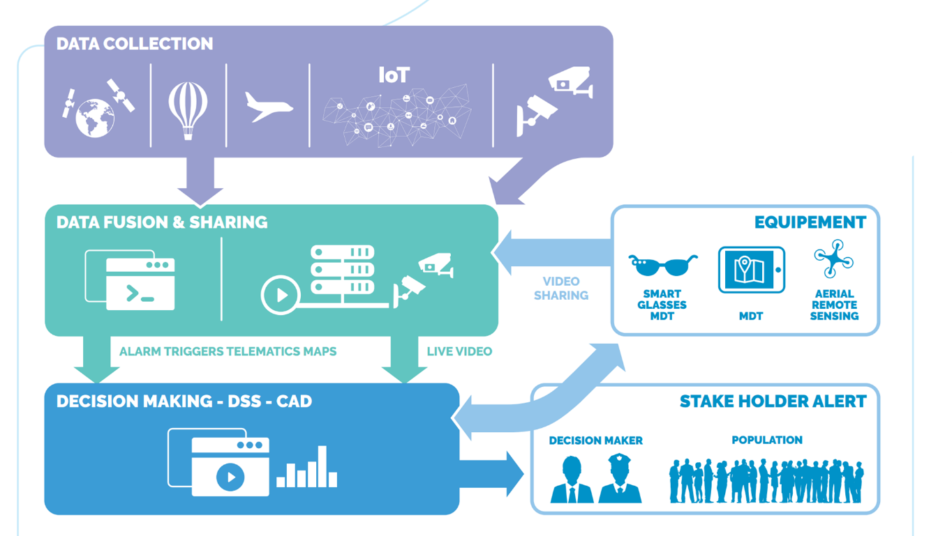
The product is organized into 4 functional levels.
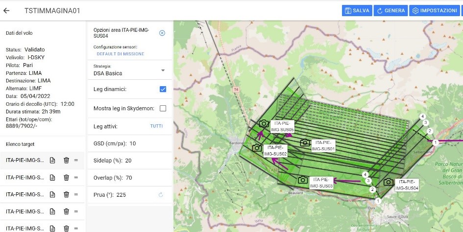
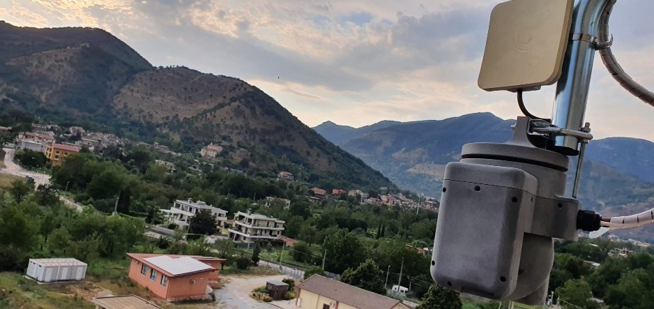
At the ‘Data Collection’ level, there are several technologies specialized in data gathering. The available technologies enable the earth observation and remote sensing exploiting different type of sensors (IoT sensor, specialized VIR/IR camera) or different type of aerial platform (plane, HAPS, satellite)
All data are constantly elaborated by a ‘data fusion& sharing’ layer devoted to transforming all gathered data into exploitable information that can be shared with all interested stakeholders.
The product includes solutions that enable customers to taking an informed decision as Computer-Aided Dispatch (CAD) and Decision Support System(DSS).
Undertaken actions might trigger an escalation alarm to Decision Makers and (if approved) to the population. Also, the unit on the field (i.e. patrol unit, fire trucks, etc) can be connected to the core function of the product via specific equipment as smart glasses, Mobile Data Terminal and Drones to execute the close aerial sensing.
Space Added Value
Earth observation is one of the most powerful tools for environmental monitoring and critical evaluation. The coverage from satellites is a global information source that detects critical details in the terrain, and satellite systems are on constant alert for monitoring 24/7. However, the value of information, especially in critical/emergency situations, depends on how fast it can be delivered and how accurate it is. In these situations, other EO technique are extremely effective, and their exploitation in conjunction with satellite EO technologies is an extremely added value.
Within the services to be developed in the project, Earth Observation is covered by satellite, RPAS, aerial and HAPS technologies. These acquiring technologies, when used in a coordinated scope, cover the requirements for a continuous, fast and hi-resolution monitoring in a cost-effective solution. Monitoring modalities span from the large coverage and systematic reviews offered by satellites, to continuously monitoring for shorter period offered by HAPS, and to fast and targeted hi-res response offered by RPAS and aerials.
Current Status
The project ended with the deployment of the services in multiple specific Pilot Demonstrators. The following list summarises the work performed:
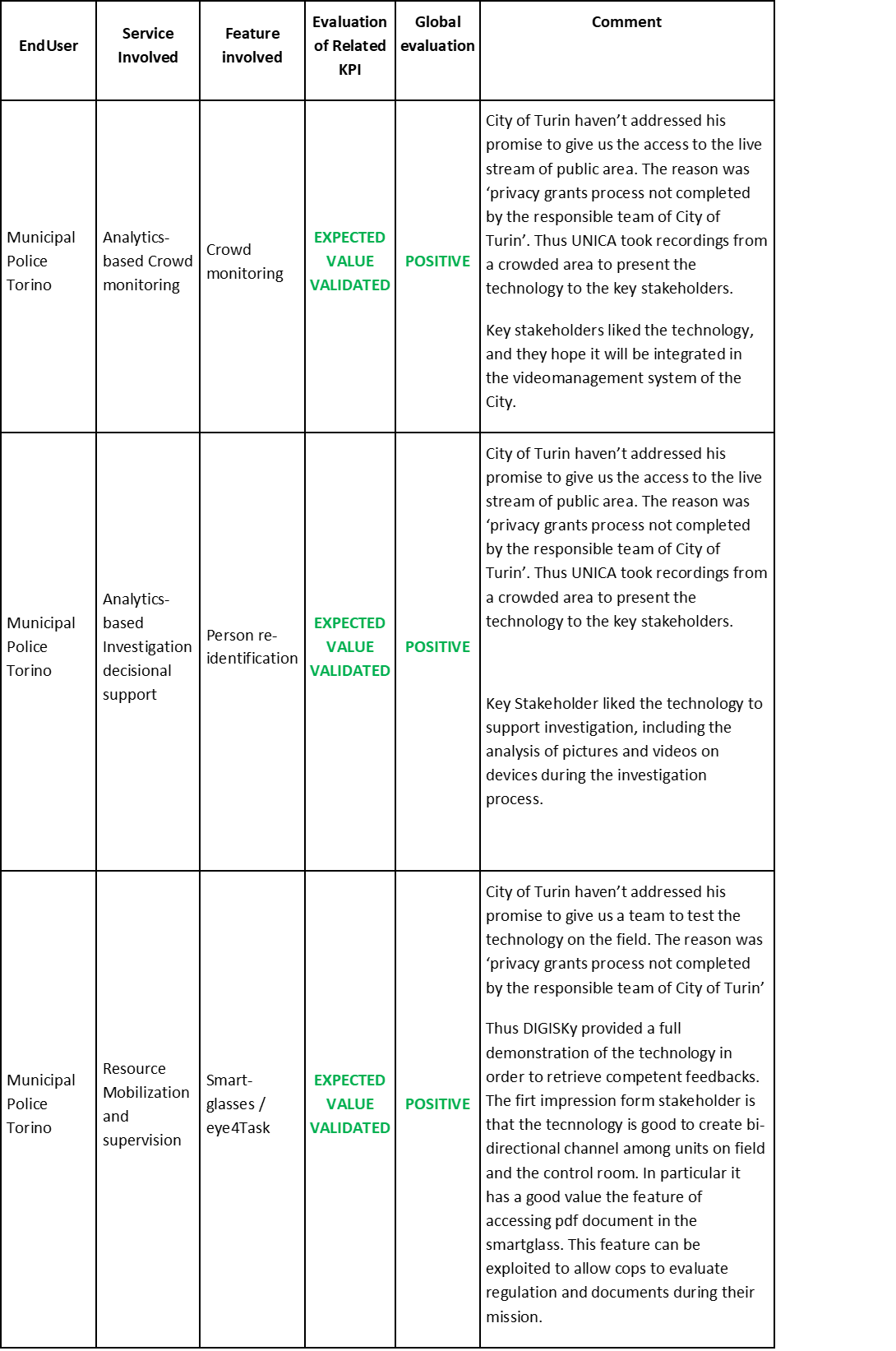
Municipal Police of Turin:
Key stakeholders expressed their interest in the mobilisation and supervision services within the Control Room. The test phases evidenced a focus on future implementations of the monitoring and investigation services.
City of Turin:
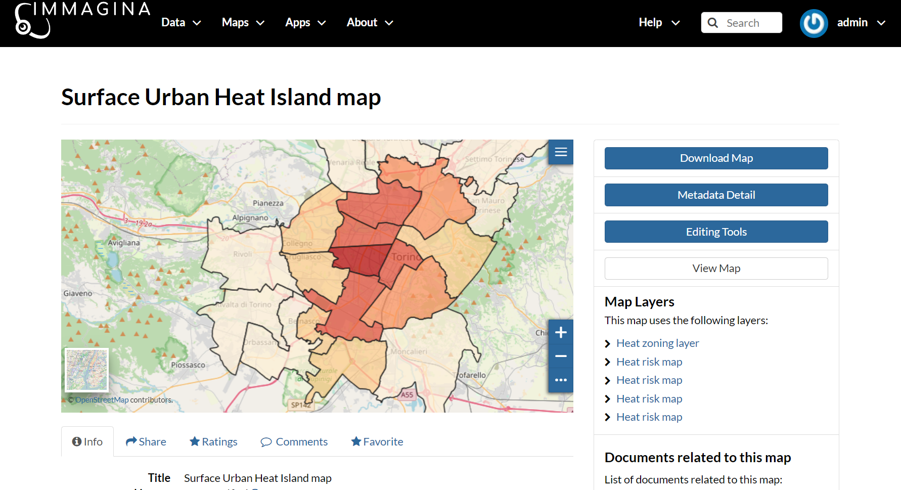
In this Pilot Demonstrator, the City expressed a particular interest on the solution offered by IMMAGINA towards territorial and soil sealing mapping, detection of illegal land use and Urban Heat Island Forecast.
I.P.L.A.:
IPLA is a company hold by Piedmont Region whose mission Is to manage all forest area of the region. They expressed a particular interest on the solution offered by IMMAGINA towards the following areas:Management and improvement of Forest Fight Plan, Forest Fire Simulator
City of Castel San Giorgio:
The municipality is very optimistic about the involvment of the system to keep under control the territory with reduced effort with respect to past. The automatic alerting feature is effective, particularly when the personnel is involved in different activities and cannot monitor the system.


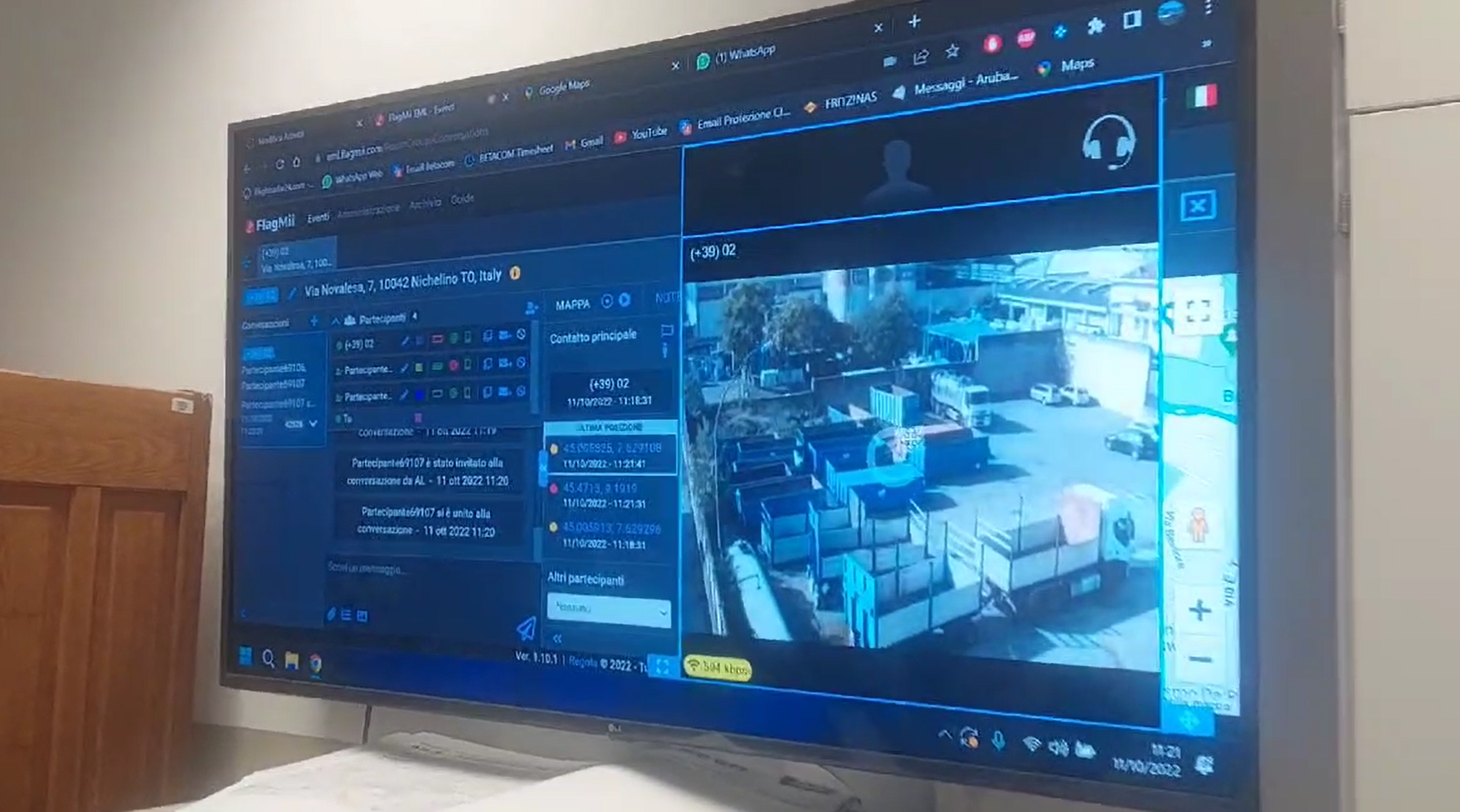
City of Nichelino:
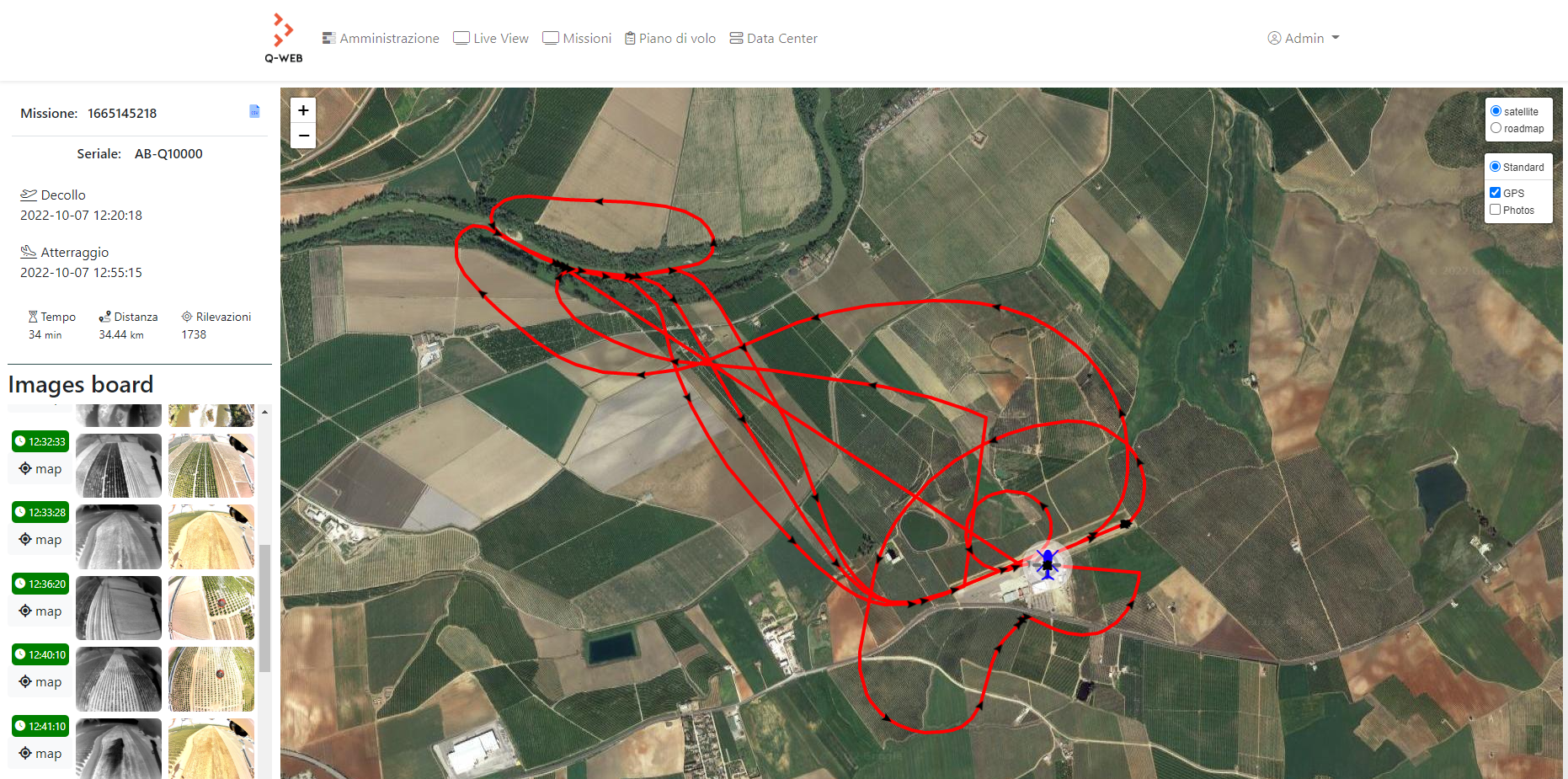
Stakeholders are enthusiast of the outcome of this feature that was used to alert and ‘engage’ all volunteer for the rescue service during the civil protection training held on 11/10/2022. The Pilot involved mass alerting using nowtice, video sharing using FlagMii EML, remote aerial sensing.
Pegasus:
This Pilot Demonstrator was based on video sharing and mission management features for resource mobilization and supervision.
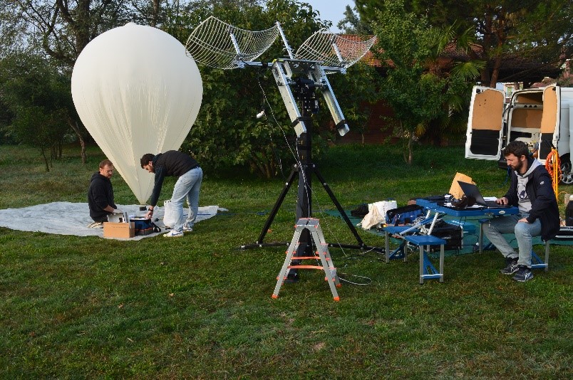
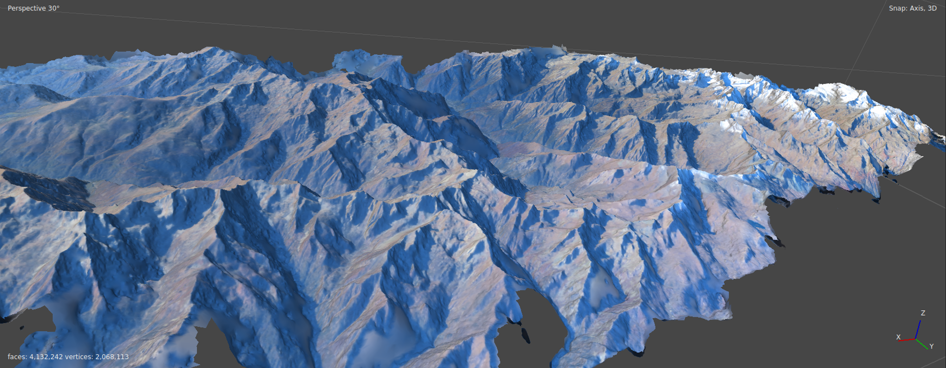
FSM (Fondazione Montagna Sicura):
FSM was able to monitor glacier of the Valle d’Aosta Region using the stratospheric sensing with stratospheric balloon.

Moreover Many KPY has been calculated to measure the performance of the services tested in our pilot demonstrator. The list of our KPI is very long and exceed the purpose of this document. However a generic evaluator of out KPI is being provided, Indeed the table below shows the global evaluation of the service we gathered after having evaluated the pilot outcome together with the end user via a simple stakeholder meeting after the end of the pilot.
The global evaluation has the following scale:
-
Positive : the service has been acknowledged by the enduser as useful for their organization
-
Neutral: the service service has been acknowledged by the enduser as valid for the sector but not useful for their organization
-
Negative: the service wasn’t recognized as useful by the endusers