
Objectives of the service
IPAS (Interruption Prevention Alert Service) is a platform-based insight risk service, utilising satellite technology and asset geo-data to identify third-party interference within close proximity to critical utility assets. This results in invaluable insights for water and gas utility companies, consequently improving asset management processes in terms of resilience, safety, and operational performance to keep essential energy and water utility services running.
Developments or changes to the built environment being constructed near strategic mains belonging to utility companies pose a threat to the supply of critical and essential services to customers. Large geographical areas can be difficult to continuously monitor, and considering the demand for housing and infrastructure investment, IPAS provides a cutting-edge solution that detects risks from 3rd party interference. IPAS harnesses the power of satellite data combined with accurate asset information to provide utilities with a risk alert service.
Users and their needs
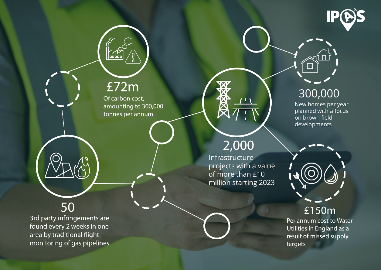
UK Water and Gas supply utilities have identified 3rd Party interference as a major cause of service supply disruption. Relaxation in planning laws and investment in building projects is likely to increase the risk in incidents resulting in loss of supply. Regulatory incentive penalties, combined with remediation costs, risk to life and property and loss of reputation amounts to £ billions in value.
Current methods of monitoring assets, based on regular flying programmes and line walking are costly both in financial and carbon footprint terms. Utility organisations are looking for new ways of managing this growing risk and are supporting MGISS in the development of IPAS as an insight service based on a more sustainable approach, using an eye in the sky to track 3rd party interference near critical assets.
Service/ system concept
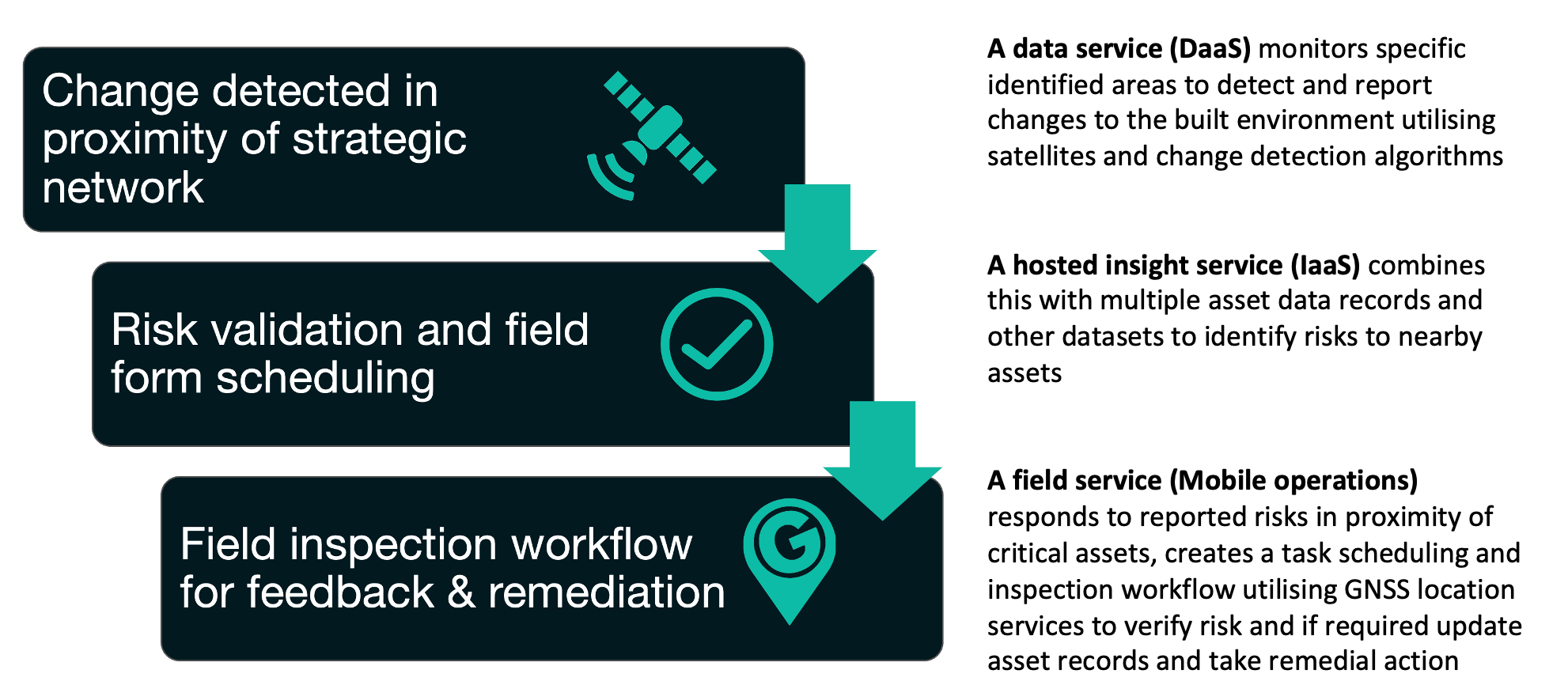
IPAS is broken down into three distinct and connected services.
Space Added Value
IPAS utilises the power of a range of satellite data, including high-resolution data to provide frequent and timely image captures. In turn, this enables analysis through applying a multi-method change detection system to identify potential risks to critical infrastructure.
Current Status
The IPAS service is proven in a real-world application to be an effective and robust solution. The service is alerting risks to critical buried infrastructure in the water sector, supporting targeted field validation activities and preventing costly 3rd party interference to networks.

Subcontractor(s)