Objectives of the service
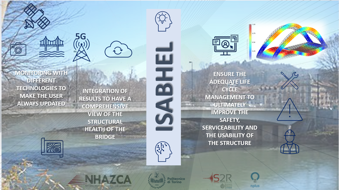
This proposal responds to user needs by addressing the growing demand for efficient monitoring and risk prediction models for critical infrastructures, particularly bridges in the Municipality of Turin, which is the pilot user. The main focus is on Structural Health Monitoring (SHM), providing users, especially municipalities and public administrations, with advanced tools for predictive risk assessment and ongoing infrastructure safety.
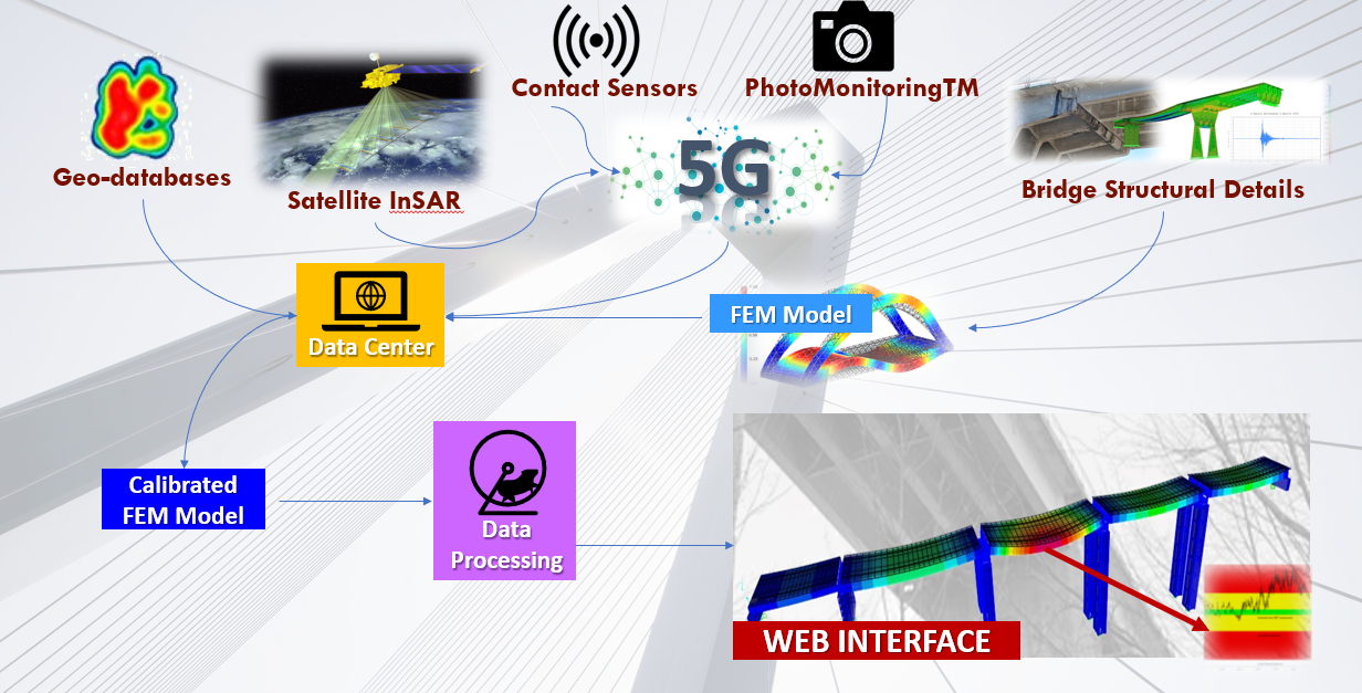
The proposed solution integrates several technologies for monitoring bridges in Turin. It combines satellite SAR data with contact sensors, using 5G communication for real-time monitoring of both static and dynamic behaviours. SAR data helps identify deformations in and around the bridges, supporting the analysis of geological processes that may affect infrastructure stability. Contact sensors, like accelerometers and clinometers, provide continuous monitoring of the bridges’ conditions.
Additionally, PhotomonitoringTM (using Change Detection and Digital Image Correlation) adds another layer of monitoring through cameras installed near the bridges, detecting deformations early.
All data from these sources, including Finite Element Models (FEMs) and historical geo-databases, will be integrated in a data center to create calibrated FEM models. These models will be compared against multitemporal ground truth data from sensors and satellites, enabling early detection of critical issues.
A web platform will provide users with an easy-to-access interface for real-time infrastructure monitoring, improving asset management and facilitating timely maintenance decisions. The project relies on 5G for high-speed, reliable data transfer and supports a model-based Structural Health Monitoring (SHM) approach.
Users and their needs
ISABHEL project is focused on analyzing the structural health of bridges in Turin, however it is designed to address the broader needs of organizations responsible for the safety of entire transportation networks, such as road and railway network managers. These stakeholders require solutions that help ensure public safety and the longevity of critical infrastructure. Various customer segments would benefit from such monitoring solutions, including companies that manage roads, railways, and construction, as well as public entities like provinces and municipalities. Engineering firms focused on civil infrastructure are another key customer group, as they require reliable data to assess the performance of their designs and ensure that bridges meet safety standards. With many transportation infrastructures in Italy nearing the end of their structural lifespan, asset owners are increasingly faced with managing aging systems that present various challenges. As a result, ongoing geotechnical and structural monitoring is essential to keep infrastructure data current and ensure safety.
The main needs identified so far are:
-
Continuous Updating: Public agencies need a system that makes them aware and always up to date on the infrastructure for which they are responsible, to identify potential risk areas and plan required actions.
-
Alarm thresholds: the user needs to be aware of alarm thresholds in order to be able to act.
-
Damage monitoring during construction phase: Construction companies need to monitor and assess for potential damages and defects that may arise during the construction phases.
-
High Frequency: Need for a high frequency of sampling, both with SAR data and from contact sensors
-
Predictive Maintenance: Prediction of static/dynamic response in relation to anthropic events or natural hazards (e.g. strong winds, floodings, earthquake).
-
Best Practice: Identify best practice, in relation to the territorial morphology and persisting geo-hazards, for structural design, testing, construction, maintenance and surveillance.
-
Scalability: Identify technical/economic factors to ensure the scalability of the envisaged services across geographical area.
The user community that the consortium aims to reach in the short term is in Italy, but with a broader perspective that extends to all of Europe.
Service/ system concept
The objective of the project is to provide the asset managers with a tool that keeps them updated on the structural health of the asset, particularly the bridges. The service is designed to be accessed via an easy-to-use web platform, which allows the visualization of the bridge's digital twin and its related information. Specifically, the platform will consolidate information from various monitoring systems: contact sensor data, which is updated at high frequency and provides real-time information on the bridges' static and dynamic behaviour, including vibration, inclination, and structural response; images acquired from cameras, which enable monitoring at a lower frequency but on a larger scale to track displacements and changes over wide areas of the bridge; satellite radar data processing, which offers a historical overview of any deformations that have occurred on the structure and its surroundings; Geohazards Database that integrates flood and landslide maps into the deformation analysis and will provide a more comprehensive risk assessment. All the data will contribute to creating a calibrated and more accurate model, resulting in a digital twin.
Space Added Value
In ISABHEL, high-resolution satellite SAR data will be used for interferometric analysis, a well-established technique aimed at detecting deformations in the ground and infrastructure with millimetric accuracy. Advanced Interferometric SAR analysis can detect long-term displacements caused by natural or human activities. This is achieved by identifying stable ground targets that remain unchanged over time, generating measurement points that provide insights into the velocity of displacement. The results of the interferometric analysis will be combined with geohazard databases, which include flood and landslide maps, and will be integrated into the deformation maps. Different geohazard datasets will be merged and incorporated to enrich the analysis. By leveraging synergies between these various datasets, the analysis offers a more comprehensive perspective, considering a wider range of geohazard factors and potential triggers. A critical step in this workflow is the interpretation of the results, made possible by the extensive and highly specialized experience of the analysts involved.
Current Status
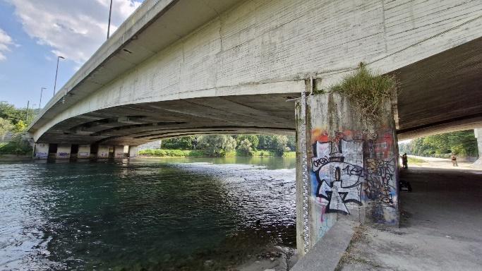
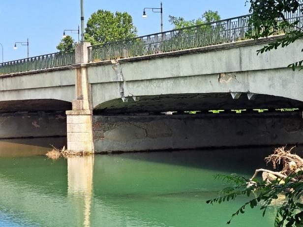
Kick-off meeting was held on July 2024. The first activities consisted in the acquisition and examination of an initial part of the technical documentation related to the two bridges that are going to be monitored, the creation of a repository for file sharing among the consortium members, and the field inspections in collaboration with the pilot user, the municipality of Turin. These preliminary activities were needed to define the system requirements in order to start the design phase for the monitoring system. The consortium conducted assessments to determine the optimal location and quantity of both contact sensors and camera and evaluated the whole configuration of the system's infrastructure. Multiple configuration options will be presented to the pilot user for consideration.
The next milestone, the BDR (Baseline Design Review), is planned for November 6th, 2024. The consortium also had interactions with other potential customers.


