Objectives of the service
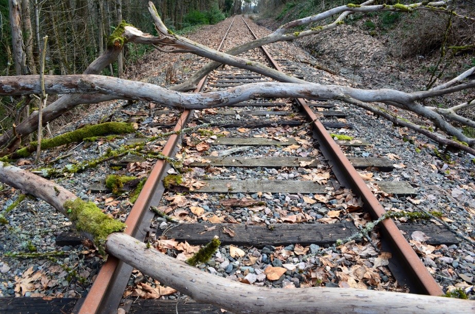
Rail engineers and trackside managers are faced with an ever changing landscape around the rail network. Small to large scale changes in the landscape adjacent to the network can have a large and potential dangerous effect on the railway and its users. LUCI’s main objective is to provide adjacent land use change identification over a demonstration part of the UK rail network. By utilising remotely sensed Earth Observation imagery and machine learning models, the project will deliver a change map of the land adjacent to the rail network. The solution delivers change alerts and type of change information to allow users to assess the impact of the change. Delivered via an API (application programming interface), users can utilise and imbed the solution within their existing systems to add value and assess all of their data in one place.
Users and their needs
Rail engineers and trackside managers are the primary users of the service. The needs of the users are to:
-
Understand adjacent land use to be able to identify potential hazards
-
Monitor changes in adjacent land use and report on a 6 monthly basis
-
Report on the changes on a regular basis
-
Put into place action plans for identified risks
The challenges for project LUCI are to:
-
Identify small land use changes from EO data
-
Reduce false positives from seasonal change
-
Develop suitable models that can detect land use accurately
-
Develop change detection routines that can identify change correctly
-
Provide updates on a regular and cost efficient basis
-
Initially the project targets the UK rail network.
Service/ system concept
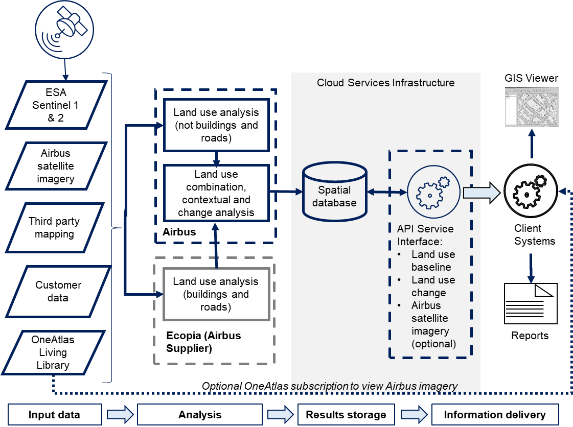
The objective of the LUCI project is the delivery of land use change information for land adjacent to the UK rail network. Via an API, users are able to search and interrogate up-to-date land use change and highlight any risks that have been identified around the rail network as a result of natural and man-made changes to the environment. Change and type of change are reported for key land use categories that put the rail network at most risk.
To identify change, firstly a data stack of Earth Observation imagery and mapping data is analysed to produce a baseline of the current land use. Machine learning techniques is applied to the data to provide accurate classifications. Once a baseline is established Airbus collects a second epoch of data and runs change algorithms that highlights changes in land use and the type of change. The results is then delivered via an API service to the customer. The diagram below shows the high level overview of the system, the data inputs and the data flows. By using widely available imagery and mapping the system could potentially be rolled out to other European countries.
Space Added Value
Project LUCI utilises SAR (synthetic aperture RADAR) and optical imagery to identify land use change. Sentinel-1 is used as the primary SAR satellite, with Pléiades and Sentinel-2 as the primary optical satellites used. Other optical satellites will be used where necessary to provide coverage. The combination of a regular time series of data from Sentinel, to identify seasonal and broad scale change, and the high resolution of Pléiades, to give the level of detail required around the rail infrastructure, enables the project to develop machine learning models that can identify small scale changes over time. Combining this approach with more traditional physical models allows a greater understanding of land use change.
Current Status
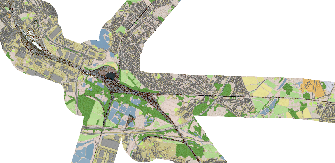
Airbus has now completed the pilot user phase of project LUCI. We have gathered feedback from our main project partners and assessed how well the dataset has performed. There have been key successes with the production of a dataset that provides detail, accuracy and currency not previously available to the user base. The project has been successful in showing that VHR EO imagery can be used in the context of project LUCI with good results. The seasonal water layer has been a particular success along with the accuracy of the Buildings and roads layer. Airbus are now assessing where the product can be enhanced and developed to provide further value and usability for customers.
Prime Contractor(s)