
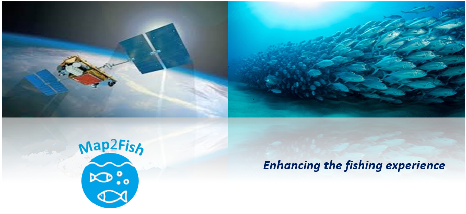
Objectives of the service
Currently, fishing tourism operators as well as professional and amateur fishermen, face the same question every day: “Where will I go to fish?” The existing approach to answer this question is quite complicated from the customer/user perspective. Every day, they need to search for the weather predictions (including sea state), assume based on these what will be the situation in some specific areas, combine them together with their previous experience (if any) and finally decide where to go exactly.
All this complex, time consuming and subjective methodology does not always lead to sufficient results (a good catch and/or satisfied tourists). Our proposed solution minimizes the complexity of the everyday decision-making life of these customers. Map2Fish service delivers to our customers and users, forecasts not only for the fish concentration probabilities, but also for other parameters like sea temperature, winds, and currents. This approach not only saves our customers and users time and effort, but also efficiency on the travelling logistics and places to go fishing, i.e. cost reduction. Also, by going to places with high fish concentration, they either catch more fish (i.e. economic benefit) or the tourist catches more fish and is satisfied.
Users and their needs
The key customers segments targeted by our service are divided in three groups of users:
a) Companies and organizations that associate with fish tourism and coastal activities and are keen on improving their customer services More specifically we will focus:
- on companies that operate in the touristic industry and want to offer some more exclusive services to their clients and enhance their touristic experience
- on fishing Tourism, seeking for a unique fishing experience in Greece that can be found by the tourists themselves
b) Separate individuals who are professional anglers or interested in recreational fishing like:
- Residents who own a fishing boat
- Professional anglers
- Private companies who rent fishing/boat equipment and will offer Map2Fish as a value added service to their rentals
c) Ads & One stop Shop
- Companies that wish to use our channel (Map2Fish promotional website) to promote their products or services by advertising them on our website.
- Also attract customers/companies who wish to use our “One stop shop” service to sell their products/services by paying an agreed over contract percentage of the sale.
The problems that we are helping to solve are:
- Where it is most probable to find fishes.
- Not updated information and maps for use on the field.
The customer needs that are satisfied are:
- More successful fishing trips
- Cost minimization
- Easy access even on the field
Country targeted in this phase: Greece
Service/ system concept
The proposed service consists of a WMS service and a mobile web application that provides to the corresponding customers and end-users near real time and forecast of pelagic fish concentration probabilities and parameters like sea surface temperature, winds, and currents. The targeted potential users/clients to the service are companies operating in the touristic industry, fishing boat operators, professional anglers and residents who own a boat. Map2Fish system architecture will take advantage of the technology built in Rheticus® Marine, a downstream service based on the operational Rheticus® platform of Planetek. It consists of a cloud and scalable platform able to process different kind of input information from different sources (including EO data, geo-localized in situ information, crowdsourcing information, etc.). From the algorithmic point of view, processing workflows will be implemented in order to calculate the fish pelagic concentration probabilities based on the historical, near-real time (NRT) and forecast CMEMS datasets, providing also the fish concentration forecasting capability within the web service/mobile application. Sentinel 3 data will be used to provide higher resolution NRT measurements, where applicable.
In the following figures examples of the Map2Fish interface and its architecture.
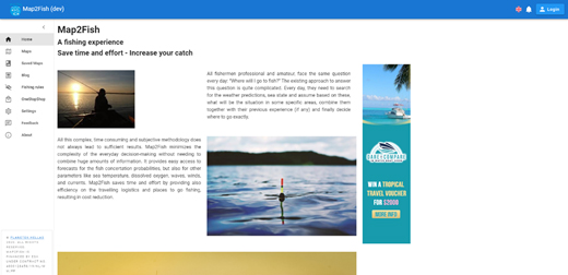
Screenshot of the web service prototype –Home Page
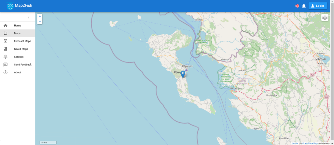
Screenshot of the web service prototype – The Maps functionality of the service
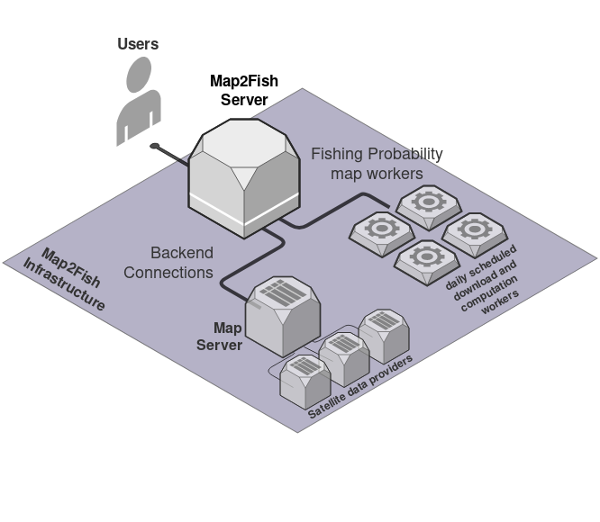
Map2Fish Architectural Diagram
Space Added Value
The targeted services exploits satellite Earth Observation capabilities to provide information about the domain of fishing.
Within the service architecture the following space assets are going to be integrated:
- COPERNICUS Sentinel 3 missions.
- Copernicus Marine Environment Monitoring Service (Although it is not directly a space or terrestrial asset, Copernicus Marine Environment Monitoring Service (CMEMS) will be used to maximize our Copernicus uptake in terms of sustainability and cost reduction).
- Galileo GNSS navigation satellites.
- Satellite telecommunications.
Current Status
Planetek Hellas held a Customers/ Users Workshop on Monday 09/12 in Corfu, Greece, attended by 11 users.
The first study activities concentrated on the customer /stakeholder analysis and business case definition.
The first review progress meeting (PM) was held on 19/12/2019 at Planetek Hellas’s premises.
A first draft for the Proof of Concept has been prepared which demonstrates a prototype of the realization of the Map2Fish service.
On the 30th of April 2020, the BCR was held successfully.
In the period between PM (December 2019) and BCR (April 2020), a service prototype has been set-up, running on Planetek’s servers to which selected potential users have access to.
The Final review was held on the 9th of July 2020.
In the following figures, screenshots of the web service prototype are presented.
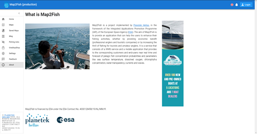
Screenshot of the web service prototype – About Map2Fish
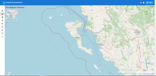
Screenshot of the web service prototype - The provided layers can be accessed by the layers icon on the bottom right of the map
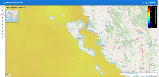
Map2Fish Sea Surface Temperature Layer for 1/7/2020- Corfu Area
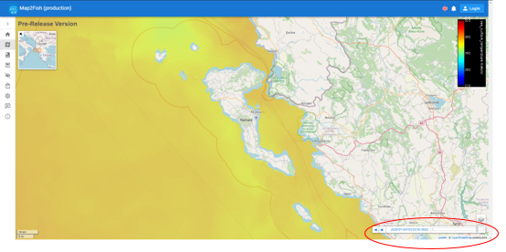
Map2Fish Sea Surface Temperature Layer for 4/7/2020 - The forecast option of the provided layers
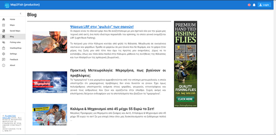
Screenshot of the Blog menu item that hosts blog posts that focus on fishing activity and at the same time companies promote their products or services by advertising them on our website.