Objectives of the service
By implementing the monitoring and verification system proposed based on satellite data of carbon removal projects in forests across the globe, the risk of procuring untrustworthy or poor credits can be reduced, thus significantly improving the quality of forestry credits as well as the general market for forest-based carbon removal units. This system could initially be applied to assess existing forestry projects and to identify new project opportunities, but could at a later stage also be applied to additional project types beyond forests (agriculture, enhanced weathering, Direct Air Capture, blue carbon, etc.).
Users and their needs
The target users for this project were carbon removal projects within forestry, and the customers were the companies purchasing carbon removal portfolios from Klimate, which include forestry projects such as the project included in this study. The needs of the users included:
-
The carbon removal project providing accurate calculations of how much CO2 their projects remove
-
The need of customers to purchase high quality, accurate carbon removal credits
-
The need of customers to see their carbon removal through graphic representations
This KickStart activity ran a pilot with a specific supplier in Timor Leste, Fundacao Carbon Offset Timor (FCOTI), operating the Halo Verde Project. This pilot allowed Halo Verde to provide more accurate calculations of how much CO2 their project removes.
Klimate’s current focus is mostly in Europe, where the majority of the countries have committed to carbon neutrality and therefore it can be assumed that companies in those countries will have more incentives to purchase carbon removals and utilise the service.
Service/ system concept
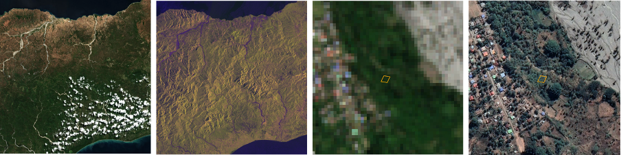
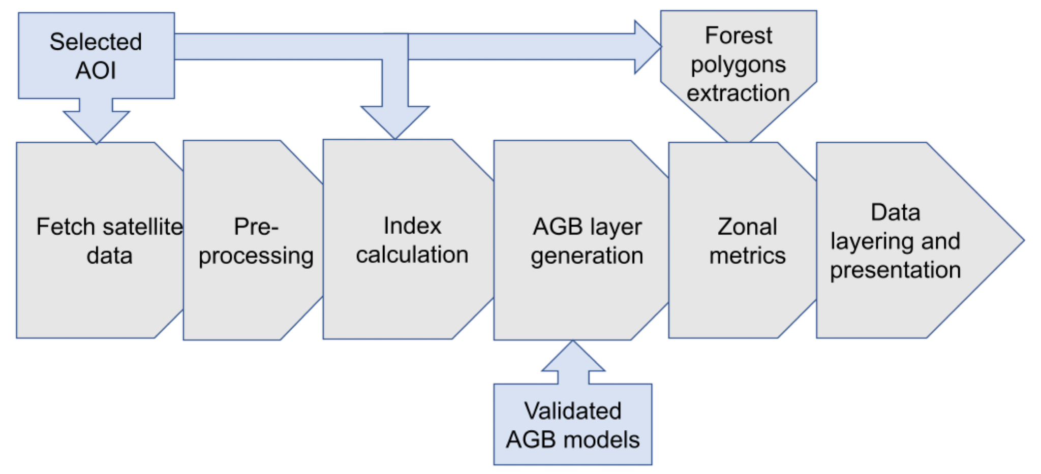
An online dashboard provides a convenient and user-friendly interface for customers to access their forest plot data and AGB estimates. After logging in, the forest plot is visualized using Sentinel-2 data, and the estimated total AGB value is provided to the user, based on multi-temporal Sentinel-1 and Sentinel-2 data.
One of the key benefits of the service is the ability for users to continuously monitor their forest plot and track changes in AGB values over time. By comparing the initial estimates of the AGB progression with ongoing measurements, users can gain a better understanding of how their forest is developing, and evaluate the carbon credits acquired in the project.
Space Added Value
The combination of Sentinel-1 and Sentinel-2 data is of high importance for the AGB estimation. Sentinel-1 data can provide valuable information on forest structure, such as the height and density of vegetation, while Sentinel-2 data can provide information on the spectral properties of vegetation, such as chlorophyll content and leaf area index. By using a combination of multi-temporal Sentinel-1 and Sentinel-2 data, we evaluated multiple models for predicting AGB values based on in-situ measurements from a forestry project in Timor Leste. This gave us unique insights into the needs and requirements of the input data and predictive models for the specific forest types in these mountainous regions, which contributed valuable knowledge on how to accurately estimate above-ground biomass from satellite data.
Current Status
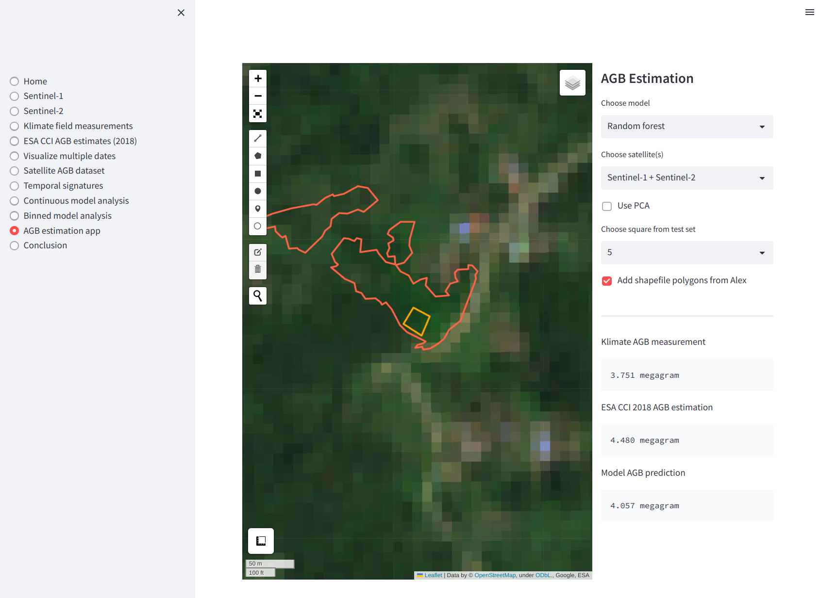
A prototype dashboard application has been developed during the project, and multiple models for estimating above ground biomass (AGB) values from Sentinel-1 and Sentinel-2 data have been evaluated. It was found that multiple opportunities exist, including derivative services. However, a larger dataset based on in-situ measurements should be collected for a continuation of the project.