Objectives of the service
Park Authorities are institutional bodies established with the overall mission of protecting natural areas. Several activities concur to achieve the overall objective: ensure biodiversity through the conservation of the natural habitats, provide support for the prevention of natural disaster, promote environmental education, but also boost the local economy in an environmentally sustainable way. The complexity of these tasks and the extension of the park area make difficult, for the park staff, which is often composed by a narrow team, to carry out its work. In this context has been conceived N@VITour, which aims to provide a set of tools, based on the expertise of Planetek in the field of Earth Observation, with the objective of reducing costs and increasing quality of the territory monitoring process.
Today, furthermore, worldwide parks are considered important instruments for growth, above all thanks to the tourism that they generate and that can bring the economic resources necessary to support the management process. N@VITour, therefore, includes also features designed for touristic support, in order to build an attractive package that is meant to open up new market opportunities, which up to now cannot be served without an integrated software module comprehensive of navigation and telecommunication components.
Users and their needs
The target users of N@VITour are:
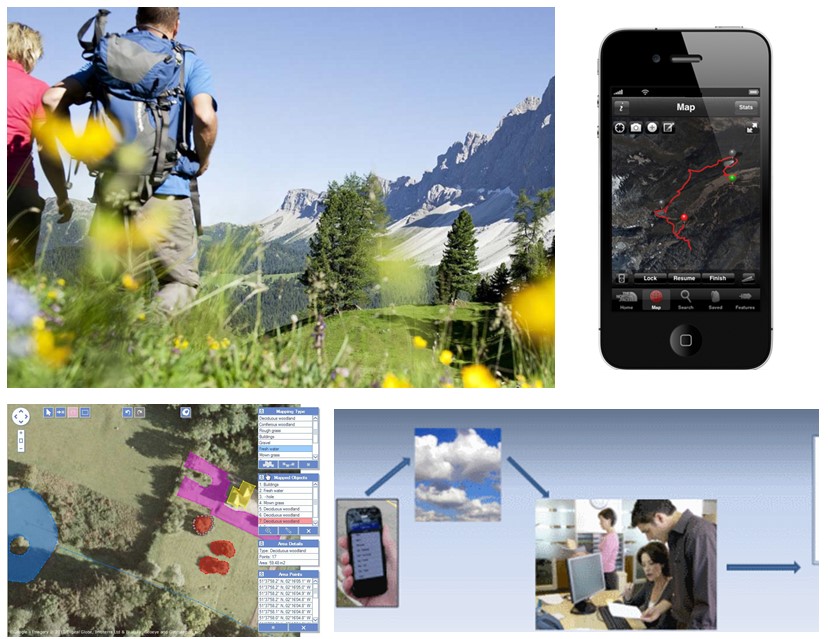
Park Operators, who use the N@VITour biodiversity and land monitoring services, accessible through a user-friendly web or mobile interface.
Tourists, who use the N@VITour touristic services.
Expert tourists or professionals (e.g. biologists) who access the same cartographic products available for the park operators, for a specific interest.
Service/ system concept
As a consequence of the analysis of the user requirements, the following primary services were identified:
Virtual Travel Service, which provides access to different levels of information that may vary according to the type of app downloaded, such as:
- introductory informations about the Park and wildlife attractions
- slide show galleries
- off-line maps with POIs and itineraries
- trails maps
- Augmented Reality contents
- EO imagery
- live feeds provided from Park Support services
- Dynamic itineraries based on intermodal routing calculation
Tourist networking service, easy in-field collection of geo-tagged multimedia items, with the possibility of sharing of multimedia contents within the park social network.
Emergency signalling service: fast emergency signaling (SMS, emergency calls) with transmission of the position.
Safety assistance service: reception of danger warning in multimedia format.
Land and resources monitoring service: on-line access to cartography responding to different monitoring tasks.
In-situ data collection service for park operators: advanced field data collection, featured with accurate drawing, map performance, offline working, custom feature classes, multiple project management, easy import and export tools, synchronization of data collected on the mobile devices with the centralized repository.
Space Added Value
The system will combine the Space Navigation technology, which allows the implementation of position-based services, with the SatCom technology that, especially in the park areas with complex morphology, is relevant for a continuous access to the services provided. Moreover, the Earth Observation technology can provide advanced features for the management activities and for the access to added-value information from expert users with specific scientific interest.
Current Status
The team has concluded the study work including user needs consolidation, technical requirements definition, service definition, integrated solution design, and technical and commercial viability analysis. A final dissemination event is planned in the context of the Global Change Research Symposium 2014 (http://www.global2014.it/ ), to be held in Ostuni in September.
The next step after the conclusion of this feasibility Study is the preparation of a Demonstration Project during which a pre-operational stage of the services will be put in place. The demonstration Project is due to start in the first half of 2015 lasting 2 years, and with the further commercialisation of the services by its conclusion.