

Objectives of the service
The objective of the nEmO – Natural Fish Ecosystem Management and Observation - Feasibility Study was to develop a concept for an EO-based toolbox providing fishermen up-to-date spatial information and analytics about the natural environment and occurrence of fish. Therefore, multiple potential customers and partners were interviewed during an on-site visit in The Netherlands and numerous online exchanges for collecting user requirements, drafting a service solution and evaluating its viability.
The proposed toolbox bundles numerous satellite-derived datasets describing the ocean state and quality along with meteorological information over a planned target area for fishing. The useful data is obtained from the Copernicus Marine Services, EMODnet, ECMWF and from Sentinel-3 imagery by applying a proprietary algorithm of EOMAP to extract specific water quality parameters. The data is updated on a regular basis over a specified area - daily for the Copernicus Marine Services or upon data availability for Sentinel-3 data. A key feature of the service is its ability to predict fish catch for the near-future, defined as upcoming week. These predictions are generated by models trained on fishing activity and environmental data, using environmental forecasts to generate the results. Furthermore, multivariate analysis based on environmental data will give fishermen indications of nutrients and favourable conditions for major fish species. The combination of both, environmental analysis and fish catch predictions will enable planning and adapting fish trips more effectively.
Major challenges of potential nEmO customers are:
-
Insecurity about fish stock abundance now and in near-future
-
Insecurity about current and near-future marine conditions
-
Lack of integrated information on conditions that favour the abundance of fish stock
-
Lack of access to integrated information in a 1-stop-shop
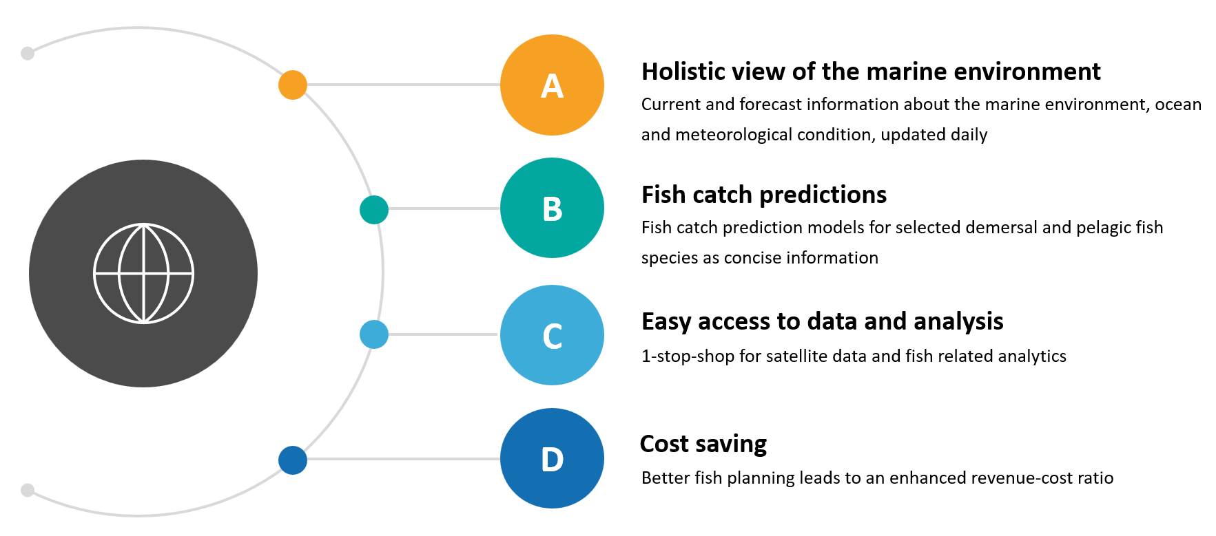
The nEmO service brings following benefits to its users:
Users and their needs
The primary targeted customer group includes companies that operate fishing vessels aligning with the aims to enhance operational efficiency and decision-making in the fishing sector through a better planning and adoption of fish trips. Secondary customer groups include fishery associations and authorities, who are interested in trend analysis on long-term data for creating annual plans and forecasts. Reflecting the broad applicability of data sourced primarily from the Copernicus program, EMODnet and ECMWF, the tool principally may serve a global customer base, while the focus within the project and potential follow-on activities in Northwest Europe.
Following user needs are addressed by the service:
-
Information on fish stock abundance to support trip planning and eventually optimise the ratio between fuel consumption and landings
-
Environmental data of now and the near-future
-
Retrospective data
-
Water depth information
-
Easy data access and assessment
…and satisfied by following value propositions:
-
Fish catch predictions: Allow fishermen identifying areas of fish abundance and consequently support the planning and adoption of fish trips
-
Provision of environmental and meteorological data via an EO toolbox supports fishermen in understanding the marine conditions and bring in their experience to make informed trip decisions
-
Indication of favourable conditions for selected fish species
Service/ system concept
Based on the collected user requirements, the nEmO toolbox is defined as a web service that may run on desktops or mobile phones and is tailored to gather and provide satellite-derived data and analytics about the marine environment and meteorological conditions. For the solution development, various marine and meteorological parameters from the Copernicus Marine Services (CMS), EMODnet and the European Centre for Medium-Range Weather Forecasts (ECMWF) are bundled and provided as current and forecast information through an easily readable and accessible a User Interface. Dedicated APIs ensure the regular data retrieval for a selected Area of Interest (AOI) defined by the end-users and its provision to the interface of the toolbox. In addition different water depth profiles for selected marine parameters are provided for the use case of demersal fishing. The development of fish catch prediction models based on fish activity data and environmental information constitutes the core part of the service. Additionally, the service offers multivariate environmental data assessment to identify optimal fishing grounds by highlighting factors such as nutrient hotspots, favourable temperatures, suitable depths, seabed characteristics, and salinity levels.
Space Added Value
SatEO is a major information contributor regarding the water quality parameters, ocean and meteorological conditions. Its integration in one platform adds value to the fish catch predictions, as customers do not need to search for this data on different platforms. Considering the dimension of the ocean, EO are an optimal data source for a digital information support tool and the implementation of features on environmental analysis tailored for specific questions enhances the usability of that information.
Following key parameters will be integrated:
-
Water quality: Chlorophyll, oxygen, salinity, turbidity
-
Ocean state: Sea surface/ bottom temperature, salinity
-
Ocean conditions: Waves, currents
-
Weather: Air temperature, precipitation/ clouds, wind
Current Status
The feasibility study was completed in April 2025, resulting in the development of a concept for the nEmO service, along with an assessment of its technical feasibility and commercial viability. This process involved close user engagement to understand requirements, define service capabilities, and discuss mock-ups.
EOMAP aims to advance the service towards commercial maturity through a follow-up demonstration study, partially funded by ESA.