
Objectives of the service
The objective of the service is to enable the commercial seafood, fishing and aquaculture companies and fish retailers/wholesalers to verify that all their produce comes from vessels that have not been engaged in IUU fishing activities. The NIVCS application will allow the companies to track the behaviour of each fishing vessel and will alert the company if suspicious activity occurs. If a vessel exhibits only compliant behaviour its catch can be verified as free of IUU fishing produce. Should this be the case across the entire fleet of a commercial fishing company, this company can have its produce certified as free of non-IUU catch. The ultimate vision is to create transparency along the full value chain of the fishing industry from catch to consumption.
Users and their needs
The customers of NIVCS are:
i) commercial seafood, fishing and aquaculture companies: These companies have an incentive to report and demonstrate that their produce is free of IUU catch and track the climate footprint of their activities.
ii) Food retailers & wholesalers exposed to the fishing industry: There is increasing focus on supply chain transparency and a trend towards greater accountability of companies from a CSR perspective. These businesses will benefit from NIVCS from the ability of better documentation of sourcing activities.
The user needs boil down to boil down to i) enabling sustainable fisheries and environmental transparency, ii) potential to brand a company as sustainable and environmentally responsible and iii) a need for increased data to digitize and follow technology developments.
Service/ system concept
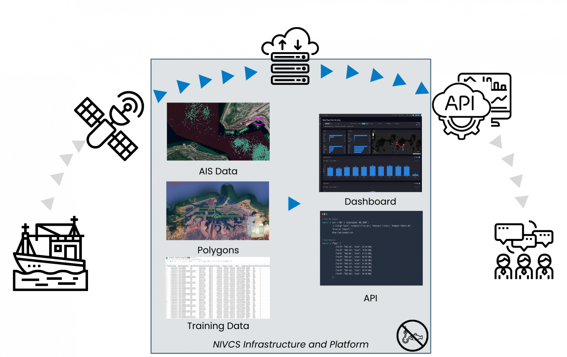
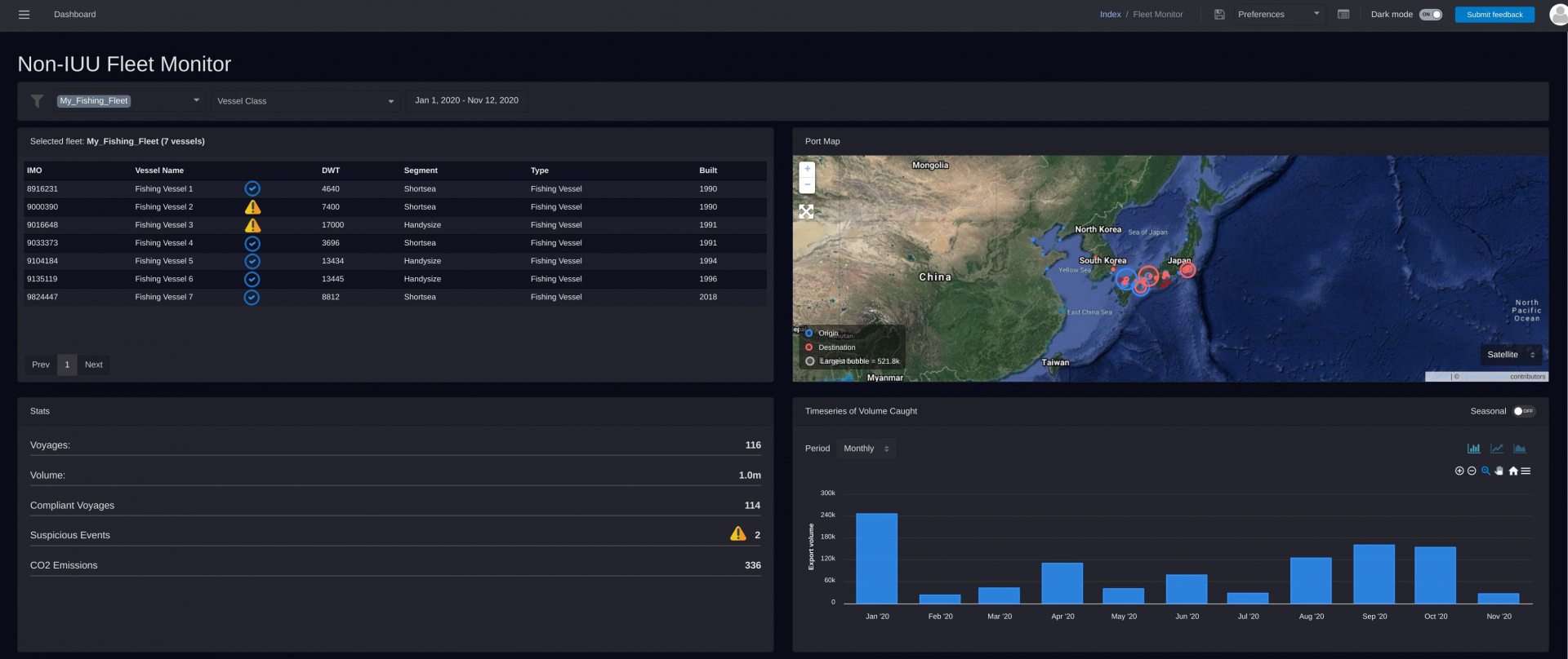
NIVCS leverages the power of AIS data, geospatial analytics and machine learning. NIVCS transforms AIS data into actionable sustainability data which is delivered to the client via either a web-based dashboard or an API. The steps are as follows:
I) AIS data is collected in raw format from satellites and then cleaned and transformed using structured data algorithms
ii) On the processed AIS data stream, we apply data algorithms for a) checking compliant vessel behaviour (e.g. checking for continuous AIS transmissions, transhipment activity, AIS spoofing), b) matching vessel positions with a polygon database to identify if activity is happening in closed national areas or in territories without permission and c) applying our vessel cargo measuring technology. The data is processed in real-time as AIS data is received
iii) We use the transport work generated to calculate the CO2 emission footprint of a vessel’s catch
iv) The generated data is structured (e.g. generating events and voyages) and stored in the cloud. We expose the insights to clients through a web-based dashboard and via an API.
Space Added Value
NIVCS leverages Global Navigation Satellite Systems (GNSS) to obtain AIS data from vessels. The AIS data transmitted from a vessel includes a position datastream with latitude/longitude and a static stream which includes draught, navigational status and destination as reported by the captain. Within the maritime sector, AIS data is the only reliable source for real-time information on vessel positions.
Current Status
Based on the work done to date, there is an imminent awareness of the IUU problem in the full fishing value chain from vessel to consumer and a strong desire among companies to comply and digitize further. However, we have found that the technical challenges of AIS data as well as the regulatory environment among European participants does not warrant a sustainable business case for the NIVCS solution.