
Objectives of the service
Using Computer Vision hardware and algorithms, Luna Systems’ solutions automatically identify and track the rider behavior patterns of shared micromobility vehicles. Its camera and platform solution enables shared micromobility operators to regulate the safe use of their vehicles based on three core data points:
-
Position (is a service user riding on a sidewalk?)
-
The speed at which a rider is travelling
-
The presence of vulnerable pedestrians in the path of the vehicle.
With these data points, operators can profile each event of sidewalk riding and take the appropriate action to mitigate (e.g. rider communication, fines, service bans etc).
Luna Systems’ customer base consists of shared micromobility operators who have a responsibility for ensuring the safe usage of their vehicles. Ensuring a reliable, robust source of data to regulate such usage is key to ensuring the provision of a safe service which is essential to ensuring public trust in shared micromobility as a viable, safe, long-term transport alternative. Leveraging computer vision also provides operators and cities the opportunity to strengthen their collaboration through the provision of anonymised ride data to cities to support a better understanding of how riders navigate car-centric infrastructure and how to most effectively prioritise development that better supports micromobility usage and adoption. On behalf of operators and cities Luna provides reports to operators and their city partners which provide data on the causative factors of sidewalk riding - including factors such as the presence of pedestrian crossings, lack of parking facilities and more (see Forbes).
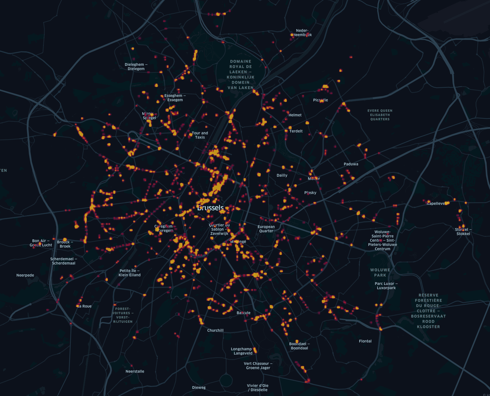
The challenge: GNSS plays a crucial role in the aforementioned processes, especially when making a determination on the exact location of each sidewalk riding event and the exact speed a rider is travelling at. Situations such as urban canyoning can diminish GNSS signal, reducing the accuracy of positioning data. Having accurate speed and location data is imperative in order to be able to understand how and where exactly riders are navigating cities, so that they can build infrastructure in line with micromobility needs.
The focus of this activity was to explore various supporting AI-based techniques which could be employed to offset the challenges posed by urban GNSS signal reduction (i.e. Visual Wayfinding, Visual Odometry, Map Matching). Through this activity we also assessed our current hardware for areas of improvement (e.g. antenna performance) and validated key business assumptions with regards to the provision of new product approaches and related pricing strategies.
Users and their needs
The main stakeholders in the provision and safe operation of shared micromobility schemes are cities and their shared micromobility operator partners, who have a shared responsibility for the delivery of sustainable alternative modes of transport.
Shared micromobility operators:
Needs
-
To better understand the extent and nature of errant vehicle use, e.g. sidewalk riding across whole scheme
-
To be able to mitigate incidences of sidewalk riding on a case by case basis (based on infraction severity) without risking service drop-off in a highly competitive environment.
-
Data that demonstrates active wide-scale mitigation to city partners
-
Data that proves that errant vehicle use is not simply due to errant misuse, but mainly to infrastructure-related issues.
- Data that enables operators to play a supporting role to their city partners so they can work collaboratively to make infrastructure safer for micromobility vehicles.
Cities:
Needs:
-
To ensure the safe usage of their public schemes and that the regulations set out in their regulations are being adhered to.
-
The provision of a safe scheme that supports wider scale adoption and reduces burden on other forms of public transport and reduces car dependency.
-
The reduction of dangerous incidents that endanger the reputation of their shared program.
Service/ system concept
The system and service concept is designed to provide more sustainable micro-mobility management by providing the following,
-
Comprehensive understanding of vehicle use: By using GNSS tracking and street-level imagery, shared micromobility operators can determine user behaviour from a ground-level perspective. In certain circumstances GNSS signals can be unreliable, making vehicle position and speed reconciliation difficult. The aim of this activity was to provide a solution that can determine vehicle location and speed using GNSS and machine vision.
-
Availability of Data-Driven risk mitigation decisions: Access to detailed rider behaviour data provides reliable empirical information on how and why the vehicles are being used. This provides insights and contextualises the data.
-
Availability of time-relevant information: Continually updating vehicle use and location data can help decision-makers understand current conditions and changes over time. High-frequency environmental change detection can be a valuable data source.
-
Integrating technological advancements: Using AI and Machine Learning, algorithms can automatically identify and track changes, anomalies, or patterns across street-level imagery. This provides for way-point identification which is not solely reliant on GNSS data.

Luna’s device merges its GNSS reference machine vision data with urban/city management data to provide contextual user behaviour data.
Space Added Value
Luna systems integrate GNSS referenced data with vision data, generated by Luna-equipped micro-mobility vehicles. The solution can be used to generate Digital Elevation Models (DEMs) from real-time image capture from shared e-scooters, e-bikes, e-mopeds etc across Europe (and globally). The data derived from the on-vehicle equipment can be merged with maps and images derived from Earth Observation and drone technology.
Current Status
This kick-start activity allowed us to explore how our existing solution could be further enhanced to improve micro-mobility data accuracy, specifically focusing on location and speed data by leveraging machine vision techniques such as Visual Wayfinding, Visual Odometry etc. Through the activity we also identified hardware improvements that can be made to improve our positioning accuracy also.
Through this activity we also identified more cost-effective ways to integrate machine vision, opening doors to new commercial opportunities and confirmed and validated key assumptions with regards to market demand and expectation. Overall, this kick-start activity validated the potential of Luna's technology to revolutionize micro-mobility data accuracy and improve rider safety.